Experiencing America > The Upper Things of Life... > Day 3
Day THREE...
Thursday, August 5th 2021
Today is the day to head home. A straight six to seven hour drive...that took over 18 hours. This was not dues to traffic, or weather, but due to the vast amount of sights to see in the Upper Peninsula.

Looking northwest over Munising Bay just after 5 a.m.

Looking east down MI 28 east of Seney.
The drive east across the Eastern Upper Peninsula was peaceful, vastness of pine trees. Occasionally, there would be a small town, but that was few and far between. Getting to the eastern side of the Upper Peninsula, brought more flat farmland. When we got to Interstate 75, we were about 10 miles from Sault Ste Marie. For those that have followed this travel blog know. What is another 10 miles... We headed up to Sault Ste Marie. This also gives the Upper Peninsula a crossing to the country of Canada. If you keep going on Interstate 75, and ignore all the Sault Ste Marie exits...that is exactly where you will go.
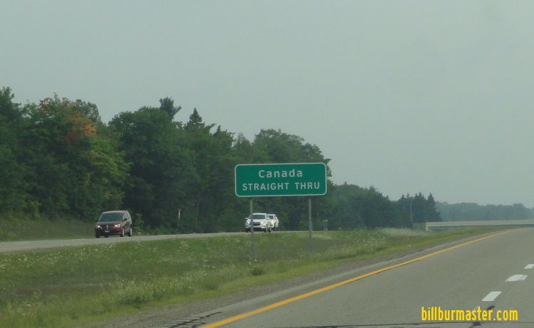
A BGS on NB I-75.

A VMS on NB I-75 with COVID restrictions.
Sault Ste Marie is a historical city. It is the oldest city in the State of Michigan. This city sits across the St. Mary River from Sault Ste Marie, Ontario. Here we went down to the river to stretch and see the views. Then over to the Soo Locks Visitor Center. At this point we got there in time to see boats going through the locks.

A sign at the entrance to the park at the locks..

Looking at the Soo Locks.

Looking at the Soo Locks.
After the locks we headed over to the Michigan Welcome Center on SB I-75 at the international crossing. As we headed out of Sault Ste Marie to the welcome center we passed the old Sault Ste Marie water tower.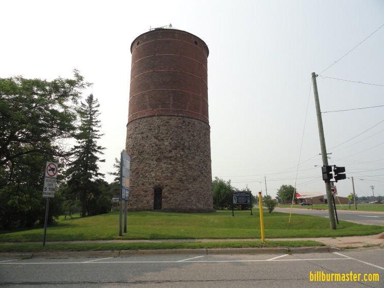
The old water tower.

A sign post at the welcome center.

The United States of America and the Michigan Welcome Sign on SB I-75.
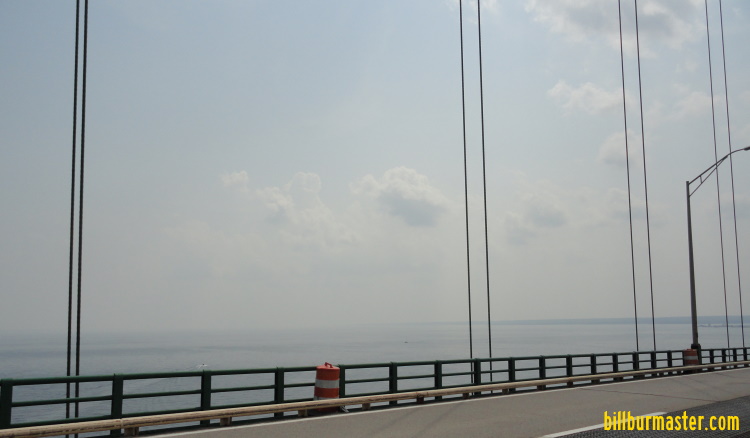
After around Sault Ste Marie, it was time to head south towards the Straights of Mackinac. We headed down Interstate 75 to get a glimpse of the water and what is described as the real treasure of the State of Michigan, the Mackinac Bridge. Just before the toll plaza is an exit on Interstate 75 to a bridge view park. To get back to the interstate you pass by the Father Marquette State Park. This park notarized Father Pere Marquette and his exploration and travels in the area.

A sign for the park.

The view looking south at the bridge.

The sign for the state park.

The Father Marquette memorial.

A map on the floor in the memorial.
Now it was time to cross the bridge. After leaving Father Marquette Park we headed up to U.S. 2 so we can get on Interstate 75 to head south.

Looking south from the northern approach.

SB I-75 at the north tower.
Looking southeast from the bridge.
On the lower peninsula of the State of Michigan now we took a quick drive through of Mackinaw City. In Mackinaw City, we were able to check off another requirement to this an official road trip, a KFC with a bucket. Here it was were a decision was made...head home via the Lower Peninsula or go back across the bridge and work our way west across the Upper Peninsula back to the State of Wisconsin to head home. We headed back north.

The KFC in Mackinaw City.

NB I-75 at the southern tower.

Looking up at the southern tower.

The welcome sign for the Upper Peninsula.
Back on the Upper Peninsula we toured through St. Ignace before heading west along U.S. 2 back towards Escanaba. St. Ignace is another port for Mackinaw Island. This beach and vacation town is a site to see. Besides the water and views, there are the standard tourist traps. With it being the north woods, Paul Bunion is a a prevalent sight.

Looking at the St. Ignace Lighthouse.

Paul Bunion and his Ox at St. Ignace.
As we made our way west the sights of the northern shores of Lake Michigan were seen. This drive is one of the best the nation has to offer. After a few hours of driving we reached Manistique. Between St. Ignace and Manistique, we were able to check off a group of or a big cross off the official road trip list. As see another lighthouse, and another Paul Bunion statue.

Looking at Lake Michigan near Hog Island State Forest Campground.

A group of crosses along U.S. 2 near Naubinway.

The lighthouse at Manistique.

A Paul Bunion at Manistique.
As we passed through Manistique we get closer to our primary stop of the day besides the Mackinac Bridge. Fayette State Park is located on a peninsula between Lake Michigan and Big Bay de Noc. This state park is home to a former smelting community on Sanil Shell Harbor. Many of the old buildings are still standing in this park.

The sign for the park.

Looking west at the community.

Looking north at Snail Shell Harbor.
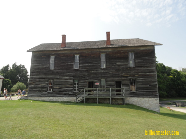
An old building in the park.

An old building in the park.
Now that is was near 5 at night, it was really time to be heading south. We still had at best a 6 hour drive a head of us. So it was time to head around Big and Little Bay de Noc. Once at Escanaba, instead of heading south on Michigan 35, which is how we came up, we stayed with U.S. 41, which we picked up at Rapid River. This way to Menominee was a bit longer, but took us through various small towns, vs having no towns along Michigan 35. Along this path, we were constantly passed by fire truck after fire truck. Then along the way we found the cause. It was a lumber yard on fire. This was not the only interesting thing we passed along the way...we saw a moose...

The was the moose...deer...elk...something...
Without really knowing what we saw outside of Wallace, we kept going. At Menominee it was a bit before sunset, the Yukon needed a fill up and so did we. Luckily there was a Shell with an A&W attached. Everyone and the Yukon filled up and we headed south to home base as fast as we cold...
Back to State #2...Wisconsin!!...

The Wisconsin Welcome Sign on SB U.S. 41 at Marinette, WI.
It was dark as we made our way past Green Bay, and Milwaukee...straight south down Interstate 43 we went...
Back to State #1...Illinois!!...
Back to Experiencing America.
