Experiencing America > UP Side of Life, Vol. 3 > Day 3
Day THREE...
Friday, July 21st, 2023
Today was an adventurous day in the Eastern Upper Pennisula. Starting out in the "Soo" (Sault Ste Marie) we routed ourselves along the southern shores of Lake Superior to see the sights that nature has to provide, and some of those that not everyone gets to. The first leg of this path took us through another indian reservation. This is home to many of the Sault Ste. Marie bands of Chippewa. Passing through the reservation we saw some of the sights that mean along to this community. Including stoping through a museum display regarding the community. It was a very educational experience. Passing through the reservation there was a scenic overlook up a narrow road.

A bural ground at Bay Mills.

A smaller version of the Point Iroquois Lighthouse, that is further up the road.
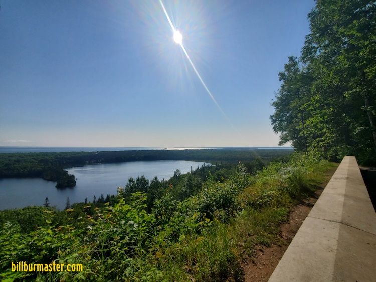
Looking east from Mission Hill.

Looking west from Mission Hill.
At the Point Iroquois Lighthouse, the U.S. Forest Service had a display set up about the lighthouse, and of the folks that are native to the lads around the lighthouse. These grounds also gave beach access to Lake Superior.
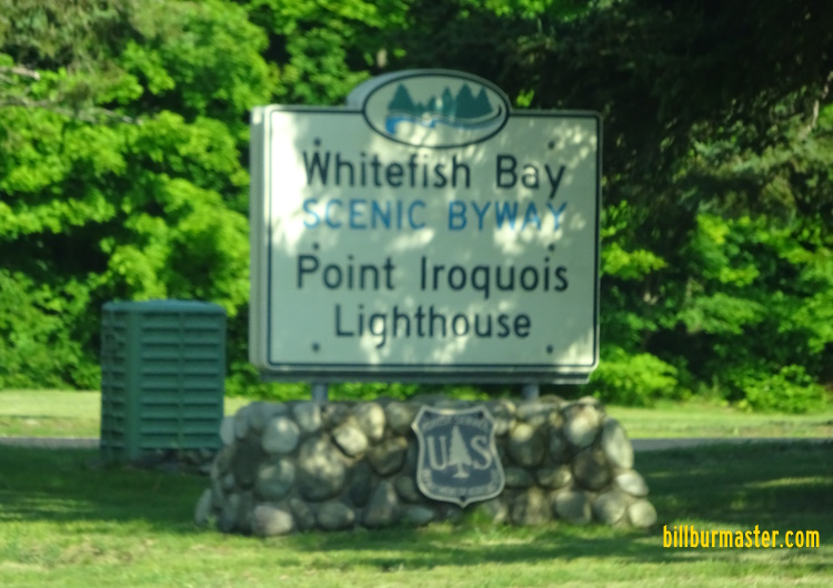
The sign for the lighthouse.

The Point Iroquois Lighthouse.

Looking west from the top of the lighthouse.
Leaving the Point Iroquois Lighthouse, we headed west down the Whitefish Bay Scenic Route. This was a very scenic drive. There was an over look near the point where Lake Superior's southern coast turns north to head up to Whitefist Point. Once we reached the end of the Whitefish Bay Scenic Route, we headed north along Michigan State Route 123, to Paradise. Before Paradise we stopped at the mouth of the Tahquamenon River, where it fed into Lake Superior.

The sign for the Naomikong Overlook.

Looking north from the overlook.
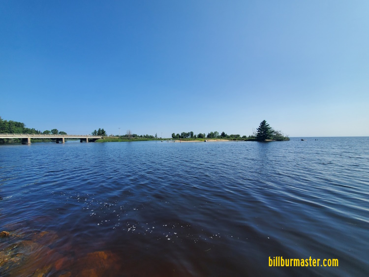
The Tahquamenon River at Lake Superior.
Continuing up Michigan State Route 123, we headed through Paradise, and up north to the end of the road. The end of the road was Whitefish Point. Here was the Great Lake Shipwreck Museum. This is home to many artifacts recovered from sunken ships that live on to tell the story of various tragic events and how life on the ships among the great lakes were and are. Also, on site is a period set up of a lightkeepers house, and a memorial to the lost ship, the SS Edmund Fitzgerald.

The Whitefist Point Lighthouse.

The SS Edmund Fitzgerald memorial.

Looking east along the beach at Whitefish Point.
The next two stops along the journey for the day were two more busy and popular tourist stops in the Upper Pennisula. These were the upper and lower falls along the Tahquamenon River. Both parks show a very much different river than we crossed on Michigan State Route 123, south of Paradise.
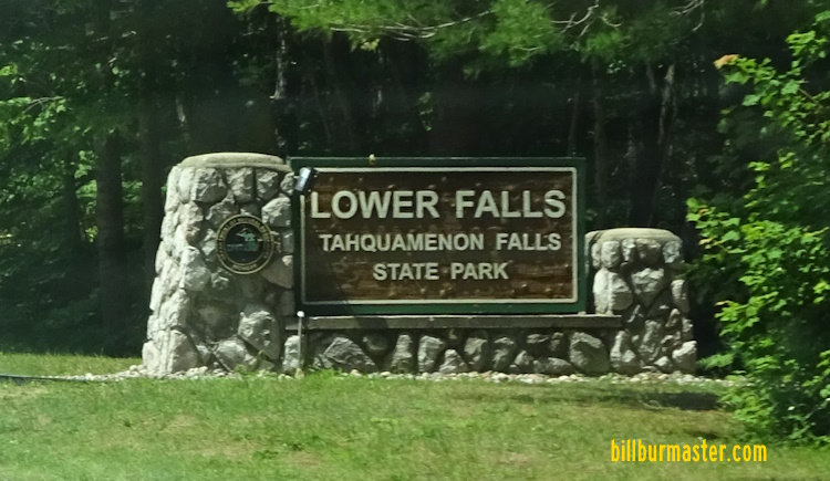
The sign for the park along Michigan 123.

The first view of the lower falls.

A close-up of the falls on the westside of the island in the river.

Another view of the falls.

Looking east along the Tahquamenon River.

The sign for the park along Michigan 123.

One of the first views of the upper falls.

Looking east along the river at the upper falls.
After going to three tourist popular sights that are on the well beaten trail, it was time to put the truck into four-wheels and go out to some off the road beaten places. Both of which were some of the most scenic places we have ever visited. Off a dirt county road north of Michigan State Route 123, and 18.5 miles up twisting, narrowing, hilly dirt/sand roads was the Crisp Point Lighthouse. This remote lighthouse and beach was just miles up awe inspiring coastlines. After some time exploring Crisp Point, it was off to another remote destination. Two Hearted River State Campground, is at the mouth of the Two Hearted River, where the river feeds into Lake Superior. At this campground, to access the beach you have to cross a one person wide walking suspension bridge. This gives access to another remote, and isolated stretch of coastline along Lake Superior. The drive between Crisp Point, and Two Hearted was interesting. It was more non-maintained county dirt roads, in what looked like a land that had been bombed out. In research, it was so devistated looking due to a forest fire some years before.

Luce County Highway 412 near Crisp Point.

Looking at the Crisp Point Lighthouse.

Looking west from the top of the lighthouse.

Looking east from the top of the lighthouse.

A marker near Crisp Point regarding some travelers that got stuck.

Looking west along Luce County Highway 412, south of Two Hearted.

Looking at the suspension bridge across the Two Hearted River.

Looking east along the river.

Looking along the beach of Lake Superior at Two Hearted.

Looking where the Two Hearted River feeds into Lake Superior.
After making our was south to paved roads, we headed south towards Mackinaw City. On Friday, and Sundays, Mackinaw City held firework shows on the Lake Huron side of the city. That was the plans for the evening. Heading down Interstate 75, to cross the "Mighty Mac" for a seocnd time of this trip, we pulled off to see the freighter the "American Century" passing under the bridge. Once in Mackinaw City we set up on the shores at a city part to see the firework show.

Looking south at the Mackinac Bridge from Bridge View Park in St. Ignace.

Looking at the "American Century".

Looking north at the bridge just after sunset from Mackinaw City.

One of the firework burst in the show.

One of the firework burst in the show.
After the show, it was time to head back to Soo. Driving through the dark of Interstate 75, back north, we took a side trip through Downtown Sault Ste Marie, to see this city and the boarder at night.

The header panel on the tol of the Mackinac Bridge Toll Plaza on NB I-75.

The International Bridge at Sault Ste Marie.
Day FOUR