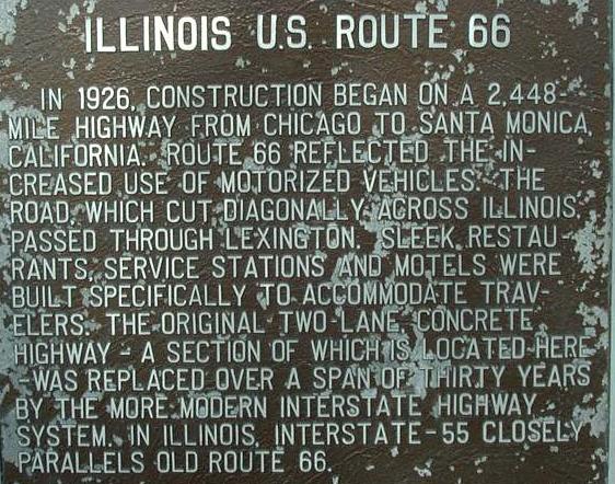
Gardner to Towanda
From Gardner, south to Towanda, U.S. 66 follows Interstate 55 and the Union Pacific Railroad (ex-Southern Pacific; Gulf, Mobile, & Ohio; Illinois Central & Gulf; Chicago & Alton). A good portion of this sections has been named the "Red Carpet Corridor". That does include some towns in the Bolingbrook to Gardner sections. In May each year, towns from Joliet to Towanda have festivities and different activities for an entire weekend.
View Gardner, IL to Towanda, IL in a larger map
Dwight
Dwight is a town that has multiple alignments. Many of the attractions in this town are a short drive off either alignment of Rt. 66. This being the windmill at the Country Mansion or the train station in downtown Dwight.

The windmill at the Country Mansion.

The train station is now the historical society and chamber of commerce.

Dwight is a Amtrak stop.

An Illinois Tourism marker at the train station.

A close-up of the marker above.

A mural in Dwight.
View Dwight, Illinois in a larger map
1st Alignment 2nd Alignment
Odell
In Odell, there are also two alignments of Rt. 66.

SB Old Rt 66 north of Odell.

View Odell, Illinois in a larger map
1st Alignment 2nd Alignment
Cayuga
This is pretty much a grain elevator along the Union Pacific Railroad north of Pontiac. Here there is a "66 roadside attraction".

Sign indicating the turn out.

Barn advertisement.

The turn out is located in the old southbound lanes of Rt. 66. This photo looks north as I-55 curves back in to line and the old northbound lanes of Rt. 66 once again become the Frontage Road.

The old train depot and grain elevator.
Pontiac
Pontiac is the county seat of Livingston County. Although it is not on Rt. 66, the courthouse, and square are worth the side trip to see. Also, just south of the courthouse, along the Vermillion River, there are beutifual suspenion bridges over the river. This is one thing Pontiac is known for. Pontiac is home to the states Route 66 Museum.
View Pontiac, IL in a larger map
1926-1930 Alignment 1930-1930 Alignment 1939-1977 Alignment
Photos of Downtown Pontiac

SB U.S. 66 north of Pontiac.

A street sign along U.S. 66.

NB Rt. 66 as it nears the southside of Pontiac.

The old State Police building south of Pontiac.

A marker outside the bulding. (September, 2017)

A close-up of the marker. (September, 2017)

A marker outside the bulding. (September, 2017)

A close-up of the marker. (September, 2017)

A cut-out of a motorcycle officer from the Rt. 66 era. (September, 2017)
Chenoa
Chenoa is the first town you come to in Mc Lean County. The Livingston/Mc Lean County Line is on the northside of town. Here Rt. 66 was recently reduced from four to two lanes.

SB U.S. 66 at the Livingston/Mc Lean County Line.

NB Rt. 66 in Chenoa. As you see the rail crossing on the right has recently been upgraded, while the one on the left (old southbound lanes) has not.

Downtown Chenoa has several old buildings. This one has a old billboard restored.

Another mural in Downtown Chenoa.
An old billboard in Downtown Chenoa.

One of the towns attractions is the Matthew T Scott House.

It is a short drive off the highway. (Follow the signs)

The plaque next to the house.

A tourist information center at the corner of U.S. 24 & U.S. 66.
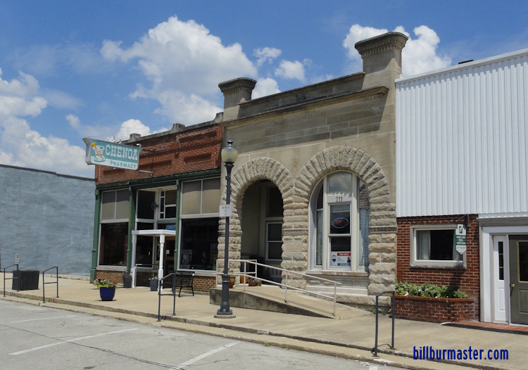
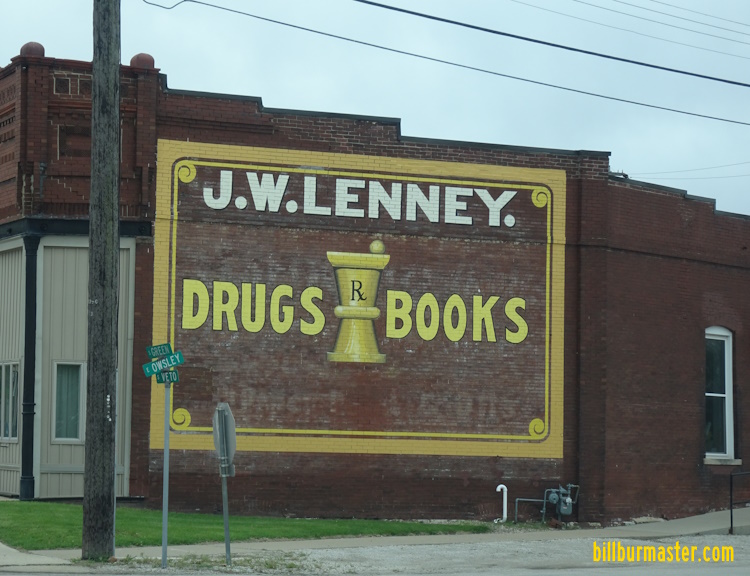
An old pharmacy in Downtown Chenoa.
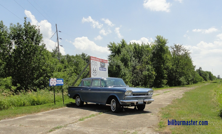
An old section with a classic car set-up just south of U.S. 24 along the Union Pacifc tracks.
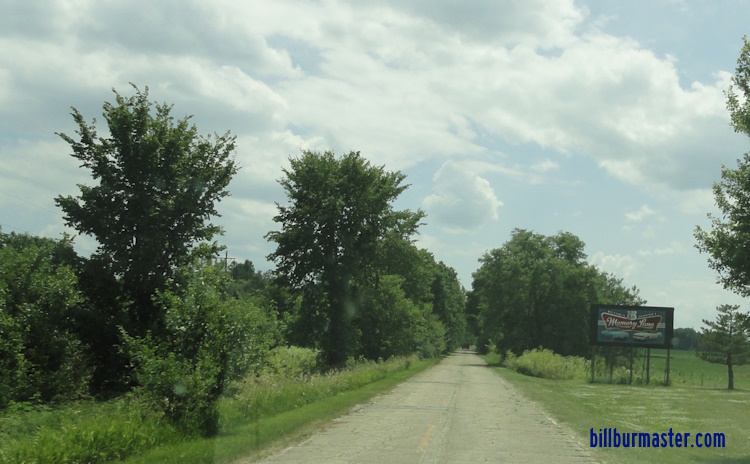
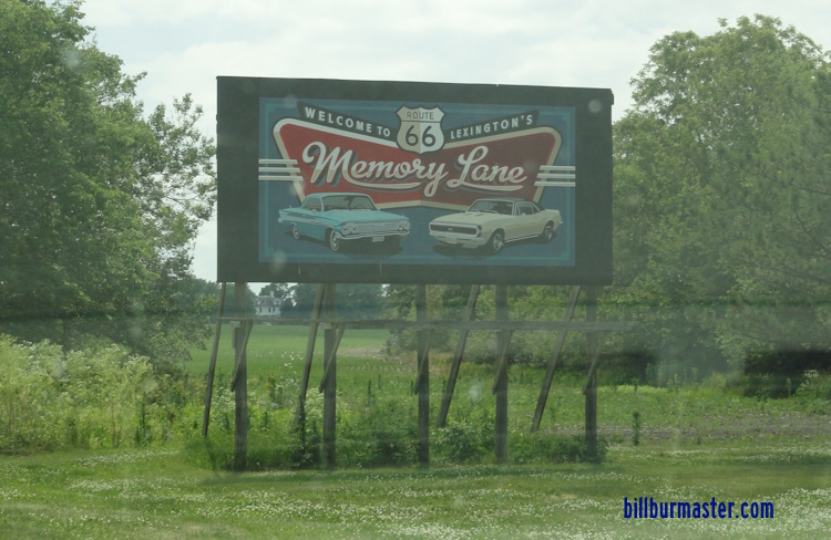
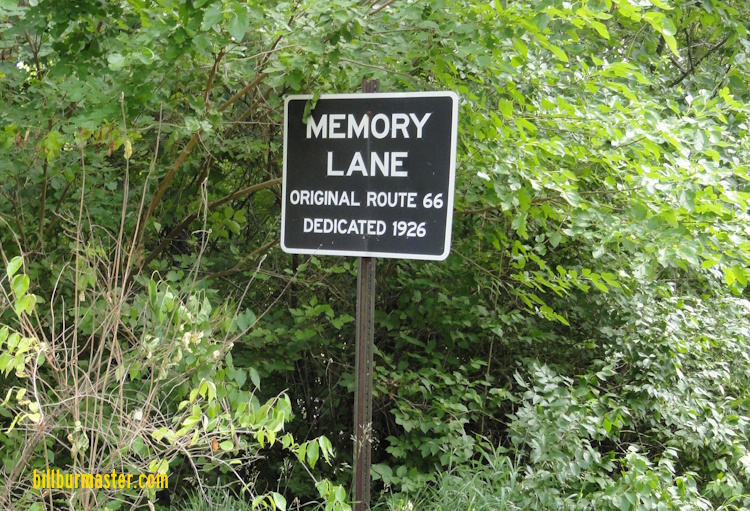
Lexington
Route 66 briefly passes through Lexington. Along the westside of the highway through the Lexington Area, the old southbound lanes have been turned into a bike/walk path. Some groups would like to see the length of Rt. 66 in Illinois turned into a bike/walk path. On the northside of town, a old strech of U.S. Rt. 66 is still intact, but closed to traffic. This is called "Memory Lane".

The attraction marker.

looking north along the southern part of the old section of road.

A woden mile post at the park on the north end of memory lane.

Looking south along memory lane from the north end.
Looking south along Memory Lane.
A sign along Memory Lane.
A sign along Memory Lane.
A sign along Memory Lane.

This neon sign use to inform motorists that Lexington was the east.
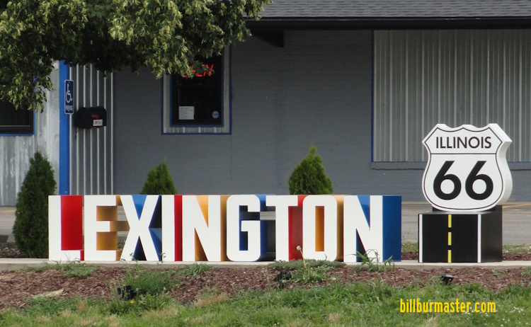
A tourism monument at Lexington.
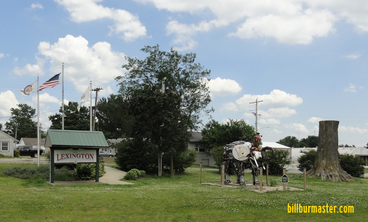
A art display at Lexington.

A marker on the bike/walk path.

Looking north along the bike/walk path north of Mc Lean County Highway 8.

Looking north along the bike/walk path south of Mc Lean County Highway 8. Notice the old highway under the new pavement.
Click the picture for a close up of the plaque.
Rural Mc Lean County
Just south of Lexington, Rt. 66 crosses the Mackinaw River. Before the highways was reduced to two lanes, IDOT replaced several aging structures. In some places they took the old southbound ones out once the northbound was replaced, but here is one place then southbound was left.

Looking north at the river bridges.

The older bridge had it's plaques removed, but the northbound one not only had the new plaque, it also had the old plaque on it. So they lead you to believe the original bridge was built in 1954 and the new bridge replacing it built in 2000.

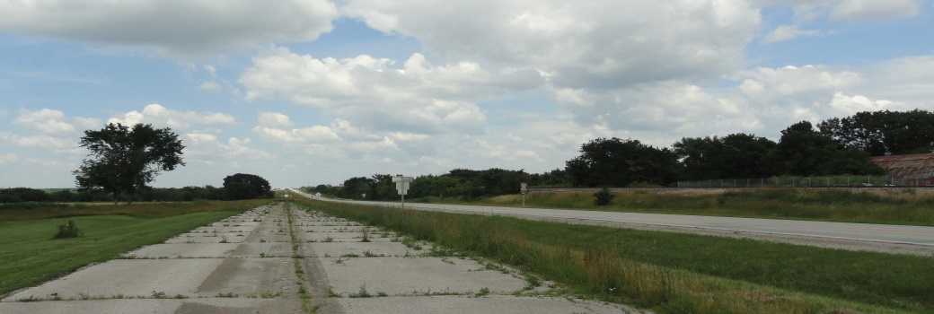
The pavement is still there for the old southbound lanes, but it is becoming overgrown and crumbling.

Looking south along Old Rt.66 (road on left) and I-55 (NB in the center; SB on the right).

Mc Lean County still labels the road as "Old Rt. 66". Many placed still do.

This is found on Mc Lean County Highway 12 at Mc LCH 65 between Lexington and Towanda. Notice the use of "Rte. 66" as a control city.
Towanda
This is a small town about four (4) miles north of the Bloomington-Normal Metro Area. Through Towanda, much of the old southbound lanes have been turned into a shrine for the old highway. For the complete info and pictures just click on the link below.

SB U.S. 66 at Towanda.

An old gas station on the northside of Towanda.

A welcome sign at Towanda.

NB Rt. 66 at Towanda.

Looking north at an old orignal section of Rt. 66.

The attraction sign.

Looking south at an old section towards Deadman's Curve.

Looking at Deadman's Curve.
Looking south at Deadman's Curve.

A plaque at the curve.

A closeup of the plaque.


