Experiencing America > The Upper Things of Life... > Day 1
Day ONE...
Tuesday, August 3rd, 2021
The short trip to the Upper Peninsula of the State of Michigan was more of a fact finding. Finding out the facts of if it is a good place to go visit. Leaving our home base we have to transverse the Chicago Metro Area on a weekday. So to not waste time sitting in traffic, we hit the road before sunrise. The idea was to be past O'Hare International Airport before the heart of the Tuesday morning rush hour. This was a success; we were able to make the Wisconsin State Line around 7 a.m.
Now to State #2...Wisconsin!!!...

The Wisconsin Welcome Sign on NB I-41/94; U.S. 41.
Now in the land of the cheese...the land of the pack...America's Dairyland...and so on... The plan for the trip was to head straight north. Just drive until we hit water. Along the way see the various places along Lake Michigan, and lighthouses. As always gathering content for the other sites in our web services family. Another obstacle to pass through is the Milwaukee Metro Area. Since the last time we have been to the Milwaukee Area the homefield of the Milwaukee Brewers changed names. This is even though to purest and many alike it will always be Miller Park.

American Family Field; Milwaukee, WI.
Once through Milwaukee it was on to get past Wisconsin and to Northern Michigan. Along the way we made brief stops that the Lake Michigan lakefront in Port Washington, and Sheboygan. The views along Interstate 43 we most of farmland and farmland...then when we would round another corner...more farmland.

A large flag along I-43 at Sheboygan, WI.

The lakefront in Sheboygan, WI.
After Sheboygan, it was back north of Interstate 43. Once again it was farmland, farmland, and more farmland. To ad to the lack of things to see...we were well outside the Milwaukee radio market...which means constant scanning and scanning and finding virtually no radio worth listening to. The high cost of the industry was clear in the low quality of the production value. With more driving going on it was time for a break to walk around. Once to Manitowoc, there was a Goodwill to see what hidden treasures await. Then to keep going north we headed into Manitowoc towards the lakefront. Here we came across a rare entry to the state for car traffic. This is where the ferry from Ludington, MI ports on the Wisconsin side.

The Wisconsin Welcome Sign on WB U.S. 10.

A tank at the Manitowoc water facility painted like fishing bobber.

The lakefront at Manitowoc.

The lighthouse at Manitowoc.
Instead of rejoining the fast paced life of the interstate highway system we took Wisconsin 42 north from Manitowoc. This hugged the Lake Michigan coast through most farmland. The drive was nice...pleasant as it maybe...until the road closed. So there was the detour...about a mile in, and a look at the map; the detour was abandoned for the sake of saving time. In came the short cut. Flashbacks of the Simpsons going to Itchy and Scratchy Land started coming back to mind. When we got to an eat-west county blacktop to had back towards Wisconsin 42 we took it. Only to find out that Wisconsin 42 is still closed at that point. This put us on a curvy, hilly, bicyclist filled narrow road. Eventually we ended up in Kewaunee. Here there was a great view of the Lake Michigan lakefront, a lighthouse, a ship, and a world's largest.

The lighthouse at Kewaunee, WI.

U.S. Army ship Ludington at Kewaunee, WI.

The world's largest clocktower in Kewaunee, WI.

A Corvette on a stick in Kewaunee, WI.
If we kept going north along this trajectory we would run out of road, and end up in Door County. So it was west from Kewaunee to Green Bay. The mecca for Packers fans alike. When is to be the football shrine of Wisconsin.
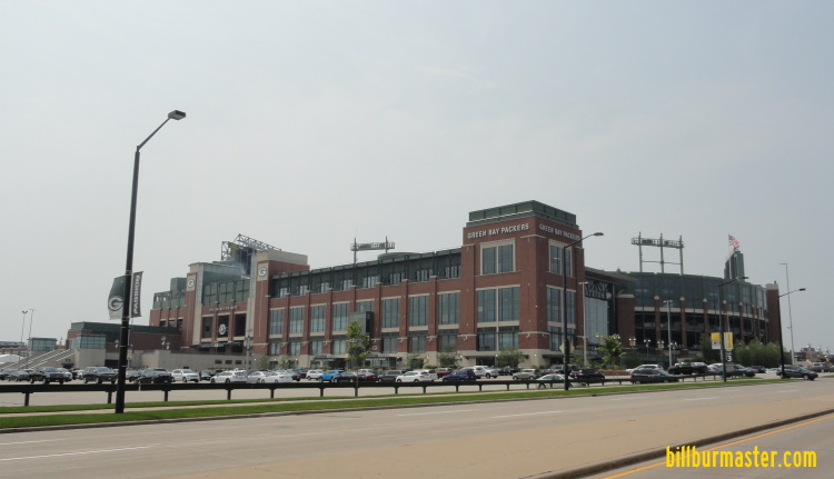
Lambeau Field. Home of the Green Bay Packers; Green Bay, WI.

Looking north into Green Bay from Interstate 43 at Green Bay, WI.
Once we went to see what the hub-bub is about the Home of the Packers...it was back onto the highway to venture into the woods and get off the grid so to speak. This would be the first time we would be away from the interstate highway system, cell service, and Mc Donald's and any long period of time. As the interstate highways ended at Green Bay (the city), and the further up along Green Bay (the water body) the highway went from a four-lane freeway...to a four-lane expressway...to a two lane city street with twists and turns. Marinette was the last city in Wisconsin we went through.

A mock-up of an old horse drawn wagon pulling timber.
Now to State #3...Michigan!!!...

The Michigan Welcome Sign on NB U.S. 41 at Menominee, MI.
At Menominee we went out to the lakefront and then made our way further north into the back woods of the Upper Peninsula.

The lighthouse at Menominee.

Looking out at Lake Michigan from MI 35 north of Menominee.
For about and hour driving of woods and water...woods and water...then some water and woods...we came into Escanaba. The third largest city in the Upper Peninsula. Here we went out to the waterfront. This made for a good place to stretch the legs out before we made the final leg of our trip north for the day.
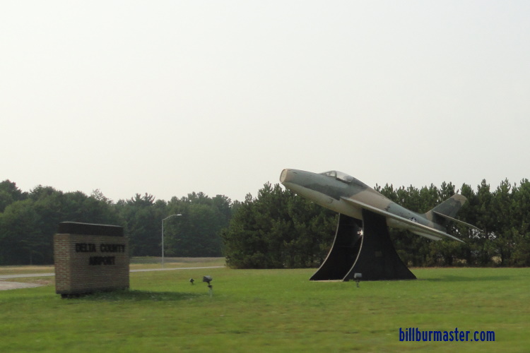
A place at the airport in Escanaba.

The lighthouse at Escanaba.

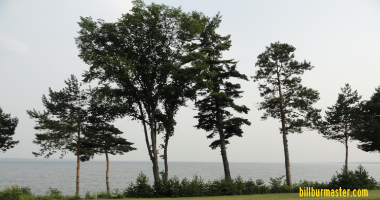
Looking out over Little Bay de Noc at Escanaba.
As we worked our way towards Munising for the day we have more water and woods to go through. To get there without wasting time we were burning daylight. So it was a stop at the last Mc Donald's we would see for days and a Subway to get food or a food like substance for the drive. The pull off was at Gladstone. The last bit of civilization. This is a nice sleepy community with a great waterfront of Little Bay de Noc and an old train that is inaccessible to the public.
Looking south at Little Bay de Noc at Gladstone.

Soo engine 730 at Gladstone.
The next hour was up a series of Michigan highway to arrive at Munising. The basecamp for the next day...
Day TWO