Experiencing America > UP Side of Life, Vol. 3 > Day 2
Day TWO...
Thursday, July 20th, 2023
The journey further north continues today. The desination for the night is Sault Ste Marie, Michigan. Yet why go in a straight line, or the shortest distance. You have heard going south by southwest...we are going north by east. To add another one of the Great Lakes to this journey, the plan was to cut across the Lower Peninsula, and drive along the Lake Huron shores. Yet before leaving the Traverse City Area, there was one lighthouse still to visit. The Mission Point Lighthouse is just south of the 45th Parellel, north of Traverse City.
The Mission Point Lighthouse, near Old Mission, MI.
As we headed south back into Traverse City, a late July rain storm moved into the area. Instead of spending the day driving east across Lower Michigan in a rainstorm, we killed sometime in Traverse City, then headed south towards Cadillac for lunch at a Big Boy, before heading west.

A mural in Kingsley, MI.
With the skys cleared...for the most part...we still hit patches of clouds, and rain, we headed across Michigan State Route 72 towards Lake Huron. Our first glimpse of Lake Huron was at the Harrisville State Park, in shockingly...Harrisville.

The sign for the state park along U.S. 23.

Looking out over Lake Huron at Harrisville.
Now at U.S. 23, we plan to follow this highway north, northwest towards the Mackinaw Bridge. Along the way there are many lighthouses to see. While we did not go to all of them, we visited many. The first was Sturgeon Point. After Sturgeon Point, we continues north through Alepna. Before Alpena we found the 45th Parellel (again), and Jesus...with the whole wolrd in his hands...

The Sturgeon Point Lighthouse.

Looking along Lake Huron at Sturgeon Point.

A statue of Jesus with a globe.
After we pass through Alpena, we head off U.S. 23 and go to see the Presqu Isle lighthouses. Heading up county blacktops, we find there are three different lighthouses at Presque Isle. There is the range light, the old lighthouse, and the new lighthouse. Between the range light, and the two other lighthouses you pass through the Presque Isle State Harbor.

Looking at a display at the Presque Isle Range Light.

Looking out over the waters at the range light.

Looking at the old Presque Isle Lighthouse from the beach at the range light.

A sign for the Presque Isle State Harbor.

Looking at the new Presque Isle Lighthouse.

Looking along Lake Huron at Presque Isle Lighthouse.
Leaving Presque Isle, we head back onto U.S. 23 and towards the Mackinaw Bridge. Heading northwest we pass through Rogers City, then the 40-Mile Point Lighthouse. At Rogers City, we see the Tourch of Freedom. It looks like, and probally is a repilica a the tourch of the Statue of Liberty. Stopping at 40-Mile Point Lighthouse, we get to see Lake Huron at this point, a lighthouse, and a shipwreck.

The Torch of Freedom.

The 40-Mile Point Lighthouse.

Looking along Lake Huron at 40-Mile Point.

Looking at the wreck of the Joseph S. Fay.
As we lose sunlight, we still have over 150 miles to goto get to Sault Ste Marie. So it is time to head up U.S. 23, and start playing everyone's favorite game...atleast those that love heading to the Upper Pennisula..."Spot the Bridge". The first glimpse is from the shores of Lake Huron at Cheyboygan, the first up-close glimpse as we head along U.S. 23 into Mackinaw City. After crossing the bridge, we stopped off at Bridge View Park in St. Ignace, before finishing the last leg along Interstate 75, to Soo for the night.
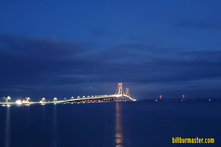
Looking south at the bridge from Bridge View Park.
Day THREE