U.S. Federal Route 30 is the main east-west highway across Southern Clinton County. From De Witt to Clinton it runs along a multi-lane highway. U.S. Rt. 30 passes through the following towns in Clinton County. Clinton
De Witt
Grand Mound
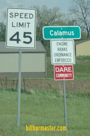
Calamus
Wheatland
U.S. Rt. 30 is multi-plexed in Clinton County. U.S. Rt. 67, at Clinton.
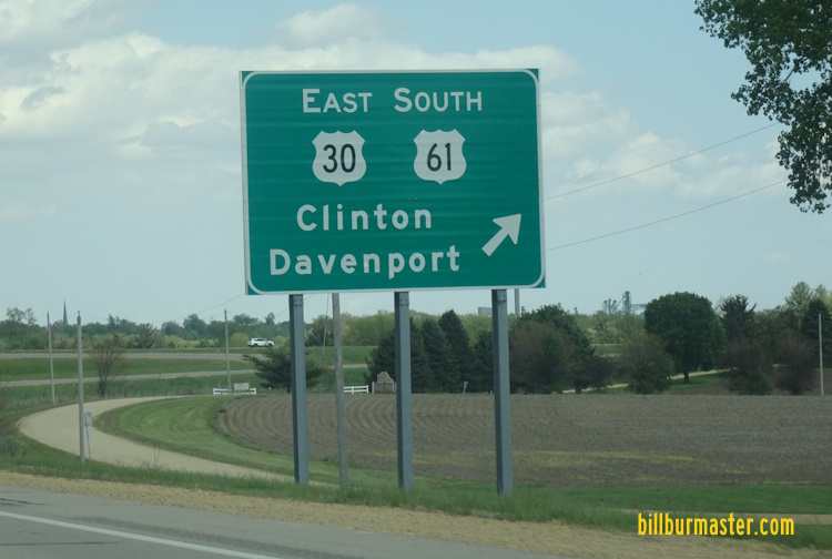
EB U.S. Rt. 30 at the Cedar/Clinton County Line. (December, 2013) EB U.S. Rt. 30 at the Cedar/Clinton County Line. (September, 2024) EB U.S. Rt. 30 east of Wheatland. EB U.S. Rt. 30 west of Calamus. WB U.S. Rt. 30 west of Calamus. WB U.S. Rt. 30 ner Davenport St in Calamus. EB U.S. Rt. 30 at Calamus. WB U.S. Rt. 30 near 2nd in Calamus. EB U.S. Rt. 30 east of Calamus. WB U.S. Rt. 30 west of Grand Mound. EB U.S. Rt. 30 at Grand Mound. EB U.S. Rt. 30 on the eastside of Grand Mound. EB U.S. Rt. 30 east of Grand Mound. WB U.S. Rt. 30 west of De Witt. EB U.S. Rt. 30 west of U.S. Rt. 61. A BGS on EB U.S. Rt. 30. A BGS on EB U.S. Rt. 30. A BGS on EB U.S. Rt. 30. WB U.S. Rt. 30/NB U.S. Rt. 61 near De Witt. WB U.S. Rt. 30/NB U.S. Rt. 61 south of north U.S. Rt. 61. A BGS on WB U.S. Rt. 30/NB U.S. Rt. 61. A BGS on WB U.S. Rt. 30/NB U.S. Rt. 61. A BGS on WB U.S. Rt. 30/NB U.S. Rt. 61. A BGS on WB U.S. Rt. 30/NB U.S. Rt. 61. A BGS on NB U.S. Rt. 61. WB U.S. Rt. 30 at U.S. Rt. 61 on the southwest side of De Witt. WB U.S. Rt. 30 at south U.S. Rt. 61. WB U.S. Rt. 30 east of south U.S. Rt. 61. A BGS on EB U.S. Rt. 30/SB U.S. Rt. 61. A BGS on WB U.S. Rt. 30. A BGS on WB U.S. Rt. 30. WB U.S. Rt. 30 at De Witt. EB U.S. Rt. 30 east of De Witt. WB U.S. Rt. 30 east of De Witt. EB U.S. Rt. 30 west of CCH Z30. WB U.S. Rt. 30 west of CCH Z30. EB U.S. Rt. 30 west of CCH Z36. WB U.S. Rt. 30 west oc CCH Z36. WB U.S. Rt. 30 east of CCH Z36. EB U.S. Rt. 30 east of Low Moor. EB U.S. Rt. 30 west of Clinton. WB U.S. Rt. 30 west of Clinton. WB U.S. Rt. 30 west of 25th in Clinton. WB U.S. Rt. 30 at 25th in Clinton. EB U.S. Rt. 30/NB U.S. Rt. 67 in Clinton. A set of guide markers in Clinton. WB U.S. Rt. 30/NB U.S. Rt. 67 on the westside of Clinton. EB U.S. Rt. 30/NB U.S. Rt. 67 in Clinton. WB U.S. Rt. 30/SB U.S. Rt. 67 at 5th in Clinton. A guide marker on SB U.S. R.t 67. A guide marker on SB U.S. Rt. 67. EB U.S. Rt. 30 at the Iowa side of the Mississippi River Bridge. EB U.S. Rt. 30 crossing the Mississippi River. EB U.S. Rt. 30 in mid-span of the Mississippi River Bridge. WB U.S. Rt. 30 on the east bank of the Mississippi River Bridge. Looking south at the U.S. Rt. 30 Mississippi River crossing.