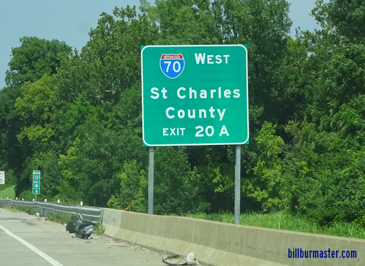
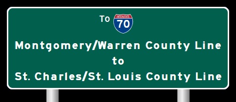
 | Interstate 70 St. Louis/St. Charles County Line to the Illinois/Missouri State Line |

WB I-70 at the Missouri/Illinois State Line.

EB I-70 near the Illinois State Line.

EB I-70 on the Stan Musual Veterans Bridge.

EB I-70 at the Stan Musual Veterans Bridge.

WB I-70 at the Missouri Welcome Sign.

A BGS on the ramp from SB I-55 to EB I-44.

A guide marker on WB Washington in St. Louis.

A guide marker on WB Washington in St. Louis.

A BGS on NB Lumier Place Blvd.

A guide marker on 4th in St. Louis.

A guide marker on 4th in St. Louis.

A guide marker on 4th in St. Louis.

A guide marker on NB 4th Street in Downtown St. Louis.
A guide marker on 4th in St. Louis.
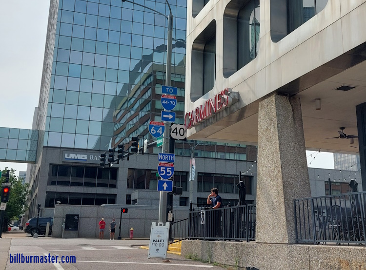
A guide marker on Walnut in St. Louis.

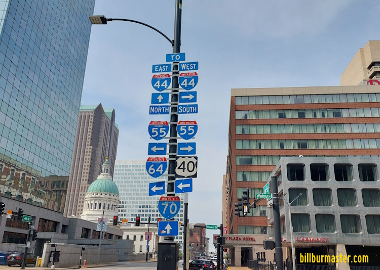
A set of guide markers on Washington in Downtown St. Louis.

A set of guide markers near the Dome in Downtown St. Louis.

A guide marker on 8th in St. Louis.

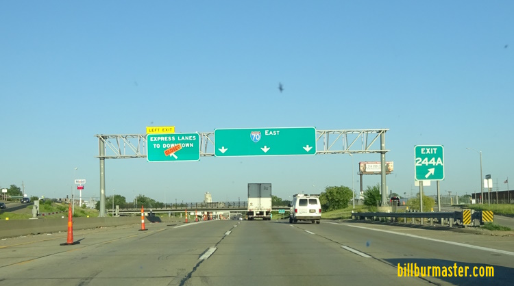
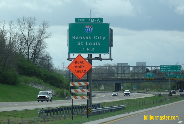
EB I-70 at Tucker Blvd.

WB I-70 west of Tucker Blvd.
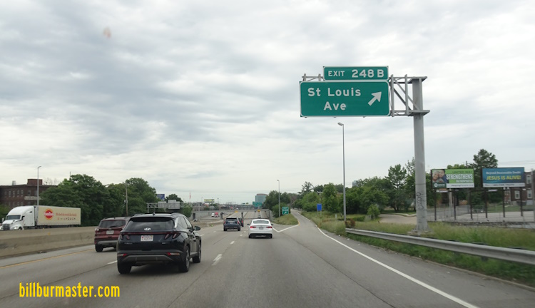
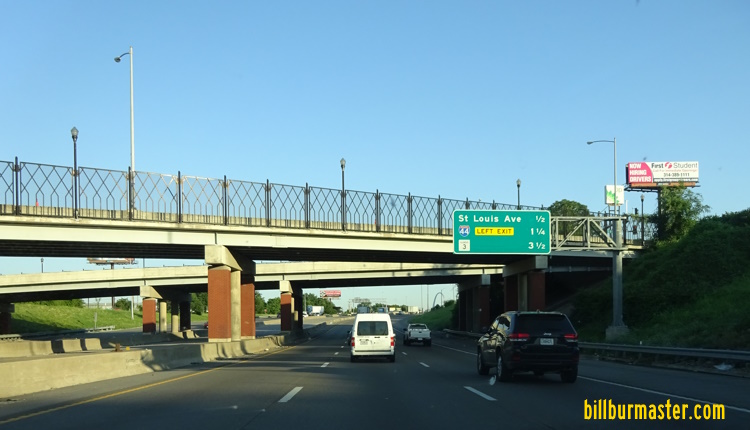
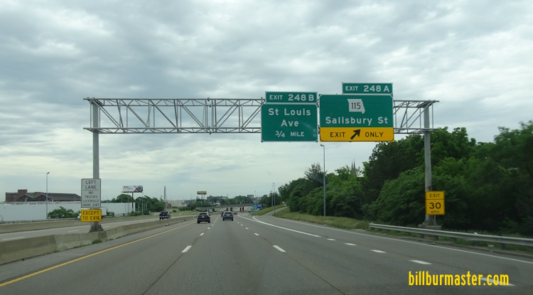
EB I-70 at St. Louis Ave.

WB I-70 at Branch Street.

A guide marker at MO St Rt 115 in St. Louis.

A guide marker on MO St Rt 115.
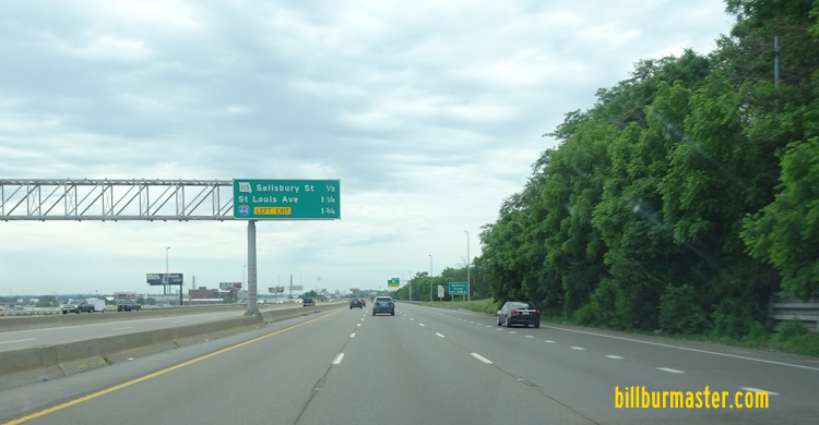
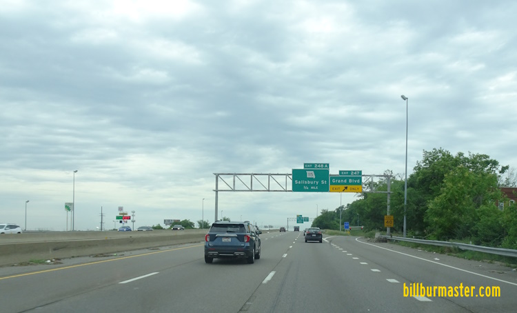
EB I-70 east of Salisbury.

EB I-70 at Salisbury.
EB I-70 at Salisbury.

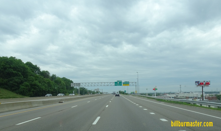
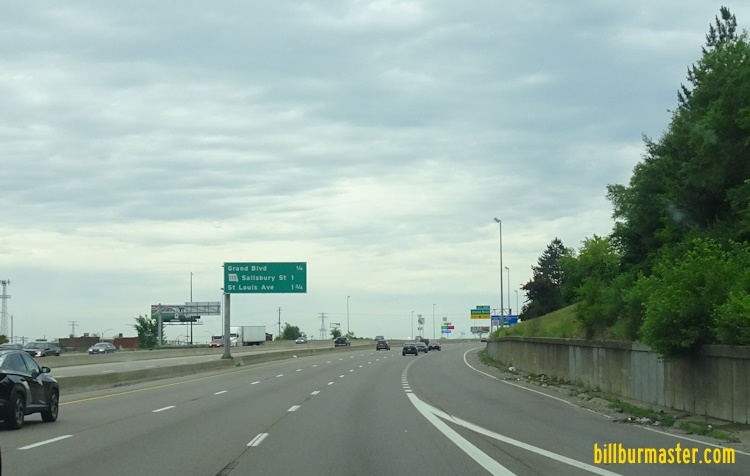
EB I-70 west of Salisbury.

WB I-70 west of Mc Kinley.
WB I-70 west of Mc Kinley Street.
EB I-70 east of Grand.
WB I-70 at Grant.
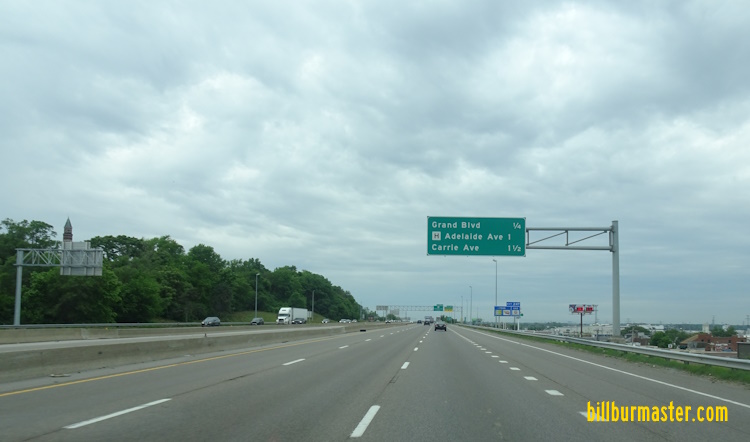
EB I-70 at Grand.

WB I-70 west of Grand.
WB I-70 west of Grand.

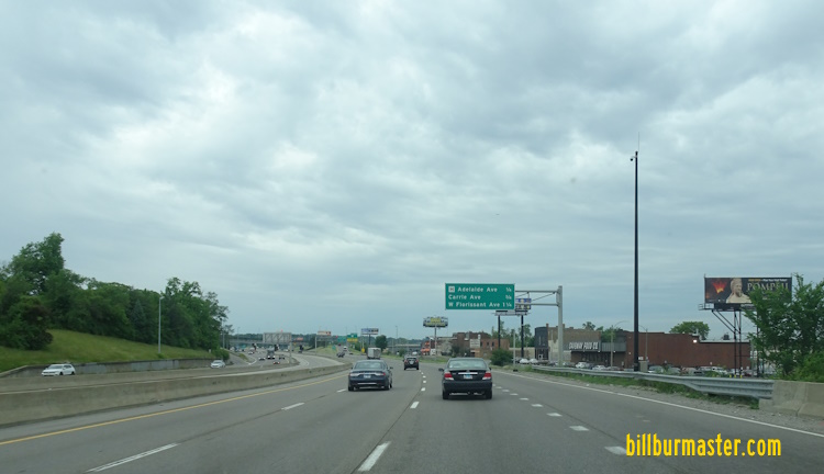
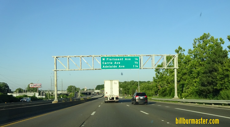
EB I-70 east of Addelaide.
EB I-70 east of Addelaide.
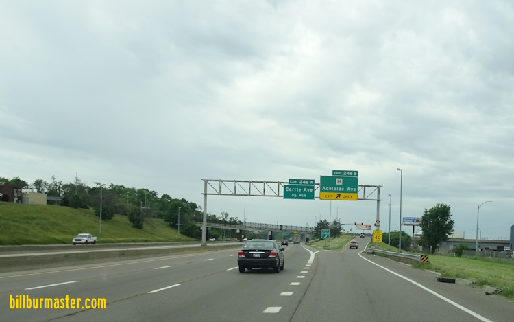
WB I-70 at Addelaide.
EB I-70 east of Shreve Avenue.

EB I-70 east of Kingshighway.
EB I-70 at Union.

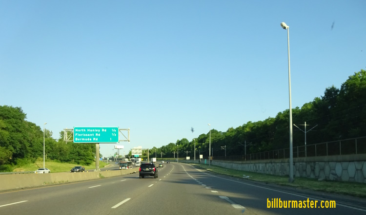
EB I-70 east of Jennings Station Road.
EB I-70 at Jennings Station Road.

A guide marker in North St. Louis.

A guide marker on SB MO St Rt 367 in St. Louis.

WB I-70 near Cool Valley.
EB I-70 west of Florissant Road.

A guide marker near UMSL.

A BGS near UMSL.

A BGS on NB I-170.
A BGS on SB I-170.

WB I-70 east of I-170.

EB I-70 east of MO St Rt 115-Natural Bridge Road.

A guide marker on WB MO St Rt 115.

A guide marker on WB MO St Rt 115.

EB I-70 at MO St Rt 115-Natural Bridge Road.
EB I-70 west of MO St Rt 115-Natural Bridge Road.

WB I-70 west of MO St Rt 115.

EB I-70 near Lambert-St. Louis International Airport.

WB I-70 near Lambert-St. Louis International Airport.

WB I-70 east of Lambert-St. Louis International Airport.

WB I-70 at Lambert-St. Louis International Airport.

EB I-70 west of Lambert-St. Louis International Airport.
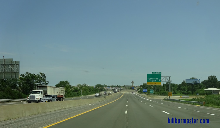
EB I-70 at Cypress.

WB I-70 west of Lambert-St. Louis International Airport.

EB I-70 at U.S. Rt. 67-Lindberg Blvd.

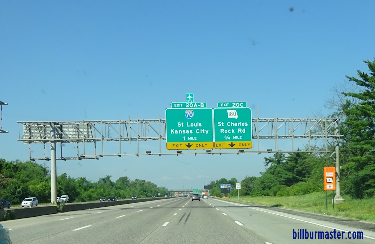
WB I-70 east of MO St Rt 180.

EB I-70 east of MO St Rt 180-St. Charles Rock Road.

EB I-70 at MO St Rt 180-St. Charles Rock Road.

EB I-70 west of MO St Rt 180-St. Charles Rock Road.

EB I-70 in Bridgeton.

A guide marker near Lambert-St. Louis International Airport.

WB I-70 near Bridgeton.

A BGS on NB I-270.
A BGS on NB I-270.

A BGS on NB I-270.

A motorist advisory BGS on WB I-270.
A BGS on WB I-270.
WB I-70 east of MO St Rt 141.

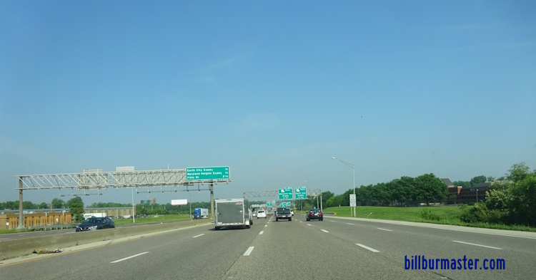
WB I-70 near the Earth City Expressway at Bridgeton

WB I-70 west of the Earth City Expressway.
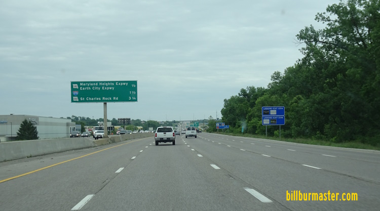
EB I-70 west of the Earth City Expressway.
WB I-70 east of the Missouri River. (May, 2023)

WB I-70 east of the Missouri River.

WB I-70 at the eastside of the Missouri River.


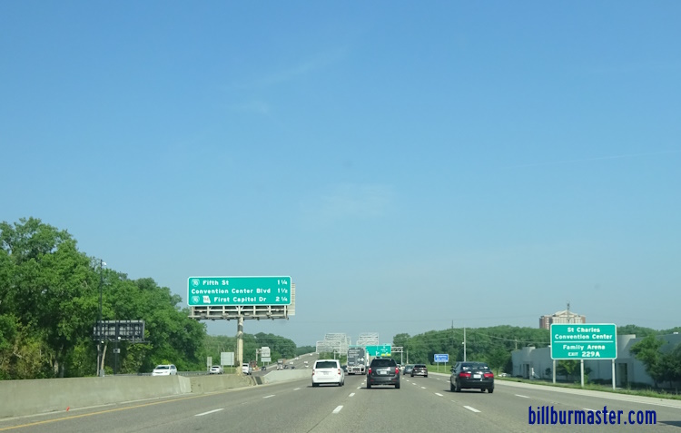
Westbound I-70 at the Blanchette Bridge over the Missouri River at St. Charles.

Westbound I-70 crossing the Missouri River on the Blanchette Bridge at St. Charles.
| CONTINUE TO: |
| EASTBOUND: | WESTBOUND: |
 |  |