U.S. Federal Route 41 runs north-south through through Milwaukee County. Throughout Milwaukee County, U.S. Rt. 41 follows Interstate 41. Prior to the designation of I-41 in the State of Wisconsin, U.S. Rt. followed I-94 from the Racine/Milwaukee County Line to the Miller Park Interchange, west of Milwaukee. From the Miller Park Interchange to Mill Road, on the northwest end of Milwaukee it followed what is now Wisconsin State Route 175. From this point to the Waukesha County Line, U.S. Rt. 41 followed it's current path. U.S. Rt. 41 passes through the following town in Milwaukee County. Oak Creek
Milwaukee
Greenfield
West Allis
Wauwatosa
U.S. Rt. 41 is multi-plexed in Milwaukee County. Interstate 41, throughout Milwaukee County. Interstate 94, at Milwaukee.
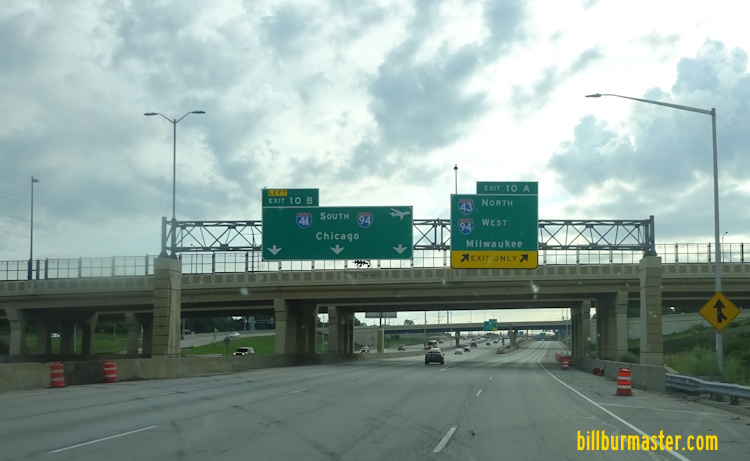
Photos for the old Milwaukee County Routing Prior to the designation of Interstate 41, U.S. Rt. 41 followed Interstate 94 from the Racine/Milwaukee County Line to the interchange at Miller Park in Milwaukee. The new routing has U.S. Rt 41 leaving I-94 at I-894 at the Airport Interchange. Photos before the alignment change. An old BGS at the Airport Interchange. A BGS near the Marquette Interchange. BGS's on Miller Park Blvd. BGS on EB I-94. A BGS on I-94. WB I-94/NB U.S. Rt. 41 near Miller Park. A BGS on NB I-43/U.S Rt. 41; WB I-94. A guide marker near National Ave. A BGS on WB I-94.
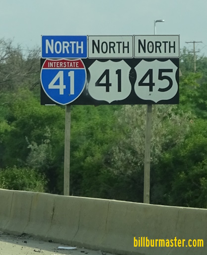
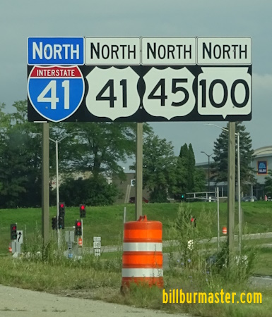
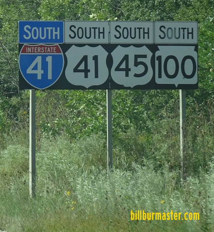
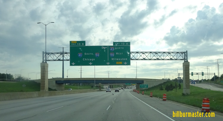
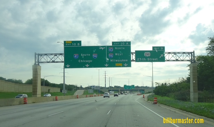
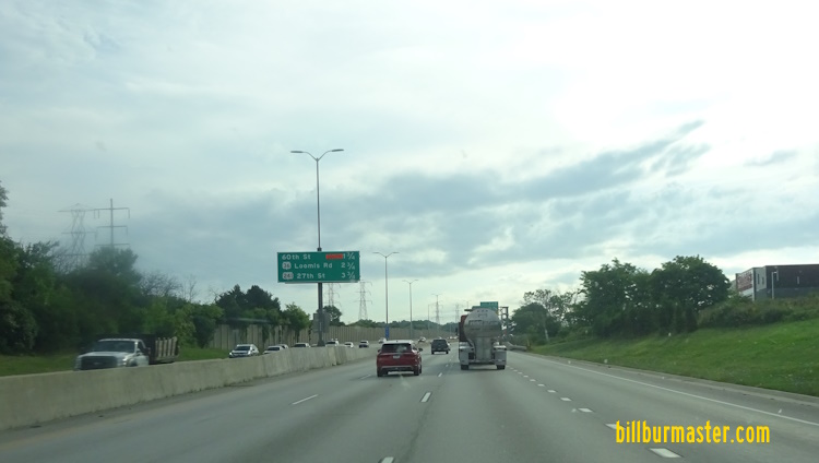
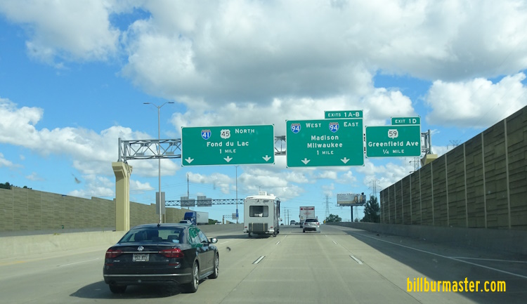
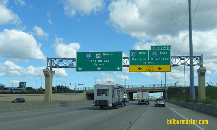
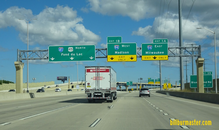
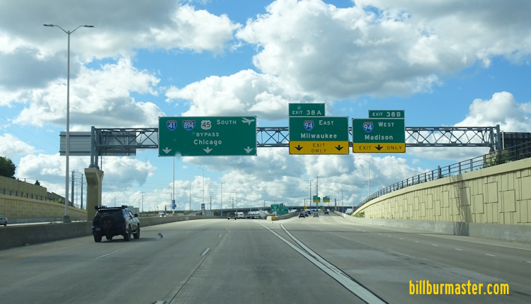
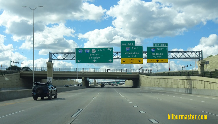
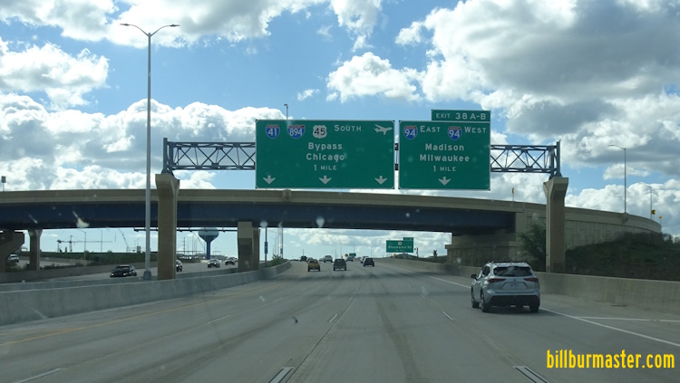
NB I-41/U.S. Rt. 41; WB I-94 at the Racine/Milwaukee County Line. (September, 2018) NB I-41/U.S. Rt. 41; WB I-94 at the Racine/Milwaukee County Line. (September, 2024) NB I-41/U.S. Rt. 41/WB I-94 at Elm Road. NB I-41/U.S. Rt. 41; WB I-94 south of WI St Rt 100. NB I-41/U.S. Rt. 41; WB I-94 at WI St Rt 100. A BGS on NB I-41/U.S. Rt. 41; WB I-94. NB I-41/U.S. Rt. 41; WB I-94 south of Drexel Ave. NB I-41/U.S. Rt. 41; WB I-94 at Drexel Ave. NB I-41/U.S. Rt. 41; WB I-94 south of Rawson Ave. in Milwaukee. SB I-41/U.S. Rt. 41; EB I-94 near Rawson Ave. in Milwaukee. SB I-41/U.S. Rt. 41; EB I-94 near College Ave. in Milwaukee. NB I-41/U.S. Rt. 41; WB I-94 at Collage Ave. NB I-41/U.S. Rt. 41; WB I-94 under one mile from I-43/894. (September 2018) NB I-41/U.S. Rt. 41; WB I-94 at WI St Rt 119. NB I-41/U.S. Rt. 41; WB I-94 at WI St Rt 119. NB I-41/U.S. Rt. 41; WB I-94 near I-43/894. (September, 2018) NB I-41/U.S. Rt. 41; WB I-94 at Layton Ave. NB I-41/U.S. Rt. 41; WB I-94 at I-43/894. (September, 2018) A junction marker on WB MCH ZZ. Guide marker in Milwaukee. A BGS on SB I-43/EB I-94. A BGS on SB I-41/U.S. Rt. 41; NB I-43; EB I-894. SB I-41/U.S. Rt. 41; NB I-43; EB I-894 at the Mitchell Interchange. SB I-41/U.S. Rt. 41; NB I-43; EB I-894 at 27th Street. SB I-41/U.S. Rt. 41; NB I-43; EB I-894 west of 27th Street. SB I-41/U.S. Rt. 41; NB I-43; EB I-894 at 68th Street in Greenfield. SB I-41/U.S. Rt. 41; NB I-43; EB I-894 at 92nd Street in Greendfield. SB I-41/U.S. Rt. 41; NB I-43; EB I-894 at 92nd Street in Greendfield. A BGS on NB I-43. A set of guide markers on NB U.S. Rt. 45/WI St Rt 100. NB I-41/U.S. Rt. 41; SB I-43; WB I-894 near I-43/U.S. Rt. 45. SB I-41/U.S. Rt. 41-45; EB I-894 at I-43. NB I-41/U.S. Rt. 41-45; WB I-894 north of I-43. SB I-41/U.S. Rt. 41-45; EB I-894 near I-43. SB I-41/U.S. Rt. 41-45; EB I-894 before I-43. SB I-41/U.S. Rt. 41-45; EB I-894 in Greenfield. SB I-41/U.S. Rt. 41-45; EB I-894 near Oklahoma Ave in West Allis. SB I-41/U.S. Rt. 41-45; EB I-894 at Lincoln Ave in West Allis. SB I-41/U.S. Rt. 41-45; EB I-894 at Lincoln Ave in West Allis. SB I-41/U.S. Rt. 41-45; EB I-894 at Lincoln Ave. SB I-41/U.S. Rt. 41-45; EB I-894 north of Lincoln Ave. NB I-41/U.S. Rt. 41-45; EB I-894 south of Greenfield Ave. NB I-41/U.S. Rt. 41-45; EB I-894 south of I-94. NB I-41/U.S. Rt. 41-45; EB I-894 at I-94. SB I-41/U.S. Rt. 41-45; EB I-894 south of I-94. SB I-41; U.S. Rt. 41/45 at I-94/894. SB I-41; U.S. Rt. 41/45 at the ramps for I-94. SB I-41; U.S. Rt. 41/45 south of U.S. Rt. 18. SB I-41; U.S. Rt. 41/45 north of U.S. Rt. 18. SB I-41; U.S. Rt. 41/45 south of Watertown Plank Road. SB I-41; U.S. Rt. 41/45 at Watertown Plank Road. SB I-41; U.S. Rt. 41/45 north of Watertown Plank Road. SB I-41; U.S. Rt. 41/45 south of North Ave. SB I-41; U.S. Rt. 41/45 at North Ave. NB I-41; U.S. Rt. 41/45 south of Center Street in Brookfield. SB I-41/U.S. Rt. 41-45 south of Burleigh Street. NB I-41; U.S. Rt. 41/45 south of WI St Rt 190. SB I-41; U.S. Rt. 41/45 south of Capital Drive. SB I-41; U.S. Rt. 41/45 north of Capital Drive. BGS on SB U.S. Rt. 41/45/WI St Rt 100. NB U.S. Rt. 41/45/WI St Rt 100 in Milwaukee. Mile marker on the Zoo Freeway. NB U.S. Rt. 41/45/WI St Rt 100 near WI St Rt 145. NB I-41/U.S. Rt. 41-45 at the Menomonee River. NB I-41/U.S. Rt. 41-45 south of Silver Springs Drive. SB I-41; U.S. Rt. 41/45; WI St Rt 100 north of Silver Springs. BGS in Milwaukee. BGS on SB U.S. Rt. 41/45/WI St Rt 100. NB I-41/U.S. Rt. 41-45/WI St Rt 100 south of WI St Rt 175. NB I-41/U.S. Rt. 41-45/WI St Rt 100 south of WI St Rt 175. NB I-41/U.S. Rt. 41-45/WI St Rt 100 north of WI St Rt 175. NB I-41/U.S. Rt. 41-45/WI St Rt 100 north of WI St Rt 175. NB I-41/U.S. Rt. 41-45/WI St Rt 100 at Good Hope. NB I-41/U.S. Rt. 41-45/WI St Rt 100 north of WI St Rt 145.