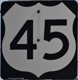
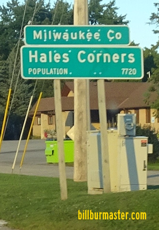
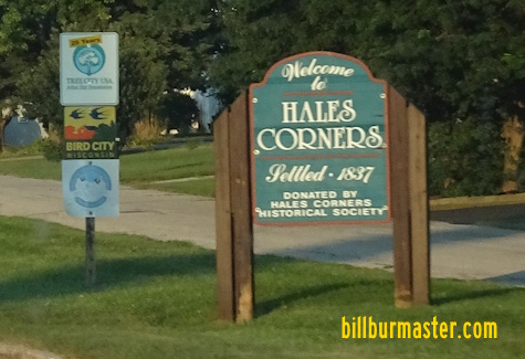
U.S. Federal Route 45 runs north-south along the western edge of Milwaukee County. From Greenfield to the Waukesha/Milwaukee County Line, this highway runs along the Zoo Freeway. U.S. Rt. 45 passes through the following towns in Milwaukee County. Franklin Hales Corners
Greenfield
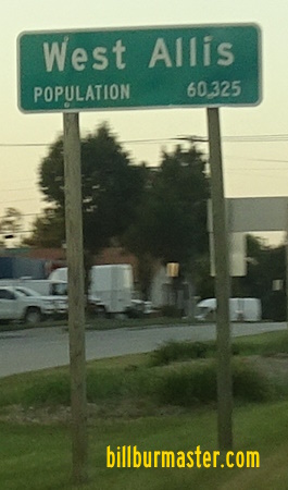
West Allis
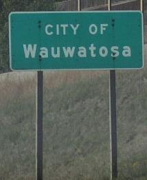
Wauwatosa
Milwaukee
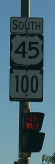
U.S. Rt. 45 is multi-plexed in Milwaukee County. Wisconsin State Route 100, from Franklin to Greenfield.
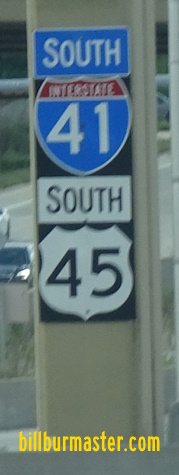
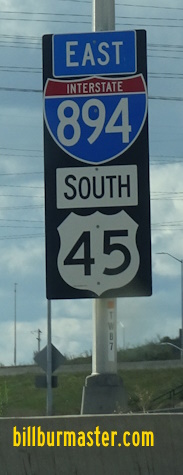
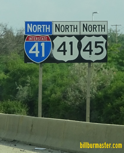
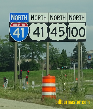
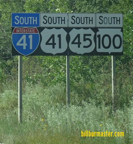
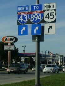
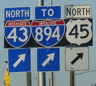
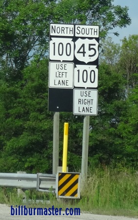
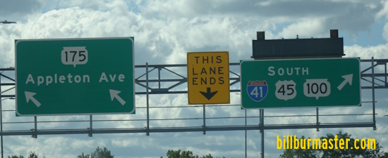
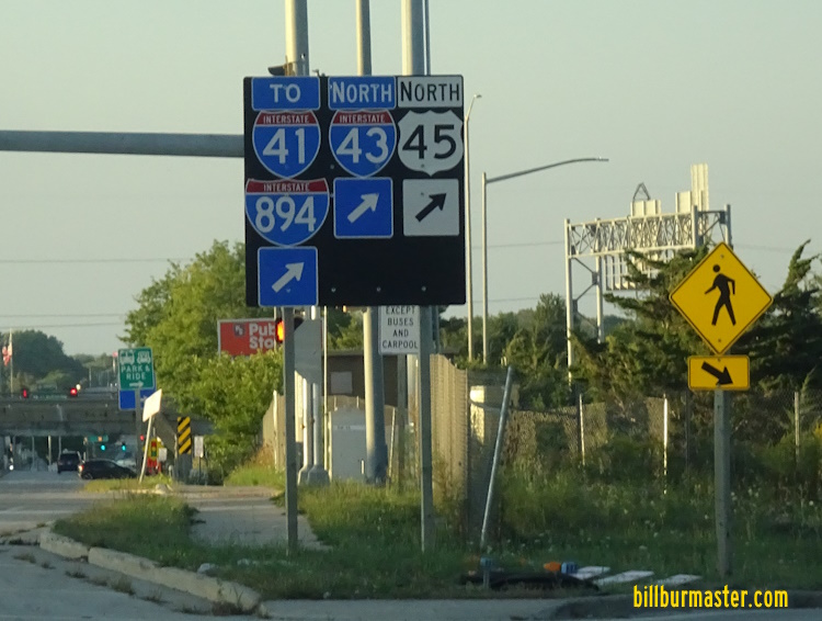
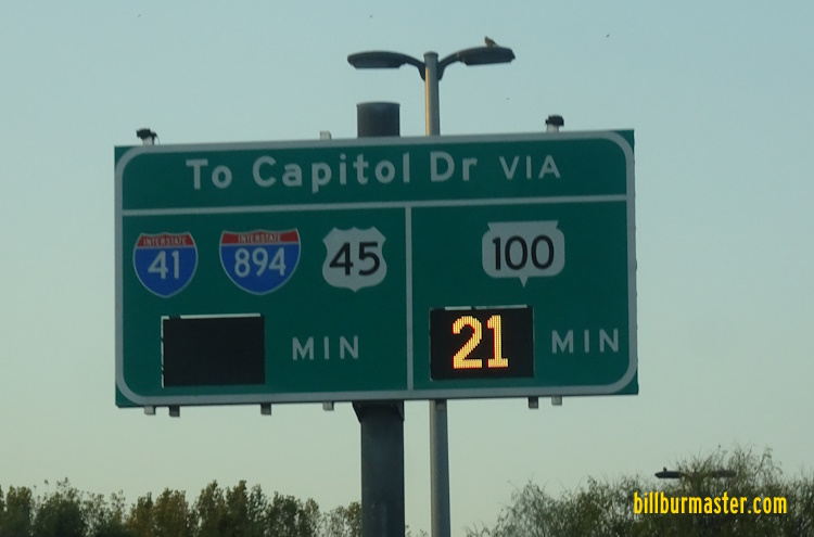
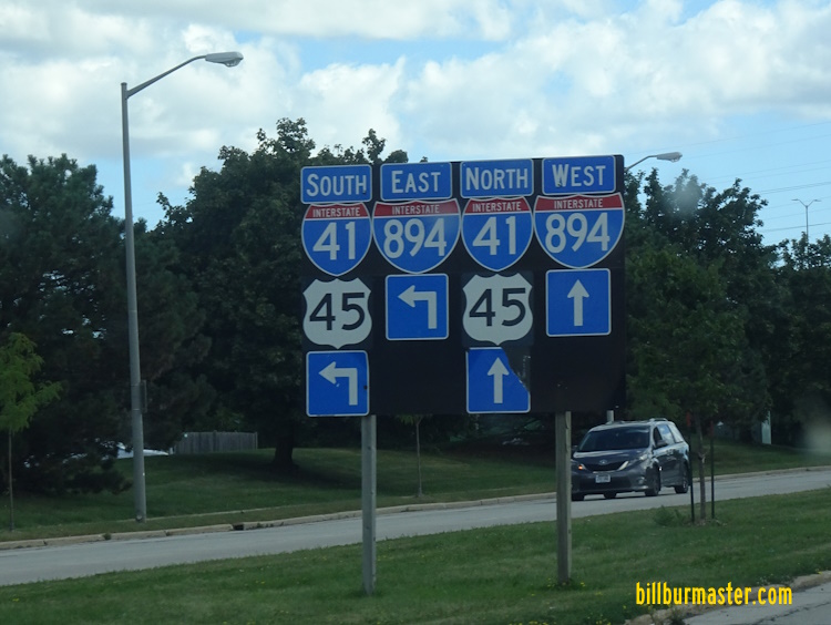
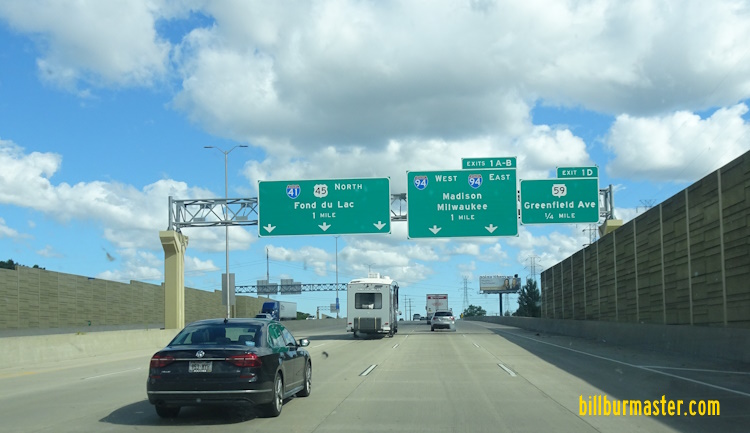
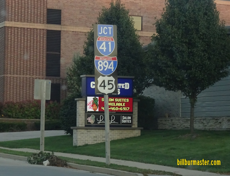
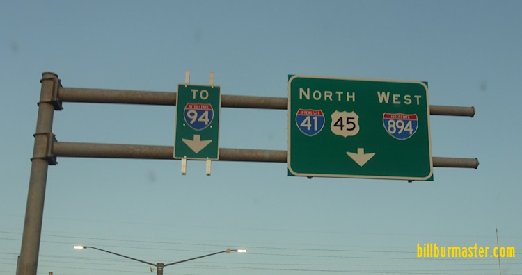
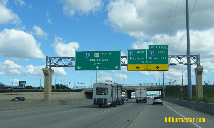
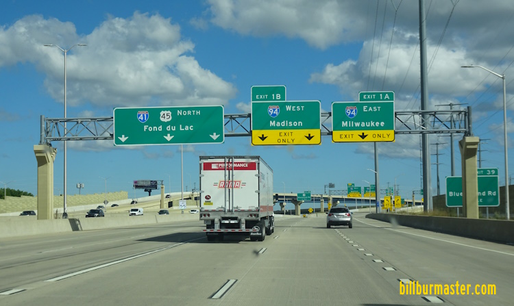
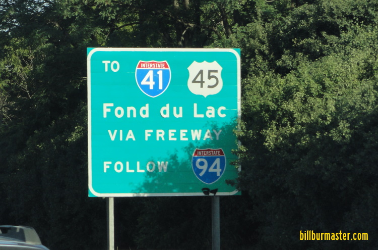
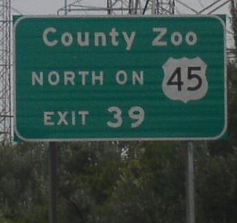
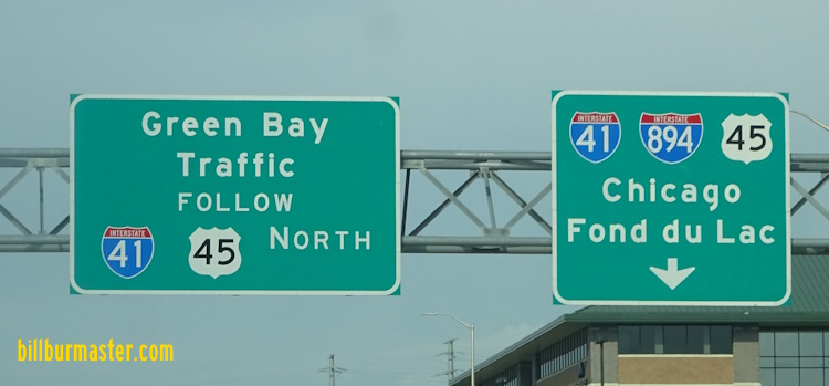
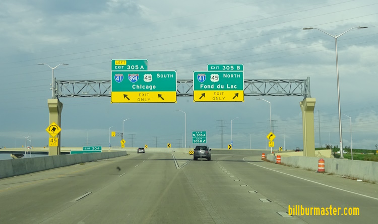
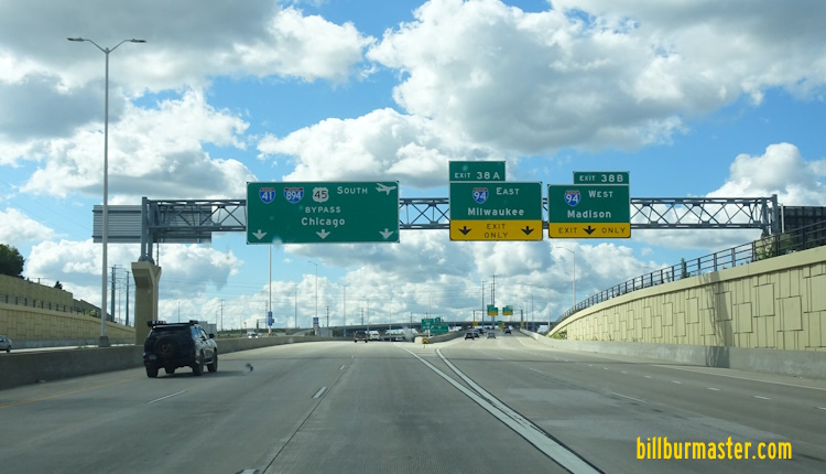
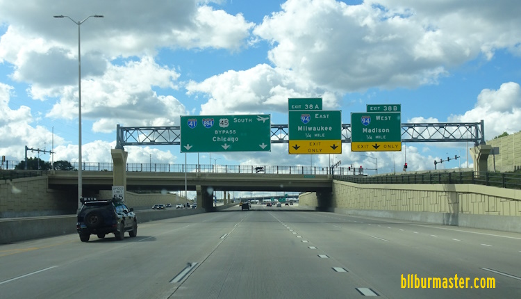
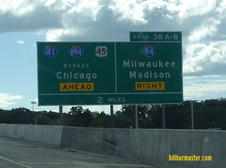
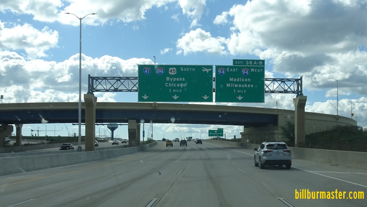
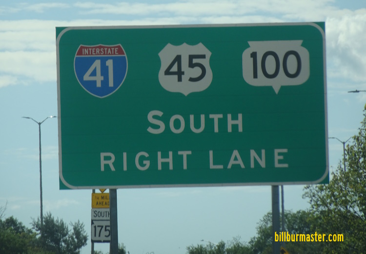
NB U.S. Rt. 45/WI St Rt 100 in Franklin. A junction marker on EB WI St Rt 24. A guide marker on EB WI St Rt 24. NB U.S. Rt. 45/WI St Rt 100 in Greenfield. A guide marker on NB U.S. Rt. 45/WI St Rt 100. NB U.S. Rt. 45/WI St Rt 100 at Edgerton Ave. NB U.S. Rt. 45/WI St Rt 100 near I-43. SB U.S. Rt. 45/WI St Rt 100 in Hales Corner. A guide marker on NB U.S. Rt. 45/WI St Rt 100. A BGS on NB I-43. A BGS on NB I-43. A BGS on SB I-43/U.S. Rt. 45. SB I-43/U.S. Rt. 45 near WI St Rt 100. NB I-43/U.S. Rt. 45 south of I-41/894; U.S. Rt. 41. NB I-43/U.S. Rt. 45 at I-41/894; U.S. Rt. 41. A BGS on NB I-41/U.S. Rt. 41; SB I-43; WB I-894. SB I-41/U.S. Rt. 41-45; EB I-894 at I-43. NB I-41/U.S. Rt. 41-45; WB I-894 north of I-43. SB I-41/U.S. Rt. 41-45; EB I-894 near I-43. SB I-41/U.S. Rt. 41-45; EB I-894 before I-43. A BGS on SB I-41/U.S. Rt. 41-45; EB I-894. SB I-41/U.S. Rt. 41-45; EB I-894 in Greenfield. A guide marker on Beloit Road. A set of guide markers on NB WI St Rt 100. SB I-41/U.S. Rt. 41-45; EB I-894 near Oklahoma Ave in West Allis. A BGS on NB WI St Rt 100. A set of guide markers on National Ave. SB I-41/U.S. Rt. 41-45; EB I-894 at Lincoln Ave in West Allis. SB I-41/U.S. Rt. 41-45; EB I-894 at Lincoln Ave in West Allis. SB I-41/U.S. Rt. 41-45; EB I-894 at Lincoln Ave. SB I-41/U.S. Rt. 41-45; EB I-894 north of Lincoln Ave. NB I-41/U.S. Rt. 41-45; EB I-894 south of Greenfield Ave. A junction marker on EB WI St Rt 59. A guide sign on EB WI St Rt 59. EB I-894/SB U.S. Rt. 45 in West Allis. NB I-41/U.S. Rt. 41-45; EB I-894 south of I-94. SB I-41/U.S. Rt. 41-45; EB I-894 south of I-94. NB I-41/U.S. Rt. 41-45; EB I-894 at I-94. A BGS on EB I-94. A BGS on WB I-94. A guide marker on WB I-894/NB U.S. Rt. 45. WB I-94 near I-894/U.S. Rt. 45. A BGS on WB I-94. A BGS on WB I-94. A BGS on WB I-94. SB I-41; U.S. Rt. 41/45 at I-94/894. SB I-41; U.S. Rt. 41/45 at the ramps for I-94. SB I-41; U.S. Rt. 41/45 south of U.S. Rt. 18. SB I-41; U.S. Rt. 41/45 north of U.S. Rt. 18. A BGS on SB I-41; U.S. Rt. 41/45. SB I-41; U.S. Rt. 41/45 south of Watertown Plank Road. SB I-41; U.S. Rt. 41/45 at Watertown Plank Road. SB I-41; U.S. Rt. 41/45 north of Watertown Plank Road. SB I-41/U.S. Rt. 41-45 south of North Ave. SB I-41/U.S. Rt. 41-45 at North Ave. NB I-41/U.S. Rt. 41-45 south of Center Street in Brookfield. SB I-41/U.S. Rt. 41-45 at Burleigh Street. NB I-41/U.S. Rt. 41-45 south of WI St Rt 190. SB I-41/U.S. Rt. 41-45 south of Capital Drive. SB I-41/U.S. Rt. 41-45 north of Capital Drive. NB I-41; U.S. Rt. 41/45 at the Menomonee River. NB I-41; U.S. Rt. 41/45 south of Silver Springs Drive. SB I-41; U.S. Rt. 41/45; WI St Rt 100 north of Silver Springs. NB U.S. Rt. 45 in Wauwatosa. NB U.S. Rt. 41/45; WI St Rt 100 in Milwaukee. A mile marker in Milwaukee. NB I-41/U.S. Rt. 41-45/WI St Rt 100 south of WI St Rt 175. NB I-41/U.S. Rt. 41-45/WI St Rt 100 south of WI St Rt 175. A BGS on SB WI St Rt 175. NB I-41/U.S. Rt. 41-45/WI St Rt 100 north of WI St Rt 175. NB I-41/U.S. Rt. 41-45/WI St Rt 100 north of WI St Rt 175. NB I-41/U.S. Rt. 41-45/WI St Rt 100 at Good Hope. NB U.S. Rt. 41/45/WI St Rt 100 near WI St Rt 145. NB I-41/U.S. Rt. 41-45/WI St Rt 100 north of WI St Rt 145. BGS on SB U.S. Rt. 41/45/WI St Rt 100. A guide marker on SB U.S. Rt. 41/45/WI St Rt 100.