Interstate 355, IllinoisRoads of the Mid-South & West > Highways of the State of Illinois > Interstate 55, Illinois > Interstate 355, Illinois
Interstate 355 is the newest of the "x55's" in Illinois. It is also the only branches of I-55 that is a toll highway. This is also the shortest of the I-55 branches. According to the Federal Highway Administration's Route Log, this highway is 32.5 miles long. I-355 carries the name of the Veterans Memorial Tollway. From Interstate 80 to Army Trail Road, I-355 is controlled and maintained by the Illinois State Toll Highway Authority. The short section from Army Trail Road to Interstate 290 is a free highway. This portion is maintained and operated by the Illinois Department of Transportation.
I-355 is not multi-plexed with any other highway in Illinois
Interstate 355 is part of by-pass around the Chicago-Metro that dates back to the 1950's. The first section of the highway runs from Interstate 90 (Jane Addams Tollway) at Woodfield, south to the Interstate 290 Extension at Itasca. This stretch of road is numbered Interstate 290, but is referred to as Illinois State Route 53. Currently, plans are in the works to extend IL St Rt 53 Expressway north and east to join with Interstate 94 near Gurnee.
The speaker of the Illinois house, Michael Madigan is one of the latest supporters of the 12.5-mile southeren extention of Interstate 355. A article in December 9th, 2003 Chicago Sun-Times noted that may not be enough to get the $750 million project started back up. Officals at the ISTHA say there is no current time table for work. When money is avalible, construction could start in a year. The current enviromental study for the project expires in 2007. When Interstate 80 was re-constructed, ramp aprons were built for the interchange. In the 12.5 mile long corridor the ISTHA currently owns most of the right-of-way for the project. At Interstate 55, the current end of the highway, the roads beds were widened. Peirs for the fly-overs at the interchange were constructed. Pictures are below. All these project were the start of the entire extension, until it was halted by a enviromental group.
The 12-mile extention of I-355 from I-55 to I-80 will start construction in December, 2004. The project was ready to go in the mid 1990's but was delayed by a legal challengeing then lack of funds. It is expected to generate 252,00 jobs and $20 million in economic benifits for this portion of Will County. I-355 will be six lans from I-55 to 143rd Street. From 143rd Street to I-80, it will be three lanes. The three lane section can be expanded in the future, should it be needed.*
Starting the first week of April, 2005, construction entrances will be placed on Cedar Road, U.S. Rt. 6, and Bruce Road. The second week of the same April, work will be focused around 167th Street, Gougar Road, 163rd Street, and 159th Street.**
The toll highway authority has held public meetings to inform and get input from the public on how the tollway extention will co-exist with the surounnding area. The highway will be at ground level with the roads going over it. Land on the eastside of the tollway will be used for a trail.***
On Veterans Day 2007 the 12.5 mile section opened.
Interstates that I-355 cross...
Interstate 80, at New Lenox.

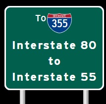
The first BGS for I-80 on SB I-355.

SB I-355 five mile from I-80.

SB I-355 two miles from I-80.

SB I-355 one mile from I-80.

SB I-355 near I-80.

SB I-355at I-80.

A BGS 2 miles from I-80 on SB I-355. (March, 2015)

SB I-355 one mile from I-80. (March, 2015)

SB I-355 a half mile from I-80. (March, 2015)

SB I-355 at I-80. (March, 2015)
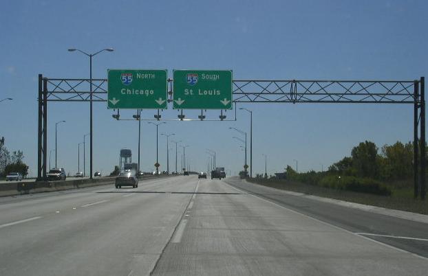
Interstate 55, at Bolingbrook/Romeoville.

The first BGS on SB I-355.

A BGS two miles from I-55 on SB I-55. (December, 2008)

A graphical BGS on SB I-355. (2005)
SB I-355 at I-55. (2005)

A BGS on SB I-355 over one mile from I-55. (Nov., 2007)

A graphical BGS on SB I-355. (Nov., 2007)

SB I-355 at I-55. (Nov., 2007)

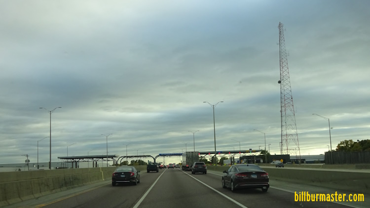
SB I-355 three miles from I-55. (October, 2016)

SB I-355 just over one mile from I-55. (October, 2016)

SB I-355 near I-55. (October, 2016)

SB I-355 at NB I-55. (October, 2016)

SB I-355 at SB I-55. (October, 2016)

SB I-355 three miles from I-55. (September, 2019)

SB I-355 two miles from I-55. (September, 2019)

SB I-355 over one mile from I-55. (September, 2019)

SB I-355 near I-55. (September, 2019)

SB I-355 at NB I-55. (September, 2019)

SB I-355 at SB I-55. (September, 2019)

The first BGS on NB I-355. (Nov., 2007)

NB I-355 three and a half miles south of I-55. (Nov., 2007)

A BGS on NB I-355 for NB I-55. (Nov., 2007)

NB I-355 near I-55. (Nov., 2007)

NB I-355 at I-55. (Nov., 2007)

A BGS for NB I-55 on NB I-355. (July, 20150

NB I-355 under one mile from I-55. (July, 2015)

NB I-355 at I-55. (July, 2015)

NB I-355 at SB I-55. (July, 2015)
Interstate 88, (Reagan Tollway) at Downers Grove.

The 2 mile BGS on NB I-355.

The two mile BGS on NB I-355. (April, 2009)

The 1 mile BGS on NB I-355.

NB I-355 one mile from I-88. (June, 2010)

NB I-355 near the ramp to I-88.

Another BGS near the ramp to I-88 on NB I-355.

A sign at the gore point on NB I-355.

Ramp from NB I-355 to I-88. The ramp to WB I-88 curves off and goes into a tunnel under I-88.

NB I-355 two miles from I-88. (July, 2015)

NB I-355 one mile from I-88. (July, 2015)

NB I-355 near I-88. (July, 2015)

NB I-355 at I-88. (July, 2015)

NB I-355 at I-88. (July, 2015)

NB I-355 two miles from I-88. (September, 2019)

NB I-355 one mile from I-88. (September, 2019)

NB I-355 near I-88. (September, 2019)

NB I-355 before I-88. (September, 2019)

NB I-355 at I-88. (September, 2019)

SB I-355 two miles from I-88. (Nov., 2007)

SB I-355 one mile from I-88. (Nov., 2007)

SB I-355 one mile from I-88. (Sept., 2012)

SB I-355 near I-88. (Nov., 2007)

SB I-355 near I-88. (Sept., 2012)

SB I-355 at I-88. (Nov., 2007)

SB I-355 one mile from I-88. (May, 2021)

SB I-355 before I-88. (May, 2021)

SB I-355 near I-88. (May, 2021)
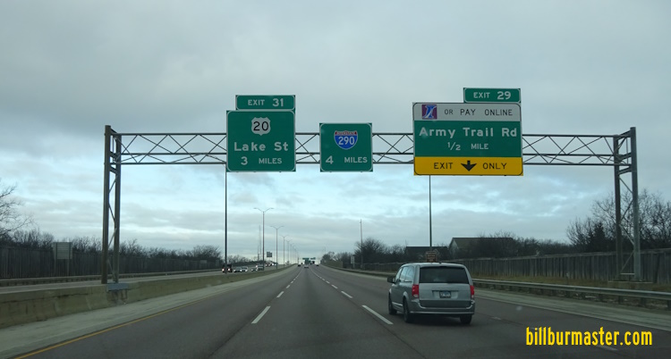
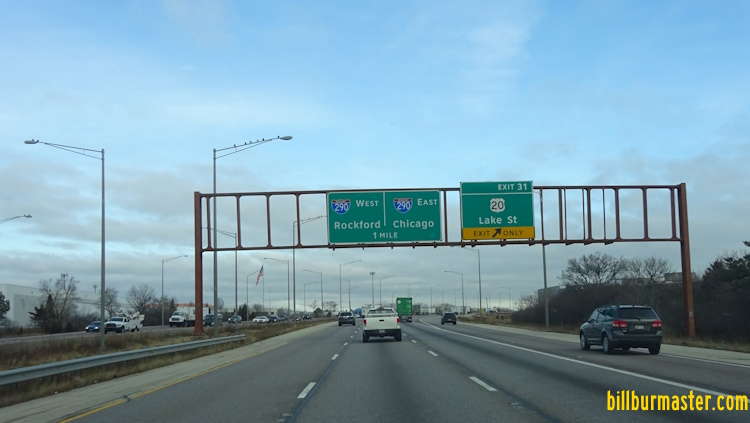
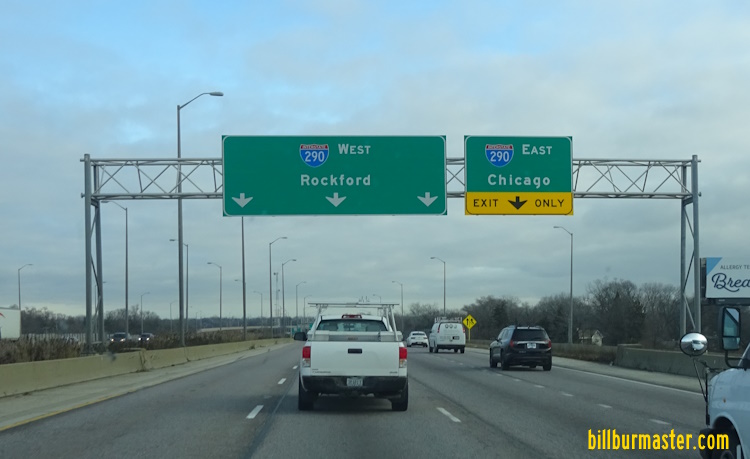
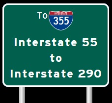
Interstate 290, at Itasca.

NB I-355 one mile from I-290.

NB I-355 near I-290.

NB I-355 at the interchange with I-290.

NB I-355 before the roadway divides for I-290.

NB I-355 one mile from I-290. (July, 2015)

NB I-355 under one mile from I-290. (July, 2015)

NB I-355 near I-290. (July, 2015)

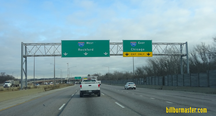
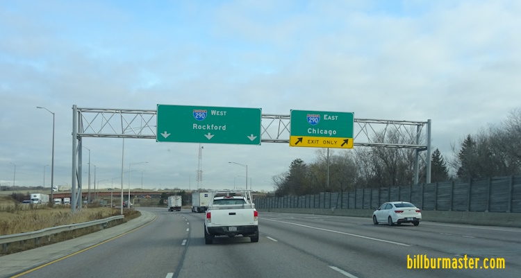
NB I-355 at I-290. (July, 2015)

NB I-355 before I-290. (May, 2021)

NB I-355 near I-290. (May, 2021)

NB I-355 at I-290. (May, 2021)
NB I-355 four miles from I-290. (January, 2023)
NB I-355 one mile from I-290. (January, 2023)
NB I-355 near I-290. (January, 2023)
NB I-355 before I-290. (January, 2023)
NB I-355 at I-290. (January, 2023)
Toll Plazas on I-355
Spring Creek Plaza near Lockport.

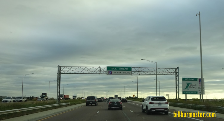
The first toll warning sign on NB I-355. (Nov., 2007)

The first toll warning sign on NB I-355. (April, 2010)

NB I-355 a half mile from the Spring Creek Toll. (Nov., 2007)

The first toll warning sign on NB I-355. (April, 2010)

Lane markers on NB I-355. (Nov., 2007)

The stop ahead sign on NB I-355. (Nov., 2007)

NB I-355 at the Spring Creek Toll Plaza. (Nov., 2007)

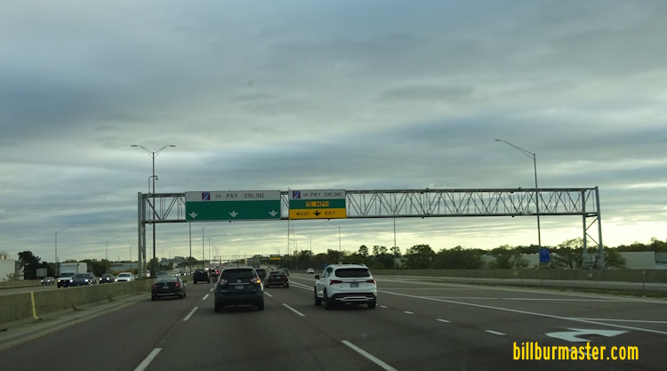
NB I-355 in the I-PASS lanes at the Spring Creek Toll Plaza. (January, 2009)

NB I-355 one mile from the Spring Creek Toll Plaza. (June, 2018)

NB I-355 a half mile from the Spring Creek Toll Plaza. (June,2018)

Lane markers on NB I-355 for the Spring Creek Toll Plaza. (June, 2018)

The stop ahead sign on NB I-355 for the Spring Creek Toll Plaza.
(June, 2018)

The toll warning sign on NB I-355 at the Spring Creek Toll Plaza. (January, 2021)

NB I-355 at the Spring Creek Toll Plaza. (June, 2018)

NB I-355 at the I-Pass Toll Lanes for the Spring Creek Toll Plaza.
(June, 2018)

Lane markers on NB I-355 for the Spring Creek Toll Plaza. (August, 2021)

NB I-355 at the Spring Creek Toll Plaza. (August, 2021)

NB I-355 at the I-Pass Lanes of the Spring Creek Toll Plaza. (August, 2021)

SB I-355 less than a mile from the plaza. (Nov., 2007)

SB I-355 less than a mile from the plaza. (April, 2010)

SB I-355 a quarter mile from the plaza. (Nov., 2007)

SB I-355 a quarter mile from the plaza. (April, 2010)

Lane markers on SB I-355. (Nov., 2007)

SB I-355 at the Spring Creek Plaza. (Nov., 2007)

SB I-355 3/4 mile from the Spring Creek Plaza. (March, 2015)

SB I-355 1/2 mile from the Spring Creek Plaza. (March, 2015)

SB I-355 at the lane separation for the Spring Creek Plaza. (March, 2015)

The stop ahead marker for the SB lanes. (March, 2015)

SB I-355 at the Spring Creek Plaza. (March, 2015)

SB I-355 at the I-Pass lanes. (March, 2015)

A price chart on SB I-355. (March, 2015)

A toll warning sign on SB I-355. (August, 2021)

Lane markers on SB I-355 for the Spring Creek Toll Plaza. (August, 2021)

SB I-355 at the Spring Creek Toll Plaza. (August, 2021)

The I-Pass lanes on SB I-355 at the Spring Creek Toll Plaza. (August, 2021)
Boughton Road Plaza Number 89 in Bolingbrook.

A toll warning sign near the Boughton Road Toll Plaza on NB I-355. (2003)

NB I-355 at Boughton Road near the Boughton Road Toll Plaza. (2003)

View of the Boughton Road Toll Plaza from the I-PASS Lanes. (2003)

The first toll warning sign on NB I-355. (Nov. 2005)

The lane markers on the overpass for Boughton Road on NB I-355. (Nov. 2005)

The Boughton Road Toll Plaza on NB I-355. (Nov. 2005)

The first warning sign on NB I-355. (September, 2008)

The first toll warning sign on NB I-355. (April, 2010)

NB I-355 a half mile from the Boughton Plaza. (September, 2008)

NB I-355 a half mile from the Bougthon Plaza. (April, 2010)

The lane markers on the Boughton Road overpass. (September, 2008)

The stop ahead sign on NB I-355. (September, 2008)

NB I-355 at the Boughton Toll Plaza. (September, 2008)

NB I-355 under one mile from the Boughton Toll Plaza. (February, 2020)

NB I-355 a half mile from the Boughton Toll Plaza. (February, 2020)

Lane markers on NB I-355 for the Boughton Toll Plaza. (February, 2020)

NB I-355 at the Boughton Toll Plaza. (February, 2020)

The toll ahead sign on NB I-355 for the Boughton Toll Plaza. (June, 2022)

A lane maker for the Boughton Toll Plaza on NB I-355. (June, 2022)

A lane marker for the Boughton Toll Plaza on NB I-355. (June, 2022)

NB I-355 at the Boughton Toll Plaza. (June, 2022)

The I-Pass Lanes on NB I-355 at the Boughton Toll Plaza. (June, 2022)

The first toll warning sign for the Boughton road Toll Plaza on SB I-355.

Another warning sign on SB I-355.

SB I-355 at the lane markers for the toll plaza.

The stop ahead sign for the cash lanes on SB I-355.

The Boughton Road Toll Plaza on SB I-355.

SB I-355 in the I-PASS lanes at the Boughton Road Toll Plaza. (February, 2009)

SB I-355 one mile from the Boughton Road Toll Plaza. (October, 2016)

A toll warning sign on SB I-355. (October, 2016)

Lane markers on SB I-355. (October, 2016)

A stop ahead sign on SB I-355. (October, 2016)

SB I-355 at the Boughton Toll Plaza. (October, 2016)

SB I-355 in the I-Pass lanes at the Boughton Toll Plaza. (October, 2016)

The toll warning sign on SB I-355. (August, 2021)

Lane markers on SB I-355 for the Boughton Road Toll Plaza. (August, 2021)

Lane markers on SB I-355 for the Boughton Road Toll Plaza. (August, 2021)

SB I-355 at the Boughton Road Toll Plaza. (August, 2021)
Army Trail Road Plaza Number 73 in Addison.

Warning sign at North Ave. on NB I-355. (2003)

NB I-355 near the Army Trail Toll Plaza. (2003)

NB I-355 closing in on the Army Trail Toll Plaza. (2003)

NB I-355 at the Army Trail Toll Plaza. (2003)

Looking north out of the Army Trail Toll Plaza. (2003)

The first toll warning sign on NB I-355. (Nov. 2005)

Lane makrers on NB I-355 near North Ave. (Nov. 2005)

Another lane marker on NB I-355. (Nov. 2005)

the stop a head sign on NB I-355. (Nov. 2005)

The Army Trail Toll Plaza on NB I-355. (Nov. 2005)

NB I-355 one mile from the Army Trail Toll Plaza. (Nov., 2007)

NB I-355 one mile from the Army Trail Toll Plaza. (April, 2010)

NB I-355 one half mile from the Army Trail Toll Plaza. (Nov., 2007)

NB I-355 one half mile from the Army Trail Toll Plaza. (April, 2010)

Lane markers on NB I-355. (Nov., 2007)

The stop ahead sign on NB I-355. (Nov., 2007)

NB I-355 at the Army Trail Toll Plaza. (April, 2010)

NB I-355 at the I-PASS lanes of the Army Trail Toll Plaza. (April, 2010)

NB I-355 one mile from the Army Trail Toll Plaza. (July, 2015)

The cash price sign the Army Trail Toll Plaza. (July, 2015)

NB I-355 a half mile from the Army Trail Toll Plaza. (July, 2015)

The lane markers on NB I-355 for the Army Trail Toll Plaza. (July, 2015)

Lane markers for the cash lanes. (July, 2015)

Looking north at the Army Trail Toll Plaza. (July, 2015)

The price paid sign for the Army Trail Toll Plaza on NB I-355. (July, 2015)

The Toll Ahead sign on NB I-355 for the Army Trail Toll Plaza. (April, 2022)

Lane markers on NB I-355 for the Army Trail Toll Plaza. (April, 2022)

A lane marker on NB I-355 for the Army Trail Toll Plaza. (April, 2022)

NB I-355 at the Army Trail Toll Plaza. (April, 2022)

SB I-355 one mile from the Army Trail Toll Plaza. (Nov., 2007)

SB I-355 one mile from the Army Trail Toll Plaza. (April, 2010)

SB I-355 a half mile from the plaza. (Nov., 2007)

SB I-355 a half mile frm the Army Trail Toll Plaza. (April, 2010)

Lane markers on SB I-355. (Nov., 2007)

The stop ahead sign on SB I-355. (Nov., 2007)

The stop ahead sign on SB I-355. (April, 2010)

SB I-355 at the Army Trail Toll Plaza. (April, 2010)

SB I-355 at the I-PASS lanes at the Army Trail Toll Plaza. (April, 2010)

SB I-355 at the Army Trail Toll Plaza. (Nov., 2007)

SB I-355 one mile from the Army Trail Toll Plaza. (May, 2021)

A toll warning sign on SB I-355. (May, 2021)

Lane markers for the Army Trail Toll Plaza on SB I-355. (May, 2021)

Another lane marker on SB I-355. (May, 2021)

The Army Trail Toll Plaza on SB I-355. (May, 2021)

The I-Pass Lanes at the Army Trail Plaza on SB I-355. (May, 2021)
The toll warning sign on SB I-355. (October, 2022)
Lane markers on SB I-355 for the Army Trail Toll Plaza. (October, 2022)
SB I-355 at the Army Trail Toll Plaza. (October, 2022)
Info on the Veterans Memorial Tollway and the Southern Extension


I-355's Parent Route
Photos of Interstate 355 as it travels through Illinois.
Select A Section of I-355.
*Work on I-355 extension to start next month. (Joliet Herald-News 29 October 2004 A3)
**Drivers will face I-355 project. (Joliet Herald-News 2 April 2005)
***Forum held on I-355 extension (Joliet Herald-news 24 April 2005)
2 February 2024


