Interstate 68, MarylandRoads of the Mid-South & West > Highways of the State of Maryland > Interstate 68, Maryland
 | Interstate 68 |
Interstate 68 is an east-west highway across Western Maryland. It runs from a junction with Interstate 70/U.S. Rt. 40, near Hancock, to the Maryland/West Virginia State Line, near Friendsville. Much of I-68 across Maryland is full over elivation changes, and curves. The only are of major population along this highway is at Cumberland.
While in Maryland, I-68 is multi-plexed.
I-68 is multi-plexed with...
...U.S. Rt. 40, from near Hancock to near Keyers Ridge.


...U.S. Rt. 220, near Cumberland.


...U.S. Rt. 219, from near Grantsville to near Keyset Ridge.


In Maryland, Interstate 68 crosses the following interstates.
Interstate 70, near Hancock.
There are not branches of I-68 in Maryland.

A travel advisory sign on NB I-270.

A travel advisory sign on NB I-81.

A BGS on SB I-81.

A guide marker on WB I-70.

A BGS on WB I-70.

A BGS on WB I-70.

A travel advisory sign on WB I-70.

A travel advisory sign on WB I-70.

A BGS on WB I-70/U.S. Rt. 40; NB U.S. Rt. 522.

A BGS on EB I-70/SB U.S. Rt. 522.

A BGS on NB U.S. Rt. 522.

A BGS on NB U.S. Rt. 522.

WB I-68/U.S. Rt. 40 west of I-70/U.S. Rt. 522.

WB I-68/U.S. Rt. 40 west of I-70/U.S. Rt. 522.

WB I-68/U.S. Rt. 40 near Harvey.

WB I-68/U.S. Rt. 40 near Scenic U.S. Rt. 40/MD St Rt 144.

WB I-68/U.S. Rt. 40 east of Sideling Hill.

WB I-68/U.S. Rt. 40/U.S. Rt. 40 at Sideling Hill.

WB I-68/U.S. Rt. 40/U.S. Rt. 40 west of Sideling Hill.

WB I-68/U.S. Rt. 40 near the Allegany/Washington County Line.

WB I-68/U.S. Rt. 40 near the Allegany/Washington County Line.

WB I-68/U.S. Rt. 40 at the Allegany/Washington County Line.

WB I-68/U.S. Rt. 40 near Piney Grove.

WB I-68/U.S. Rt. 40 near Green Ridge State Forest.

Looking east along I-68/U.S. Rt. 40 from exit 64.

A BGS at exit 64.

A EB guide marker at exit 64.

A BGS at exit 64.

WB I-68/U.S. Rt. 40 west of exit 64.

WB I-68/U.S. Rt. 40 near M.P. 62.

WB I-68/U.S. Rt. 40 near M.P. 62.

WB I-68/U.S. Rt. 40 west of M.P. 62.

WB I-68/U.S. Rt. 40 near Pratt.

WB I-68/U.S. Rt. 40 east of Flintstone.

WB I-68/U.S. Rt. 40 near Flintstone.

WB I-68/U.S. Rt. 40 at Flintstone.

WB I-68/U.S. Rt. 40 west of Flintstone.

WB I-68/U.S. Rt. 40 near Flintstone.

WB I-68/U.S. Rt. 40 near Rocky Gap State Park.

WB I-68/U.S. Rt. 40 near Pleasant Valley Road.

WB I-68/U.S. Rt. 40 west of Pleasant Valley Road.

WB I-68/U.S. Rt. 40 east of U.S. Rt. 220.

WB I-68/U.S. Rt. 40 at north U.S. Rt. 220.

WB I-68/U.S. Rt. 40; SB U.S. Rt. 220 at Hillcrest Drive.

WB I-68/U.S. Rt. 40; SB U.S. Rt. 220 near Baltimore Ave. in Cumberland.

A BGS on WB I-68/U.S. Rt. 40; SB U.S. Rt. 220.

WB I-68/U.S. Rt. 40; SB U.S. Rt. 220 near Monore Street in Cumberland.

WB I-68/U.S. Rt. 40; SB U.S. Rt. 220 near Maryland Ave in Cumberland.

WB I-68/U.S. Rt. 40; SB U.S. Rt. 220 near Park Street in Cumberland.

WB I-68/U.S. Rt. 40; SB U.S. Rt. 220 near MD St Rt 51 in Cumberland.

A BGS on NB MD St Rt 51.

A junction marker on NB MD St Rt 51.

A set of guide markers in Cumberland.

WB I-68/U.S. Rt. 40; SB U.S. Rt. 220 at MD St Rt 51.
WB I-68/U.S. Rt. 40; SB U.S. Rt. 220 at Beall Street.

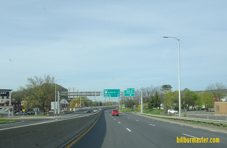
WB I-68/U.S. Rt. 40; U.S. Rt. 220 east of Greene Street.

WB I-68/U.S. Rt. 40; SB U.S. Rt. 220 at Greene Street.

WB I-68/U.S. Rt. 40; SB U.S. Rt. 220 near Kelly Road in Cumberland.

WB I-68/U.S. Rt. 40 west of MD St Rt 49.

WB I-68/U.S. Rt. 40 east of Vocke Road.

WB I-68/U.S. Rt. 40 at Vocke Road.

WB I-68/U.S. Rt. 40 near LaVale.

WB I-68/U.S. Rt. 40 at LaVale.

WB I-68/U.S. Rt. 40 west of LaVale.

WB I-68/U.S. Rt. 40 near LaVale.

WB I-68/U.S. Rt. 40 near M.P. 39.

WB I-68/U.S. Rt. 40 east of MD St Rt 36.

WB I-68/U.S. Rt. 40 west of MD St Rt 36.

WB I-68/U.S. Rt. 40 near the Garrett/Allegany County Line.

WB I-68/U.S. Rt. 40 at the Garrett/Allegany County Line.

WB I-68/U.S. Rt. 40 east of MD St Rt 546.

WB I-68/U.S. Rt. 40 at MD St Rt 546.

WB I-68/U.S. Rt. 40 west of MD St Rt 546.

WB I-68/U.S. Rt. 40 east of Lower New Germany Road.

WB I-68/U.S. Rt. 40 at Lower New Germany Road.

WB I-68/U.S. Rt. 40 near Avilton.

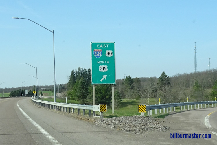
WB I-68/U.S. Rt. 40 at north U.S. Rt. 219.

WB I-68/U.S. Rt. 40; SB U.S. Rt. 219 west of BUSN U.S. Rt. 219.

WB I-68/U.S. Rt. 40 east of MD St Rt 495.

A guide marker on WB ALT U.S. Rt. 40.

A junction marker on SB MD St Rt 495.

WB I-68/U.S. Rt. 40; SB U.S. Rt. 219 at MD St Rt 495.

WB I-68/U.S. Rt. 40; SB U.S. Rt. 219 at Grantsville.

WB I-68/U.S. Rt. 40; SB U.S. Rt. 219 west of MD St Rt 495.

WB I-68/U.S. Rt. 40; SB U.S. Rt. 219 near Spiker Run.

WB I-68/U.S. Rt. 40; SB U.S. Rt. 219 near Keyers Ridge.

WB I-68 near Keyers Ridge.

WB I-68/U.S. Rt. 40; SB U.S. Rt. 219 east of M.P. 14.

WB I-68/U.S. Rt. 40; SB U.S. Rt. 219 at M.P. 14.

WB I-68/U.S. Rt. 40; SB U.S. Rt. 219 at M.P. 14.

A BGS on EB U.S. Rt. 40/SB U.S. Rt. 219.

A BGS on EB U.S. Rt. 40/SB U.S. Rt. 219.
A BGS on EB U.S. Rt. 40/SB U.S. Rt. 219.

WB I-68 near Friendsville.
18 December 2025