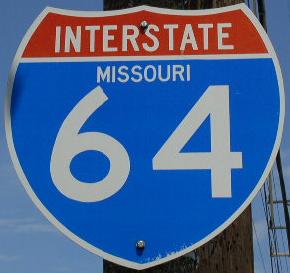
 | Interstate 64 Illinois/Missouri State Line to Interstate 270 |  |

Looking south at the Poplar Street Bridge from the East Riverfront MetroLink Station. The PSB is the grayish line in the foreground.

SB I-55; WB I-64/70; U.S. Rt. 40 at the westend of the PSB.

The Missouri Welcome Sign on the PSB.

The Missouri Welcome sign on the Poplar Street Bridge-SB I-55; WB I-64/70 U.S. Rt. 40. (September, 2010)

SB I-55; WB I-64/70; U.S. Rt. 40 at the St. Louis City Limits on the PSB.

EB I-64/U.S. Rt. 40 on the Missouri side of the PSB.

Looking east along the Poplar Street Bridge from the Missouri side.

Looking north at the Poplar Street Bridge from the Mac Arthur Bridge.

Looking east at the Poplar Street Bridge complex from a overlook at Busch Stadium. (August, 2006)

A news report about cracks found on the Poplar Street Bridge on 9/14/2004. Story from FOX 2 St. Louis; KTVI-TV.

A set of guide markers near the Dome in Downtown St. Louis.

A guide marker on Washington in St. Louis.

A guide marker on 4th in St. Louis.

A guide marker on 4th in St. Louis.

A guide marker on 4th in St. Louis.

A guide marker on NB 4th Street in Downtown St. Louis.
A guide marker on 4th in St. Louis.
A guide marker on Walnut in St. Louis.

A guide marker on Washington in St. Louis.

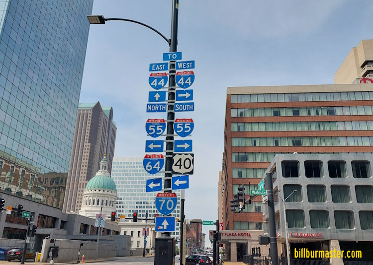
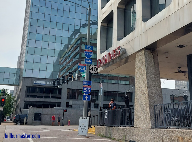
WB I-64/U.S. Rt. 40 at I-44/55.

WB I-64/U.S. Rt. 40 at Busch Stadium.

WB I-64/U.S. Rt. 40 at 9th Street.

WB I-64/U.S. Rt. 40 at 9th Street.

EB I-64 at the Last Missouri Exit in Downtown St. Louis.

EB I-64/U.S. Rt. 40 at 6th Street. (July, 2014)

EB I-64/U.S. Rt. 40 at 6th Street. (January, 2023)

EB I-64/U.S. Rt. 40 at 11th Street. (July, 2014)

A guide marker in Downtown St. Louis.

A guide marker north of Downtown St. Louis.

WB I-64/U.S. Rt. 40 near 14th Street.

EB I-64/U.S. Rt. 40 crossing 14th Street.

EB I-64/U.S. Rt. 40 at the exit for 14th Street.

WB I-64/U.S. Rt. 40 near Union Station.

WB I-64/U.S. Rt. 40 at Union Station.

EB I-64/U.S. Rt. 40 near Union Station.

WB I-64/U.S. Rt. 40 near 22nd Street.

WB I-64/U.S. Rt. 40 at 22nd Street.

EB I-64/U.S. Rt. 40 at 22nd Street.

A BGS in Downtown St. Louis, near Union Station.

EB I-64/U.S. Rt. 40 at Chestnut.

WB I-64/U.S. Rt. 40 at Jefferson. (September, 2014)

EB I-64/U.S. Rt. 40 at Jefferson. (July, 2017)

WB I-64/U.S. Rt. 40 at Jefferson. (August, 2022)

WB I-64/U.S. Rt. 40 near Ewing Ave.

WB I-64/U.S. Rt. 40 at Ewing Ave. (August, 2022)

WB I-64/U.S. Rt. 40 near Forest Park Parkway/Grand Blvd.

WB I-64/U.S. Rt. 40 near Compton.

EB I-64/U.S. Rt. 40 at Compton.

WB I-64/U.S. Rt. 40 west Compton.

EB I-64/U.S. Rt. 40 at Grand.

EB I-64/U.S. Rt. 40 at Market.

WB I-64/U.S. Rt. 40 near Spring Ave.

WB I-64/U.S. Rt. 40 near Vandeventer.

EB I-64/U.S. Rt. 40 near Vandeventer.

EB I-64/U.S. Rt. 40 at Tower Grove Ave.

EB I-64/U.S. Rt. 40 at Taylor.

A guide marker on SB Boyle.

WB I-64/U.S. Rt. 40 east of Boyle.

A guide marker on WB Clay.

EB I-64/U.S. Rt. 40 at Newstead Ave.

EB I-64/U.S. Rt. 40 at Kingshighway.

A BGS on NB Kingshighway.

WB I-64/U.S. Rt. 40 west of Kingshighway.

EB I-64/U.S. Rt. 40 east of the St. Louis Science Center.

Looking east at I-64/U.S. Rt. 40 from the St. Louis Science Center.

Looking west at I-64/U.S. Rt. 40 from the St. Louis Science Center.

EB I-64 near the St. Louis Science Center

EB I-64/U.S. Rt. 40 at Hampton.

A guide marker on Hampton in St. Louis.

A guide sign on NB Hampton in St. Louis.

WB I-64/U.S. Rt. 40 west of Hampton.

EB I-64/U.S. Rt. 40 west of Hampton.

EB I-64/U.S. Rt. 40 at Tamm Dr.

EB I-64/U.S. Rt. 40 at Oakland.

EB I-64/U.S. Rt. 40 at Clayton.

EB I-64/U.S. Rt. 40 east of Skinker.

A guide marker on Skinker.

A junction marker on Skinker.

WB I-64/U.S. Rt. 40 at the St. Louis City/St. Louis County Line.

WB I-64/40 at Bellevue.

WB I-64/40 at Highland.

EB I-64/U.S. Rt. 40 east of Big Bend.

WB I-64/U.S. Rt. 40 at Big Bend.

EB I-64/U.S. Rt. 40 at Boland Place.

EB I-64/U.S. Rt. 40 at I-170.

EB I-64 in Richmond Heights just east of I-170

WB I-64/U.S. Rt. 40 at Hanley.

EB I-64/U.S. Rt. 40 at Hanley.

EB I-64/U.S. Rt. 40 at Hanley.

A BGS on a ramp at I-64/170; U.S. Rt. 40.

A BGS on SB Hanley.

A BGS on SB I-170.

EB I-64/U.S. Rt. 40 at McCutcheon Ave.

EB I-64/U.S. Rt. 40 at Mc Knight Road.

EB I-64/U.S. Rt. 40 west of Mc Knight Road.

EB I-64/U.S. Rt. 40 near Deer Creek.

WB I-64/U.S. Rt. 40 near Lindburgh.

EB I-64/U.S. Rt. 40 east of U.S. Rt. 61/67.

EB I-64/U.S. Rt. 40; SB U.S. Rt. 61 at Spoede Road.

EB I-64/U.S. Rt. 40; SB U.S. Rt. 61 west pf Spoede Road.

EB I-64/U.S. Rt. 40; SB U.S. Rt. 61 east of I-270.

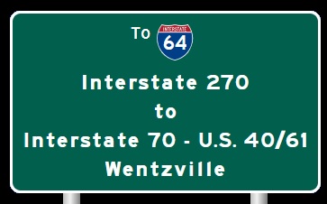
A BGS on SB I-270.

A BGS on SB I-270.

A BGS on SB I-270.
| CONTINUE TO: |
| EASTBOUND: | WESTBOUND: |
 |  |