Interstate 64, Missouri
Roads of the Mid-South & West > Highways of the State of Missouri > Interstate 64, Missouri
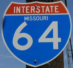
 | Interstate 64 |  |
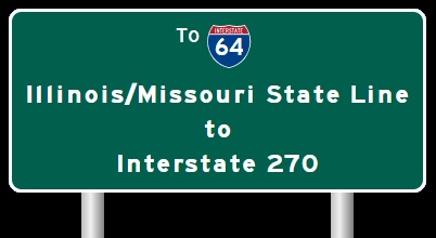
Interstate 64 is one of the newer interstates in the state of Missouri. Currently, it is slowly being extended. From once ending just over the Illinois/Missouri State Line, to ending near Dardenne Prairie. I-64 through the StL Metro is named the Daniel Boone Expressway.
The December, 19th, 2004 St. Louis Post-Dispatch, said the state highway and transportation department has approved the location for a new bridge over the Missouri River. A new four-lane bridge will built west of the current eastbound bridge, which opened in 1989. It will be many year though until the bridge is built. When completed, the new bridge will carry eastbound traffic. The current eastbound traffic will carry traffic west into St. Charles County. The original bridge at the site, which currently carries westbound traffic, was built in 1937. It will become a ramp from Chesterfield Airport Road to WB I-64/U.S. Rt. 40; NB U.S. Rt. 61. As of now, no money is avalible for the project. The state projects that it to be built near 2012 to 2020.
In May, 2009, the Missouri legislature passed House Bill 1198. This names the streach of Interstate 64 from the St. Louis City Limits to the Illinois State Line, as "Jack Buck Memorial Highway". Jack Buck was the voice of the St. Louis Cardinals for over 50 years. Interstate 64 runs just south of the Cardinals ball park, Busch Stadium, in Downtown St. Louis. (20 May 2009 Newchannel 5 KSDK-TV St. Louis, MO)
While in Missouri, I-64 is multi-plexed several times.
I-64 is multi-plexed with...
...Interstate 55, from the Illinois/Missouri State Line for less than a 1/4 mile at St. Louis.

...U.S. Rt. 40, from the Illinois/Missouri State Line at St. Louis, to the end of I-64 near the Boone Bridge in Chesterfield.


...U.S. Rt. 61, from Lindbergh Blvd. in Ladue to the end of I-64 near the Boone Bridge in Chesterfield.


Near Downtown St. Louis, I-64 goes into a "double-decker" formation twice. The first being near Forest Park.

EB I-64 as it goes under WB I-64 east of Forrest Park.

EB I-64 under WB I-64.
The second time is at downtown near Busch Memorial Stadium.

EB I-64 near Busch Stadium.

EB I-64 at Busch.
"The New I-64"
Taking "Highway 40" to "I-64".

Located on SB I-170. (July, 2009)

Looking east along I-64/U.S. 40, east of Big Bend. (July, 2009)

Looking at Big Bend and I-64/U.S. 40. (July, 2009)
While in Missouri I-64 crosses several Interstates.
Interstate 44, at Downtown St. Louis.
Interstate 55, at Downtown St. Louis.

SB I-55; WB I-64/70; U.S. Rt. 40 near their split in Downtown St. Louis.

SB I-55; WB I-64/70; U.S. Rt. 40 at WB I-70.

WB I-64/U.S. Rt. 40; SB I-55 a half mile from the ramps to I-44/55. (June, 2019).

WB I-64/U.S. Rt. 40; SB I-55 near the ramps to I-44/55. (June, 2019)>

WB I-64/U.S. Rt. 40; SB I-55 at the ramps to I-44/55. (June, 2019)
Interstate 170 at Brentwood.

A BGS on WB I-64/U.S. Rt. 40 one half mile from I-170.

WB I-64/U.S. Rt. 40 near I-170.

WB I-64/U.S. Rt. 40 at I-170.

A BGS two miles from I-170 on WB I-64/U.S. Rt. 40. (August, 2022)

A BGS one mile from I-170 on WB I-64/U.S. Rt. 40. (August, 2022)

WB I-64/U.S. Rt. 40 near I-170. (August, 2022)

WB I-64/U.S. Rt. 40 at I-170. (August, 2022)

A BGS on EB I-64/U.S. Rt. 40.

EB I-64/U.S. Rt. 40 near I-170.

WB I-64/U.S. Rt. 40 near I-170. (June, 2010)

WB I-64/U.S. Rt. 40 at I-170. (June, 2010)

EB I-64/U.S. Rt. 40 over two miles from I-170. (June, 2010)

EB I-64/U.S. Rt. 40 over one mile from I-170. (June, 2010)

EB I-64/U.S. Rt. 40 a half mile from I-170. (June, 2010)

EB I-64/U.S. Rt. 40 near I-170. (June, 2010)

EB I-64/U.S. Rt. 40 at I-170. (June, 2010)

A BGS on EB I-64/U.S. Rt. 40 two miles from I-170. (July, 2017)

EB I-64/U.S. Rt. 40 a half mile from I-170. (July, 2017)

EB I-64/U.S. Rt. 40 near I-170. (July, 2017)

EB I-64/U.S. Rt. 40 at I-170. (July, 2017)
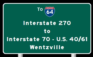
Interstate 270 at Town and Country.

The 1 1/2 mile BGS on WB I-64/U.S. Rt. 40; NB U.S. Rt. 61.

The one mile BGS.

The half mile BGS.

WB I-64/U.S. Rt. 40; NB U.S. Rt. 61 near I-270.

WB I-64/U.S. Rt. 40; NB U.S. Rt. 61 at I-270.

EB I-64/U.S. Rt. 40; SB U.S. Rt. 61 before I-270.

EB I-64/U.S. Rt. 40; SB U.S. Rt. 61 near I-270.

EB I-64/U.S. Rt. 40; SB U.S. Rt. 61 at I-270.
Interstate 70, at Wentzville.

WB I-64/U.S. Rt. 40; NB U.S. Rt. 61 two miles from I-70.

WB I-64/U.S. Rt. 40; NB U.S. Rt. 61 two miles from I-70. (September, 2010)

WB I-64/U.S. Rt. 40; NB U.S. Rt. 61 one mile from I-70. (September, 2010)

A BGS for EB I-70 on WB I-64/U.S. Rt. 40; NB U.S. Rt. 61. (June, 2019)

WB I-64/U.S. Rt. 40; NB U.S. Rt. 61 at I-70.

WB I-64/U.S. Rt. 40; NB U.S. Rt. 61 at EB I-70. (June, 2019)

WB I-64/U.S. Rt. 40; NB U.S. Rt. 61 at WB I-70. (June, 2019)
There are no branches of I-64 in Missouri.

Looking south at the Poplar Street Bridge from the East Riverfront MetroLink Station. The PSB is the grayish line in the foreground.

SB I-55; WB I-64/70; U.S. Rt. 40 at the westend of the PSB.

The Missouri Welcome Sign on the PSB.

The Missouri Welcome sign on the Poplar Street Bridge-SB I-55; WB I-64/70 U.S. Rt. 40. (September, 2010)

SB I-55; WB I-64/70; U.S. Rt. 40 at the St. Louis City Limits on the PSB.

EB I-64/U.S. Rt. 40 on the Missouri side of the PSB.

Looking east along the Poplar Street Bridge from the Missouri side.

Looking north at the Poplar Street Bridge from the Mac Arthur Bridge.

Looking east at the Poplar Street Bridge complex from a overlook at Busch Stadium. (August, 2006)

A news report about cracks found on the Poplar Street Bridge on 9/14/2004. Story from FOX 2 St. Louis; KTVI-TV.

A set of guide markers near the Dome in Downtown St. Louis.

A guide marker on Washington in St. Louis.

A guide marker on 4th in St. Louis.

A guide marker on 4th in St. Louis.

A guide marker on 4th in St. Louis.

A guide marker on NB 4th Street in Downtown St. Louis.

A guide marker on Washington in St. Louis.

WB I-64/U.S. Rt. 40 at I-44/55.

WB I-64/U.S. Rt. 40 at Busch Stadium.

WB I-64/U.S. Rt. 40 at 9th Street.

WB I-64/U.S. Rt. 40 at 9th Street.

EB I-64 at the Last Missouri Exit in Downtown St. Louis.

EB I-64/U.S. Rt. 40 at 6th Street. (July, 2014)

EB I-64/U.S. Rt. 40 at 11th Street. (July, 2014)

A guide marker in Downtown St. Louis.

A guide marker north of Downtown St. Louis.

WB I-64/U.S. Rt. 40 near 14th Street.

EB I-64/U.S. Rt. 40 crossing 14th Street.

EB I-64/U.S. Rt. 40 at the exit for 14th Street.

WB I-64/U.S. Rt. 40 near Union Station.

WB I-64/U.S. Rt. 40 at Union Station.

EB I-64/U.S. Rt. 40 near Union Station.

WB I-64/U.S. Rt. 40 near 22nd Street.

WB I-64/U.S. Rt. 40 at 22nd Street.

A BGS in Downtown St. Louis, near Union Station.

EB I-64/U.S. Rt. 40 at Chestnut.

WB I-64/U.S. Rt. 40 at Jefferson. (September, 2014)

EB I-64/U.S. Rt. 40 at Jefferson. (July, 2017)

WB I-64/U.S. Rt. 40 at Jefferson. (August, 2022)

WB I-64/U.S. Rt. 40 near Ewing Ave.

WB I-64/U.S. Rt. 40 at Ewing Ave. (August, 2022)

WB I-64/U.S. Rt. 40 near Forest Park Parkway/Grand Blvd.

WB I-64/U.S. Rt. 40 near Compton.

EB I-64/U.S. Rt. 40 at Compton.

WB I-64/U.S. Rt. 40 west Compton.

EB I-64/U.S. Rt. 40 at Grand.

EB I-64/U.S. Rt. 40 at Market.

WB I-64/U.S. Rt. 40 near Spring Ave.

WB I-64/U.S. Rt. 40 near Vandeventer.

EB I-64/U.S. Rt. 40 near Vandeventer.

EB I-64/U.S. Rt. 40 at Tower Grove Ave.

EB I-64/U.S. Rt. 40 at Taylor.

A guide marker on SB Boyle.

WB I-64/U.S. Rt. 40 east of Boyle.

A guide marker on WB Clay.

EB I-64/U.S. Rt. 40 at Kingshighway.

A BGS on NB Kingshighway.

WB I-64/U.S. Rt. 40 west of Kingshighway.

EB I-64/U.S. Rt. 40 east of the St. Louis Science Center.

Looking east at I-64/U.S. Rt. 40 from the St. Louis Science Center.

Looking west at I-64/U.S. Rt. 40 from the St. Louis Science Center.

EB I-64 near the St. Louis Science Center

EB I-64/U.S. Rt. 40 at Hampton.

A guide marker on Hampton in St. Louis.

A guide sign on NB Hampton in St. Louis.

WB I-64/U.S. Rt. 40 west of Hampton.

EB I-64/U.S. Rt. 40 west of Hampton.

EB I-64/U.S. Rt. 40 at Tamm Dr.

A guide marker on Skinker.

A junction marker on Skinker.

WB I-64/U.S. Rt. 40 at the St. Louis City/St. Louis County Line.

WB I-64/40 at Bellevue.

WB I-64/40 at Highland.

EB I-64/U.S. Rt. 40 east of Big Bend.

WB I-64/U.S. Rt. 40 at Big Bend.

EB I-64/U.S. Rt. 40 at Boland Place.

EB I-64 in Richmond Heights just east of I-170

WB I-64/U.S. Rt. 40 at Hanley.

EB I-64/U.S. Rt. 40 at Hanley.

A BGS on a ramp at I-64/170; U.S. Rt. 40.

A BGS on SB Hanley.

EB I-64/U.S. Rt. 40 at McCutcheon Ave.

EB I-64/U.S. Rt. 40 at Mc Knight Road.

EB I-64/U.S. Rt. 40 west of Mc Knight Road.

EB I-64/U.S. Rt. 40 near Deer Creek.

WB I-64/U.S. Rt. 40 near Lindburgh.

EB I-64/U.S. Rt. 40 east of U.S. Rt. 61/67.

EB I-64/U.S. Rt. 40; SB U.S. Rt. 61 at Spoede Road.

EB I-64/U.S. Rt. 40; SB U.S. Rt. 61 west pf Spoede Road.

EB I-64/U.S. Rt. 40; SB U.S. Rt. 61 east of I-270.

A BGS on SB I-270.

A BGS on SB I-270.

A BGS on SB I-270.

EB I-64/U.S. Rt. 40; SB U.S. Rt. 61 west of I-270.

WB I-64/U.S. Rt 40; NB U.S Rt. 61 west of I-270.

WB I-64/U.S. Rt. 40; NB U.S. Rt. 61 near Mason.

EB I-64/U.S. Rt. 40; SB U.S. Rt. 61 west of Mason.

WB I-64/U.S.Rt. 40; NB U.S. Rt. 61 in Town and Country.

A BGS in Chesterfield.

A BGS on WB I-64/U.S. Rt. 40; NB U.S. Rt. 61.

WB I-64/U.S. Rt. 40; NB U.S. Rt. 61 at MO St Rt 141.

EB I-64/U.S. Rt. 40; SB U.S. Rt. 61 west of MO St Rt 141.

WB I-64/U.S. Rt. 40; NB U.S. Rt. 61 near Maryville Center.

WB I-64/U.S. Rt. 40; NB U.S. Rt 61 near Timberlake Manor.

WB I-64/U.S. Rt. 40; NB U.S. Rt. 61 near Chesterfield Parkway.

WB I-64/U.S. Rt. 40; NB U.S Rt 61 in Chesterfield.

A BGS on SB MO St Rt 340.

A guide marker on NB MO St Rt 340.

A BGS on NB MO St Rt 340.

A BGS on Chesterfield Pkwy West.

WB I-64/U.S. Rt. 40; NB U.S. Rt. 61 at Boone's Crossing.

WB I-64/U.S Rt. 40; NB U.S. Rt. 61 at Boone's Crossing.

WB I-64/U.S. Rt. 40; NB U.S. Rt. 61 at Boone's Crossing.

WB I-64/U.S. Rt. 40; NB U.S. Rt. 61 west of Boone's Crossing.

EB I-64/U.S. Rt. 40; SB U.S. Rt. 61 near Spirit of St. Louis Airport.

EB I-64/U.S. Rt. 40; SB U.S. Rt. 61 east of Chesterfield Airport Road.

WB I-64/U.S. Rt. 40; NB U.S. Rt. 61 near the Missouri River.

EB I-64/U.S. Rt. 40; SB U.S. Rt. 61 entering the Chesterfield Valley.

EB I-64/U.S. Rt. 40; SB U.S. Rt. 61 at the St. Charles/St. Louis County Line.

EB I-64/U.S. Rt. 40; SB U.S. Rt. 61 crossing the Missouri River.

EB I-64/U.S. Rt. 40; SB U.S. Rt. 61 at the Missouri River.

WB I-64/U.S. Rt. 40; NB U.S. Rt. 61 has the older bridge across the Missouri River. There are no shoulders and no passing on the bridge.

A closer look at the signs on the bridge.

WB I-64/U.S. Rt. 40; NB U.S. Rt. 61 crossing the Missouri River.

WB I-64/U.S. Rt. 40; NB U.S. Rt. 61 at the Boone Bridge. (October, 2022)

WB I-64/U.S. Rt. 40; NB U.S. Rt. 61 at the Boone Bridge. (October, 2022)

WB I-64/U.S. Rt. 40; NB U.S. Rt. 61 at the Boone Bridge. (October, 2022)

WB I-64/U.S. Rt. 40; NB U.S. Rt. 61 west of the Boone Bridge.

EB I-64/U.S. Rt. 40; SB U.S. Rt. 61 east of Research Park Circle.

WB I-64/U.S. Rt. 40; NB U.S. Rt. 61 at Research Park Circle.

WB I-64/U.S. Rt. 40; NB U.S. Rt. 61 near Weldon Springs.

WB I-64/U.S. Rt. 40; NB U.S. Rt. 61 east of MO St Rt 94.

EB I-64/U.S. Rt. 40; NB U.S. Rt. 61 east of MO St Rt 94.

A junction marker on WB MO St Rt 94.

A BGS on WB MO St Rt 94.

The former western end marker near Welson Springs.

WB I-64/U.S. Rt. 40; NB U.S. Rt. 61 near MO Sec St Rt N.

WB I-64/U.S. Rt. 40; NB U.S. Rt. 61 at Town Square Road.

A BGS on WB MO St Rt 364.

A BGS on WB MO St Rt 364.

A BGS on WB MO St Rt 364.

A BGS on EB MO St Rt 364.

A BGS on EB MO St Rt 364.

A BGS on WB MO St Rt 364.

EB I-64/U.S. Rt. 40; SB U.S. Rt. 61 at MO St Rt 364/MO Sec St Rt N.

EB I-64/U.S. Rt. 40; SB U.S. Rt. 61 west of MO St Rt 364/MO Sec St Rt N.

WB I-64/U.S. Rt. 40; NB U.S. Rt. 61 west of MO St Rt 364/MO Sec St Rt N.

WB I-64/U.S. Rt. 40; NB U.S. Rt. 61 near Lake St. Louis.

The current western end marker near I-70. (September, 2010)

EB I-64/U.S. Rt. 40; SB U.S. Rt. 61 east of Prospect Road.
13 September 2023