Roads of the Mid-South & West > Highways of the State of Ohio > Interstate 90, Ohio
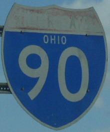 | Interstate 90 |  |
Interstate 90 runs east-west across the northern part of the state. From the Indiana/Ohio State Line to near Elyria, this highway runs along the Ohio Turnpike. It has one spur in the state. I-90 connects Toledo, Cleveland, and Ashtabula to each other. At the Cleveland Metro, this highway heads northeast toward Pennsylvania and New York state.
While in Ohio, I-90 is multi-plexed.
I-90 is multi-plexed with...
...Interstate 80, from the Ohio/Indiana State Line to near Elyria.


...Ohio State Route 2, from near Elyria to near Westlake.


...Ohio State Route 2, from Cleveland to Euclid.


Info on the Ohio Turnpike.

In Ohio, Interstate 90 crosses the following interstates.
Interstate 475, at Toledo. (NO Direct INTERCHANGE)

BGS on EB I-80/90.

Second BGS on EB I-80/90.

EB I-80/90 at the ramp to U.S. Rt. 20, which leads to I-475.

EB I-80/90 two miles from I-475. (July, 2019)

EB I-80/90 one mile from I-475. (July, 2019)

EB I-80/90 under one mile from I-475. (July, 2019)

EB I-80/90 at I-475. (July, 2019)

WB I-80/90 two miles from the interchange to connect to I-475.

A BGS on WB I-80/90 one mile from the interchange to connect to I-475.

WB I-80/90 a half mile from the interchange to connect to I-475.
Interstate 75, at Perrysburg.

EB I-80/90 two miles from I-75. (July, 2019)

EB I-80/90 one mile from I-75. (July, 2019)

EB I-80/90 near I-75. (July, 2019)

EB I-80/90 at I-75. (July, 2019)

A overhead BGS EB I-80/90.

A BGS on WB I-80/90.

WB I-80/90 two miles from I-75.

WB I-80/90 one mile from I-75.

WB I-80/90 a half mile from I-75.

WB I-80/90 near I-75.

WB I-80/90 at I-75.
Interstate 280, near Lemoyne.

EB I-80/90/OH Turn two miles from I-280.

EB I-80/90/OH Turn one mile from I-280.

EB I-80/90/OH Turn near I-280.

EB I-80/90/OH Turn at I-280.

EB I-80/90 two miles from I-280. (July, 2019)

EB I-80/90 one mile from I-280. (July, 2019)

EB I-80/90 near I-280. (July, 2019)

EB I-80/90 at I-280. (July, 2019)

WB I-80/90 two miles from I-280.

WB I-80/90 one mile from I-280.

WB I-80/90 a half mile from I-280.

WB I-80/90 near I-280.

WB I-80/90 at I-280.
Interstate 80, near Elyria.

EB I-80/90 over one mile from their split.

EB I-80/90 one mile from their split.

EB I-80/90 a half mile from their split.

EB I-80/90 at their split.

EB I-80/90 over one mile from east I-80. (July, 2019)

EB I-80/90 one mile from east I-80. (July, 2019)

EB I-80/90 under a half mile from east I-80. (July, 2019)

EB I-80/90 at east I-80. (July, 2019)
Interstate 71, at Cleveland.
Interstate 490, at Cleveland.
Interstate 77, at Cleveland.
Interstate 271, near Highland Heights

EB I-90 over one mile from I-271.

EB I-90 near I-271.

EB I-90 at I-271.
Toll plazas on Interstate 90.
Westgate Toll Barrier, near Columbia.

First overhead for the plaza on EB I-80/90.

The one mile warning sign.

The stop ahead sign.

The Westgate Plaza on EB I-80/90.

EB I-80/90 two miles from the Westgate Plaza.

EB I-80/90 one mile from the Westgate Plaza.

EB I-80/90 near the Westgate Plaza.

EB I-80/90 at the Westgate Plaza.

EB I-80/90 two miles from the Westgate Plaza. (May, 2016)

EB I-80/90 one miles from the Westgate Plaza. (May, 2016)

Electroic forms of payments accepted on EB I-80/90. (May, 2016)

A stop a head sign on EB I-80/90. (May, 2016)

EB I-80/90 at the Westgate Plaza. (May, 2016)

EB I-80/90 two mile from the Westgate Plaza. (April, 2025)

EB I-80/90 under one mile from the Westgate Plaza. (April, 2025)

Lane markers on EB I-80/90 for the Westgate Plaza. (April, 2025)

Lane markers on EB I-80/90 for the Westgate Plaza. (April, 2025)

EB I-80/90 at the Westgate Plaza. (April, 2025)

WB I-80/90 2 miles from the Westgate Plaza.

WB I-80/90 one mile from the Westgate Plaza.

WB I-80/90 near the Westgate Plaza.

The stop ahead sign on WB I-80/90.

WB I-80/90 at the Westgate Plaza.

WB I-80/90 two miles from the Westgate Toll Plaza. (September, 2022)

WB I-80/90 one mile from the Westgate Toll Plaza. (September, 2022)

WB I-80/90 at the new Westgate Toll Plaza. (September, 2022)

WB I-80/90 at the stop ahead sign for the Westgate Toll Plaza. (September, 2022)

WB I-80/90 near the Westgate Toll Plaza. (September, 2022)

WB I-80/90 at the Westgate Toll Plaza. (September, 2022)
Swanton Toll Barrier, near Swanton.

EB I-80/90 two miles for the Swanton Plaza. (April, 2025)

Lane markers on EB I-80/90 for the Swanton Plaza. (April, 2025)

Lane markers on EB I-80/90 for the Swanton Plaza. (April, 2025)

Lane markers on EB I-80/90 for the Swanton Plaza. (April, 2025)

EB I-80/90 at the Swanton Plaza. (April, 2025)
Lorain County West Plaza, near North Ridgeland.

A toll warning sign one mile from the Lorain Plaza on EB I-90.

EB I-90 a half mile from the Lorain Plaza.

EB I-90 near the Lorain Plaza.

Stop ahead signs on EB I-90 for the Lorain Plaza.

EB I-90 at the Lorain Plaza.
Branches of I-90 in Ohio.

Photos of Interstate 90 as it travels through Ohio.
Select A Section of I-90.


18 July 2025