Roads of the Mid-South & West > Highways of the Commonwealth of Kentucky > Interstate 69, Kentucky
 | Interstate 69 |
Interstate 69 is a north-south interstate that runs north-south-east-west across Western Kentucky. As of August, 2018 the highway has not been completed within the Commonwealth of Kentucky. The highway was signed into law in 2008, and first signed along the highways in 2011. When completed, I-69 will run from the Indiana/Kentucky State Line, at Henderson, to the Kentucky/Tennessee State Line, at Fulton.
The path used for I-69 used existing parkways within Kentucky. From Henderson to near Nortonville, it uses the Edward T. Breathitt Pennyrile Parkway. From Nortonville to near Eddyville, it uses the Wendell H. Ford Western Kentucky Parkway. To go around Kentucky Lake, I-69 joins I-24 from near Eddyville to near Calvert City. Then from near Calvert City to the Kentucky/Tennessee State Line, it uses the Julian M. Carroll Purchase Parkway.
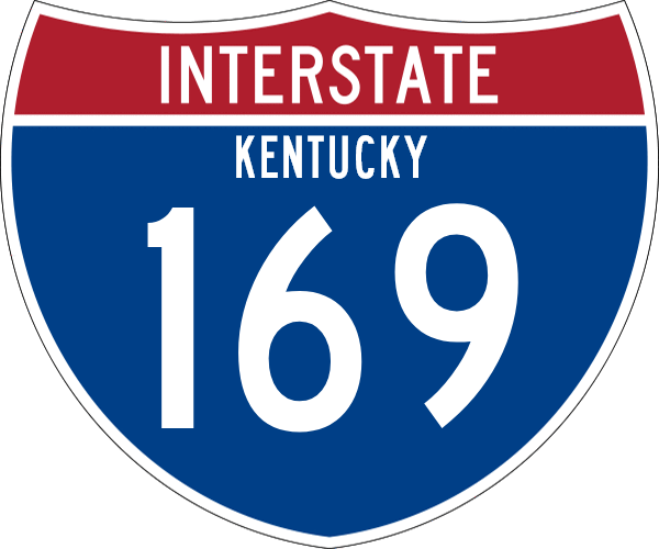
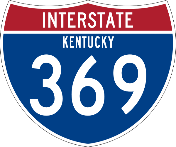
The section of the Edward T. Breathitt Pennyrile Parkway from near Nortonville to Hopkinsville is designated to become Interstate 169. While, the Audubon Parkway carries the designation of "Future I-69 Spur". Officials in Davidson County have suggested the designation of Interstate 369.
In Kentucky, I-69 is multi-plexed.
I-69 is multi-plexed with...
...Interstate 24, from near Eddyville to near Calvert City.

...BY-PASS U.S. Rt. 45, at Mayfield.
...U.S. Rt. 51, from the Kentucky/Tennessee State Line to Fulton.
In Kentucky, Interstate 69 crosses the following interstates.
Interstate 169, near Nortonville.
Interstate 24, near Eddyville.

A BGS one and a half miles from north I-69 on EB I-24/NB I-69.

A BGS one mile from north I-69 on EB I-24/NB I-69.

A BGS a half mile from north I-69 on EB I-24/NB I-69.

A BGS at north I-69 on EB I-24/NB I-69.

A BGS one mile from I-24 on SB I-69.

Lane markers on SB I-69.

SB I-69 at I-24.
Interstate 24, near Calvert City.

A BGS two miles from I-24 on NB I-69.

A BGS one mile from I-24 on NB I-69.

A BGS a half mile from I-24 on NB I-69.

NB I-69 at WB I-24.

A BGS on the ramp from NB I-69 for WB I-24.

The ram from NB I-69 ato WB I-24.
Branches of I-69 in Kentucky.

NB I-69/JMC Parkway/U.S. Rt. 51 at the Tennessee/Kentucky State Line.

I-69/JMC Parkway/U.S. Rt. 51 at KY St Rt 166.

SB I-69/JMC Parkway/U.S. Rt. 51 south of U.S. Rt. 51/KY Sec St Rt 1648.

A guide marker on SB I-69/JMC Parkway/BY-PASS U.S. Rt. 45.

A set of guide markers on SB U.S. Rt. 641.

A guide marker on SB SPUR U.S. Rt. 641.

A BGS on NB SPUR U.S. Rt. 641.

A BGS on NB SPUR U.S. Rt. 641.

A BGS on NB SPUR U.S. Rt. 641.

NB I-69/Purchase Parkway near KY St Rt 348.

NB I-69/Purchase Parkway at KY St Rt 795.

A guide marker on WB U.S. Rt. 68.

A set of guide markers on WB U.S. Rt. 68.

NB I-69/Purchase Parkway north of U.S. Rt. 68.

A BGS on EB I-24.

A junction marker on SB JMC Purchase Parkway.

A BGS on SB JMC Purchase Parkway.

A guide marker on EB U.S. Rt. 62.

A set of guide markers on EB U.S. Rt. 62.

A set of guide markers on SB JMC Purchase Parkway.

A junction marker on EB U.S. Rt. 62/NB U.S. Rt. 641.

A set of guide markers on NB KY St Rt 453.

A set of guide markers on NB KY St Rt 453.

EB I-24/NB I-69 east of KY St Rt 453.

EB I-24/NB I-69 west of the Cumberland River.

EB I-24/NB I-69 east of the Cumberland River.

EB I-24/NB I-69 near Suwanee.

EB I-24/NB I-69 west of U.S. Rt. 62/641.

EB I-24/NB I-69 east of U.S. Rt. 62/641.

A guide marker on EB U.S. Rt. 62/NB U.S. Rt. 641.

NB I-69/EB WKY Pkwy east of I-24.

NB I-69/EB WKY Pkwy west of U.S. Rt. 62.

A NB guide marker for I-69 as the name transitions from the Western Kentucky Parkway.

NB I-69/EB WKY Pkwy east of U.S. Rt. 62.

NB I-69/EB WKY Pkwy west of Princeton.

A set of guide markers on the courthouse square in Princeton.

A set of guide markers on the courthouse square in Princeton.

A guide marker on EB U.S. Rt. 62/NB KY St Rt 293.

NB I-69/EB WKY Pkwy east of KY St Rt 293.

NB I-69/EB WKY Pkwy near the Jones-Kenney Wildlife Management Area.

NB I-69/EB WKY Pkwy west of Dawson Springs.

NB I-69/EB WKY Pkwy at the Caldwell/Hopkins County Line.

NB I-69/EB WKY Pkwy west of KY St Rt 109.

NB I-69/EB WKY Pkwy east of KY St Rt 109.

NB I-69/EB WKY Pkwy west of St. Charles.

NB I-69/EB WKY Pkwy west of LIttle Valley.

A traffic direction sign.

NB I-69/EB WKY Pkwy two miles from the Pennyrile Parkway.

NB I-69/EB WKY Pkwy one mile from the Pennyrile Parkway.

NB I-69/EB WKY at the Pennyrile Parkway.

A guide marker on NB U.S. Rt. 41.

A guide marker on NB U.S. Rt. 41.

A guide marker on NB U.S. Rt. 41.

NB I-69/Pennyrile south of KY St Rt 138.

NB I-69/Pennyrile north of KY St Rt 138.

NB I-69/Pennyrile north of KY St Rt 147.

NB I-69/Pennyrile near Onton.

NB I-69/Pennyrile south of KY St Rt 56.

NB I-69/Pennyrile at KY St Rt 56.

NB I-69/Pennyrile north of KY St Rt 56.

NB I-69/Pennyrile near Sebree.

NB I-69/Pennyrile at the Webster/Henderson County Line.

NB I-69/Pennyrile south of KY St Rt 416.

NB I-69/Pennyrile at KY St Rt 416.

NB I-69/Pennyrile south of KY St Rt 425.

An end marker for the current end point in August, 2018.

NB I-69/Pennyrile at KY St Rt 425.

NB I-69/Pennyrile north of KY St Rt 425.

A BGS on WB Audubon Parkway.

A BGS on WB Audubon Parkway.

A guide marker on WB KY St Rt 351.

A guide marker on WB KY St Rt 351.

A BGS on EB U.S. Rt. 60/NB ALT U.S. Rt. 41.

A BGS on the ramp from EB U.S. Rt. 60/NB ALT U.S. Rt. 41 to U.S. Rt. 41.
10 October 2023