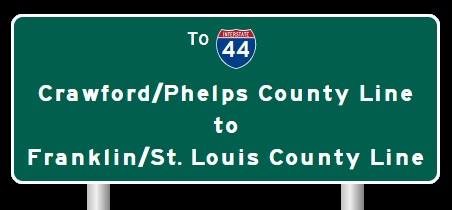
 | Interstate 44 Franklin/St. Louis County Line to Interstate 70-St. Louis |

EB I-44/U.S. Rt. 50 at the Franklin/St. Louis County Line.

WB I-44/U.S. Rt. 50 west of Six Flags-St. Louis.

A set of guide markers on BUSN Loop I-44.

WB I-44/U.S. Rt. 50 near Six Flags-St. Louis.

WB I-44/U.S. Rt. 50 west of MO St Rt 109.

A junction marker on NB MO St Rt 109.

EB I-44/U.S. Rt. 50 at Williams.

WB I-44/U.S. Rt. 50 east of the Meramec River.

WB I-44/U.S. Rt. 50 near Forest 44.

WB I-44/U.S. Rt. 50 near M.P. 268.
EB I-44/U.S. Rt. 50 east of Antire.

EB I-44/U.S. Rt. 50 east of M.P. 269.

WB I-44/U.S. Rt. 50 west of MO St Rt 141.

WB I-44/U.S. Rt. 50 west of MO St Rt 141.

A BGS on SB MO St Rt 141.

A BGS on SB MO St Rt 141.

A BGS on NB MO St Rt 141.

A BGS on WB I-44/U.S. Rt. 50.

A BGS on the ramp from WB I-44/U.S. Rt. 50.

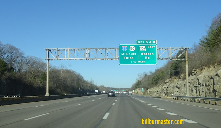
EB I-44/U.S. Rt. 50 east of MO St Rt 141.

EB I-44/U.S. Rt. 50 east of MO St Rt 141.

A guide marker in Fenton.

A BGS on SB I-270.
A BGS on SB I-270.
A BGS on SB I-270.
A BGS on NB I-270. (December, 2024)

WB I-44/U.S. Rt. 50 at the stack with I-270.

WB I-44/U.S. Rt. 50 at I-270.

A BGS on the ramps from I-270to EB I-44.

EB I-44/U.S. Rt. 50 west of Lindberg Blvd.

EB I-44/U.S. Rt. 50 west of Lindberg Blvd.

A BGS on EB I-44/U.S. Rt. 50.

EB I-44 east of Lindberg Blvd.

WB I-44 east of Lindberg.

EB I-44 in Crestwood.

WB I-44 west of Berry.

WB I-44 east of Berry.

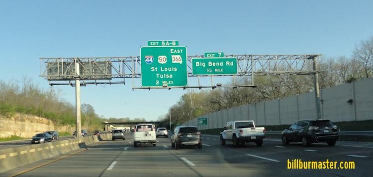
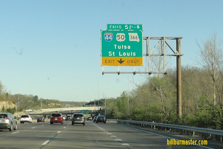
EB I-44 at Big Bend Road.

EB I-44 east of Big Bend Road.

EB I-44 at Elm Ave.

EB I-44 east of Elm Ave.

EB I-44 east of Elm Ave.

WB I-44 east of Elm.

EB I-44 near Laclede Station Road.

WB I-44 at Shrewsbury Ave.

EB I-44 west of the River Des Peres.

WB I-44 at the St. Louis County/City of St. Louis line.

EB I-44 at the St. Louis County/City of St. Louis line.

EB I-44 west of Jamieson Ave.

WB I-44 at Jamieson.

A guide marker in Webster Grove.

WB I-44 at Arsenal.

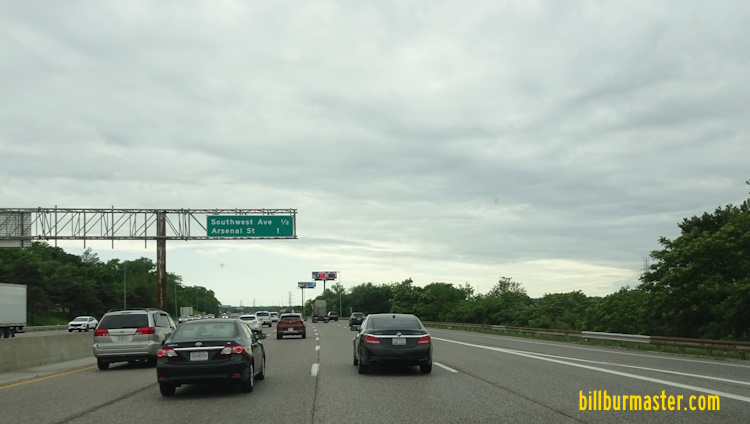
EB I-44 near Southwest Avenue.

WB I-44 at Southwest Avenue.

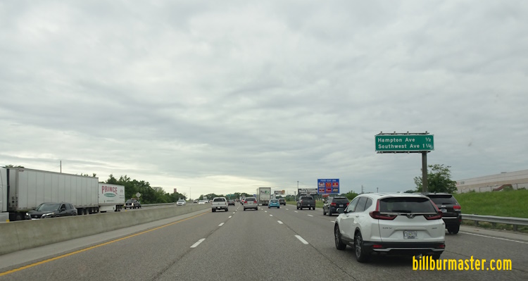
EB I-44 near Hampton.
WB I-44 west of Hampton.

EB I-44 at Hampton.
WB I-44 east of Hampton.

EB I-44 at Macklind Avenue.

EB I-44 at Kingshighway.

WB I-44 near Vaderventer.

EB I-44 east of Vanderventer.

EB I-44 at Thruman.

EB I-44 near Grand.

WB I-44 west of Grand.

WB I-44 at Grand.

EB I-44 at Compton.

EB I-44 at Compton.

WB I-44 at Nebraska. (July, 2014)

WB I-44 at Nebraska. (May, 2023)

A BGS on NB I-55.

A BGS on WB I-44.

A BGS on WB I-44.

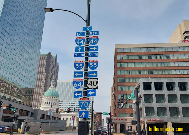
EB I-44/NB I-55 at Park Ave. in St. Louis.

EB I-44 at the Poplar Street.

WB I-44 at Poplar Street.

EB I-44 at Spruce.

A BGS on SB I-55.

A BGS on the ramp from SB I-55 to EB I-44.

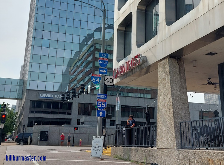
EB I-44 near Walnut.

EB I-44 at Walnut.

EB I-44 at Pine.

A guide marker on 4th in St. Louis.

A guide marker on 4th in St. Louis.

A guide marker on 4th in St. Louis.
A guide marker on 4th in St. Louis.
A guide marker on Walnut in St. Louis.

A BGS on Market in St. Louis.

A guide marker on 8th in St. Louis.

A guide marker on NB 4th Street in Downtown St. Louis.

A guide marker on Washington in St. Louis.

A BGS on Washington in St. Louis.
A guide marker on Washington in St. Louis.

A guide marker on Washington in St. Louis.

A BGS on Washington in St. Louis.

EB I-44 at Washington.

A set of guide markers on Washington in Downtown St. Louis.

A set of guide markers near the Dome in Downtown St. Louis.

A guide marker north of Downtown St. Louis.

A BGS on NB Lumier Place Blvd.

WB I-44 at Cole Street.

EB I-44 near the Edward Jones Dome.

EB I-44 near the start of the express lanes.

EB I-44 near Broadway.

WB I-44 at Broadway.

WB I-44 at I-70 in north St. Louis.

A BGS on EB I-70.

The eastern end point. (July, 2014)

The eastern end marker. (July, 2014)

The first end marker one mile from the east end of I-44. (May, 2022)

The east end of I-44. (May, 2022)
The former end point.
Prior to 2014

The end marker for EB I-44. (Feb., 2005)

The end marker on EB I-44. (June, 2006)
| CONTINUE TO: |
| EASTBOUND: | WESTBOUND: |
 |  |