Interstate 74, Illinois
Roads of the Mid-South & West > Highways of the State of Illinois > Interstate 74, Illinois
 | Interstate 74 |
Interstate 74 is a east-west highway running across Central Illinois. Entering Illinois at the Quad-Cities and exiting just east of Danville, I-74 links several major metropolitain areas in Central Illinois.
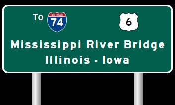
Interstate 74 has recieved $67.4 million in federal funding to replace the twin-spans over the Mississippi River in the Quad Cities. In 2002 it was estimated that it would cost $650 million to replace the bridges. The first span was constructed in 1935 by the WPA. Span two was built in 1959. Landmark status was considored in 1999, but it woul cost $3 million a year to maintain the old bridges. The new bridge could have three lanes in each directions, a viewing platform, and a pedestrian trail.* A link to the page dedicated to the bridge is below.
I-74 is multi-plexed several times in Illinois.
I-74 is multi-plexed with...
...U.S. Rt. 6, from the Iowa/Illinois State Line to the Quad City International Airport in Moline.


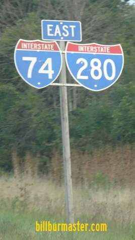
...Interstate 280, from the Quad City International Airport to Interstate 80.


...Illinois State Route 110, from near Colona to Galesburg.


...Illinois State Route 29, from Peoria to East Peoria.


...Interstate 55, from the northwest side of Normal to the southwest side of Bloomington.

...U.S. Rt. 51, from the northwest side of Normal to the southwest side of Bloomington.


On Saturday, July 7, 2007, at tanker truck crashed into a bridge carring WB I-74 across the Kickapoo Creek, near Downs, in Mc Lean County. From mid-afternoon to midnight, all lanes of I-74 were closed while the fire and scene was cleared. The heat from the burning gas cause major damage to the WB bridge over the Kickapoo Creek bridge, and minor damage to the northside of the Kickapoo Creek bridge. At midnight, one EB lane of I-74 was re-opened to traffic, while all WB lanes we still closed. WB traffic was put on a temporary detour along U.S. Rt. 136 west to U.S. Rt. 51 north.


Various markers along NB U.S. Rt. 51. (July, 2007)

WB I-74 on the eastside of the damaged bridge. All traffic shares the EB bridge. (Aug, 2007)

WB I-74 as it crosses over to the EB bridge. (Aug, 2007)

Looking north at the WB bridge from the EB bridge. (Aug, 2007)
Interstates that I-74 cross in Illinois...
Interstate 280, in Moline.

A BGS 2miles from I-280 on EB I-74/U.S. Rt. 6.

Overhead signs a 1/4 mile from I-280 on EB I-74/U.S. Rt. 6.

EB I-74/U.S. Rt. 6 at WB I-280.

Overhead sign on EB I-74 at I-280 in Moline.

A BGS on EB I-74/U.S. Rt. 6 two miles from I-280. (August, 2010)

A BGS one mile from I-280. (August, 2010)

EB I-74/U.S. Rt. 6 a half mile from I-280. (August, 2010)

EB I-74/U.S. Rt. 6 at WB I-280. (August, 2010)

EB I-74/U.S. Rt. 6 at EB I-280. (August, 2010)

EB I-74/U.S. Rt. 6 two miles from I-280. (September, 2021)

EB I-74/U.S. Rt. 6 near I-280. (September, 2021)

EB I-74/U.S. Rt. 6 at WB I-280. (September, 2021)

EB I-74/U.S. Rt. 6 at EB I-280. (September, 2021)

A BGS on WB I-74/280 two miles from the interchange near QCA. (August, 2010)

A BGS on WB I-74/280 one mile from the interchange. (August, 2010)

A BGS on WB I-74/280 for WB I-74/U.S. Rt. 6. (August, 2010)

WB I-280 at WB I-74. (August, 2010)
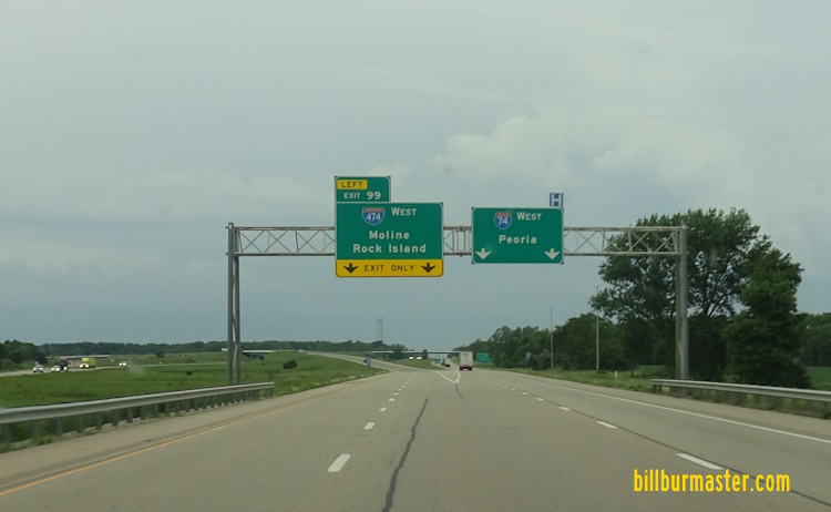
Interstate 80, near Colona.
Interstate 280, near Colona.

A BGS on EB I-74/280.

The one mile BGS on EB I-74/280.

EB I-74 near I-80 at the Quad-Cities.

EB I-74/280 at I-80.

A BGS on EB I-74/280 two miles from I-80. (August, 2010)

EB I-74/280 one mile from I-80. (August, 2010)

EB I-74/280 at I-80.

A BGS on WB I-74/IL St Rt 110 two miles before I-80/280.

WB I-74/IL St Rt 110 one mile from I-80/280.

A BGS on WB I-74/IL St Rt 110 for EB I-80.

A BGS on WB I-74/IL St Rt 110 for I-74/280.

WB I-74/IL St Rt 110 at EB I-80.

A diagram for traffic on I-74/280.

WB I-74/IL St Rt 110 at the ramp to WB I-280.
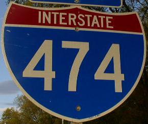
Interstate 474, at Peoria.

BGS on EB I-74.

EB I-74 near I-474.

EB I-74 at the ramp to I-474 on the westside of Peoria.

A BGS on WB I-74.

Another BGS on WB I-74.

WB I-74 near EB I-474. (February, 2019)

WB I-74 at EB I-474. (February, 2019)
Interstate 474, at Peoria.

WB I-74 near I-474.

WB I-74 at I-474

WB I-74 at the split of I-474.

WB I-74 one mile from I-474. (April, 2012)

WB I-74 near I-474. (April, 2012)

WB I-74 at I-474. (April, 2012)

WB I-74 one mile from I-474. (February, 2019)

WB I-74 near I-474. (February, 2019)

WB I-74 at I-474. (February, 2019)

WB I-74 at I-474. (February, 2019).
WB I-74 at west I-474. (June, 2025)

EB I-74 one mile from I-474. (October, 2018)

EB I-74 a half mile from I-474. (October, 2018)

EB I-74 at I-474. (October, 2018)

EB I-74 one mile from I-474.

A BGS on EB I-74.

EB I-74 at I-474.
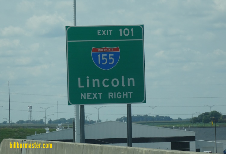
Interstate 155, at Morton.

EB I-74 one mile from I-155.

EB I-74 near I-155.

EB I-74 at I-155.

EB I-74 one mile from I-155.

EB I-74 near I-155.

EB I-74 at I-155.

A BGS on WB I-74.

WB I-74 at I-155. This was shortly after a tornado passed through the area. (2003)

WB I-74 at I-155. (August, 2007)
A BGS on WB I-74. (August, 2024)

WB I-74 at I-155. (August, 2024)
Interstate 55, at Normal, IL.

EB I-74 near I-55 at Normal. (2003)

EB I-74 at I-55. (2003)

A BGS two miles from I-55 on EB I-74.

The overhead signs above were replaced in May, 2004.

Another set of overhead BGS's on EB I-74. (2004)

A set of lane markers on EB I-74.

EB I-74 at I-55. (2004)

NB I-55/WB I-74 near their split at Normal. (2004)

Another set of overhead signs on NB I-55/WB I-74. (2004)

NB I-55 at the split with WB I-74. (2004)

NB I-55/WB I-74 one mile from their split. (October, 2005)

A BGS on NB I-55/WB I-74. (October, 2005)

WB I-74 at NB I-55 in Normal. (October, 2005)

A BGS for west I-74 on NB I-55/U.S. Rt. 51; WB I-74. (August, 2022)

NB I-55/U.S. Rt. 51; WB I-74 one mile from north I-55/U.S. Rt. 51. (August, 2022)

A BGS on NB I-55/U.S. Rt. 51; WB I-74. (August, 2022)

NB I-55/U.S. Rt. 51; WB I-74 at north I-55/U.S. Rt. 51. (August, 2022)
Interstate 55, at Bloomington.

WB I-74 two miles from I-55.

A BGS on WB I-74/NB U.S. Rt. 51 one mile from I-55.

WB I-74 at the South Veterans Parkway interchange.

WB I-74 at the ramp to SB I-55.

WB I-74/NB U.S. Rt. 51 one mile from south I-55. (April, 2022)

WB I-74/NB U.S. Rt. 51 near south I-55. (April, 2022)

WB I-74/NB U.S. Rt. 51 at SB I-55. (April, 2022)

The first BGS on SB I-55/U.S. Rt. 51; EB I-74 for their split.

A BGS one mile from the split of I-55/74; U.S. Rt. 51.

SB I-55/U.S. Rt. 51; EB I-74 near their split.

SB I-55 at EB I-74/SB U.S. Rt. 51.

SB I-55/EB I-74/SB U.S. 51 two miles from their split. (July, 2011)

SB I-55/EB I-74/SB U.S. 51 one mile from their split. (July, 2011)

SB I-55/EB I-74/SB U.S. 51 near their split. (July, 2011)

SB I-55/EB I-74/SB U.S. 51 at their split. (July, 2011)
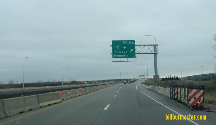
Interstate 57, at Urbana.

The two mile BGS on EB I-74.

The one mile BGS on EB I-74.

A BGS for SB I-57 on EB I-74.

EB I-74 at I-57.

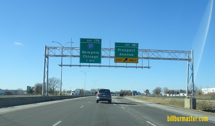
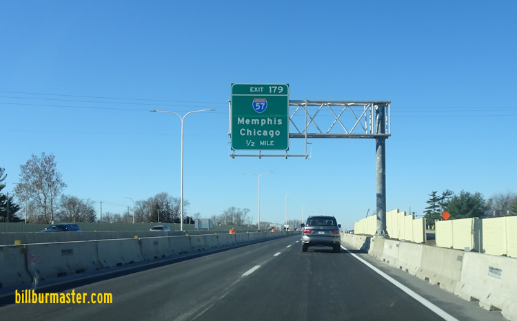
A BGS on EB I-74 two miles from I-57. (January, 2026)

A BGS on EB I-74 one mile from I-57. (January, 2026)

A BGS on EB I-74 a half mile from I-57. (January. 2026)
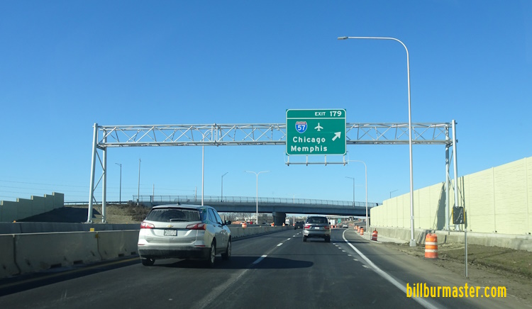
EB I-74 at I-57.

A BGS on the ramp to I-57 from EB I-74. (January, 2026)

WB I-74 over one mile from I-57. (September, 2011)

WB I-74 less than a mile from I-57. (September, 2011)

A BGS for NB I-57 on WB I-74. (September, 2011)

WB I-74 at NB I-57. (September, 2011)

WB I-74 at SB I-57. (September, 2011)
WB I-74 one mile from I-57. (December, 2024)
WB I-74 a half mile from I-57. (December, 2024)
WB I-74 at I-57. (December, 2024)
Branches of I-74 in Illinois.
Photos of Interstate 74 as it travels through Illinois.
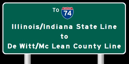
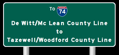
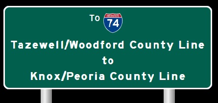
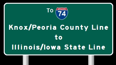
Select A Section of I-74.

*"Aging I-74 bridge gets federal funding for replacement" Belleville News-Democrat Belleville, IL August, 2005
1 May 2026