Illinois State Route 110 Chicago-Kansas City Expressway
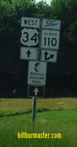
Illinois State Route 110 is the route designaition for the Chicago-Kansas City Expressway. The Illinois General Assembly passed SJR 118. That created IL St Rt 110. It provides a direct route between the two major metros without going through Des Moine or St. Louis. In Illinois it is aporx. 325 miles in length. The northern start point is at the Circle Interchange with Interstate 90/94/290 in Downtown Chicago. From here it heads west to the Quad Cities, then moves south. IL St Rt 110 has it's southern end point on Interstate 72/U.S. Rt. 36, at the Mark Twain Bridge, in Hannibal, Missouri. IL St Rt 110 passes through the following counties in Illinois. Cook Du Page Kane De Kalb Ogle Lee Whiteside Rock Island Henry Knox Warren Mc Donough Hancock Adams Pike IL St Rt 110 passes through the following towns in Illinois. Chicago
Oak Park Forest Park Maywood Bellwood
Westchester Hillside Oak Brook
Lombard Downers Grove Lisle Naperville
Warrenville Aurora
North Aurora
Sugar Grove De Kalb Dixon East Moline Colona Galesburg
Monmouth
Roseville Good Hope
Macomb
Carthage Quincy
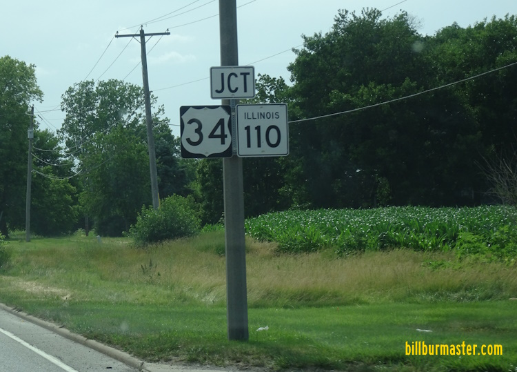
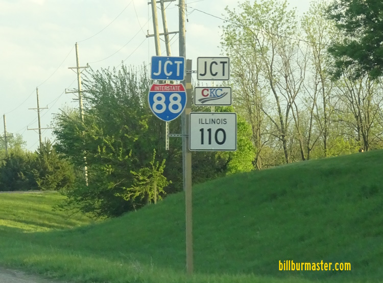
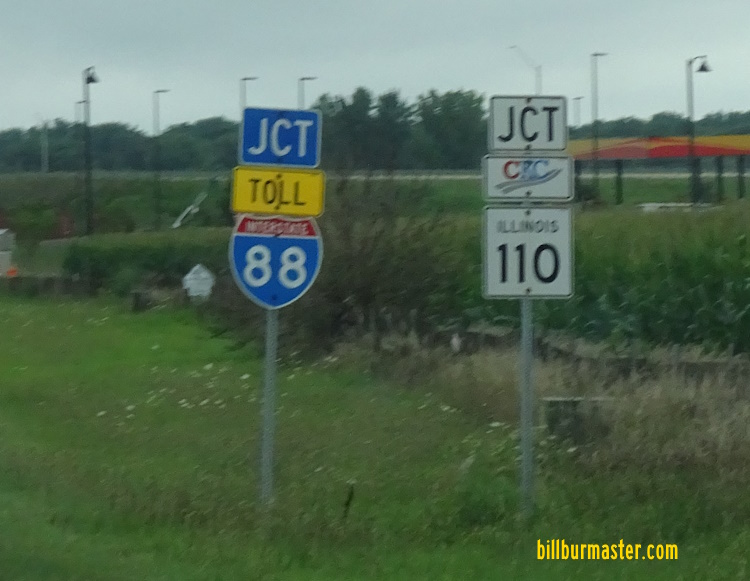
East Hannibal IL St Rt 110 is multi-plexed in Illinois. Interstate 290, from Chicago to Hillside.
EB I-88/IL St Rt 110 near the Dixon Toll Plaza. EB I-88/IL St Rt 110 at the Dixon Toll Plaza. The I-PASS Lane at the Dixon Toll on EB I-88/IL St Rt 110. WB I-88/IL St Rt 110 one mile from the Dixon Toll. WB I-88/IL St Rt 110 a half mile from the Dixon Toll. Lane markers on WB I-88/IL St Rt 110 near the Dixon Toll. The stop a head sign on WB I-88/IL St Rt 110. WB I-88/IL St Rt 110 at the Dixon Toll. A toll warning sign two miles from the Dixon Toll Plaza on WB I-88/IL St Rt 110.
(September, 2021) A toll warning sign on WB I-88/IL St Rt 110 for the Dixon Toll Plaza. (September, 2021) Lane markers for the Dixon Toll Plaza on WB I-88/IL St Rt 110. (September, 2021) The Dixon Toll Plaza on WB I-88/IL St Rt 110. (September, 2021) WB I-88/IL St Rt 110 at the Dixon Toll Plaza. (September, 2021) WB I-88/IL St Rt 110 at the I-Pass Lanes at the Dixon Toll Plaza. (September, 2021)
DeKalb West Plaza Number 66 at DeKalb.
Toll warning sign on WB I-88/IL St Rt 110. WB I-88/IL St Rt 110 near the De Kalb Toll Plaza. Second toll warning sign. WB I-88/IL St Rt 110 at the De Kalb Toll Plaza. Plaza marker. EB I-88/IL St Rt 110 one mile from the De Kalb Toll. (June, 2010) EB I-88/IL St Rt 110 a half mile from the De Kalb Toll. (June, 2010) Lane markers on EB I-88/IL St Rt 110. (June, 2010) Another set of lane markers on EB I-88/IL St Rt 110. (June, 2010) The stop ahead sign in the cash lanes of EB I-88/IL St Rt 110. (June, 2010) EB I-88/IL St Rt 110 in the I-Pass lanes at the De Kalb Toll Plaza. (June, 2010) The first warning sign for the De Kalb Toll Plaza on WB I-88/IL St Rt 110. (August, 2010) The half mile sign for the De Kalb Toll Plaza on WB I-88/IL St Rt 110. (August, 2010) The lane markers for the De Kalb Toll Plaza on WB I-88/IL St Rt 110. (August, 2010) Another set of lane markers for the De Kalb Toll Plaza on WB I-88/IL St Rt 110. (August, 2010) The stop ahead sign for the De Kalb Toll Plaza on WB I-88/IL St Rt 110. (August, 2010) WB I-88/IL St Rt 110 at the De Kalb Toll Plaza. (August, 2010) The toll warning sign two miles from the De Kalb Toll Plaza on WB I-88/IL St Rt 110. (September, 2021) The toll warning sign for the De Kalb Toll Plaza on WB I-88/IL St Rt 110. (September, 2021) Lane markers on WB I-88/IL St Rt 110 for the De Kalb Toll Plaza. (September, 2021) The former cash lanes for the De Kalb Toll Plaza on WB I-88/IL St Rt 110. (September, 2021) WB I-88/IL St Rt 110 at the De Kalb Toll Plaza. (September, 2021) WB I-88/IL St Rt 110 at the I-Pass Lanes at the De Kalb Toll Plaza. (September, 2021)
Aurora Plaza Number 61 at Aurora.
Warning sign on EB I-88/IL St Rt 110. EB I-88/IL St Rt 110 near the Aurora Toll Plaza and Fox River. EB I-88/IL St Rt 110 at the Aurora Toll Plaza (I-PASS to left, others to right). EB I-88/IL St Rt 110 at the Aurora Toll Plaza. EB I-88/IL St Rt 110 at the Manuel Lanes of the Aurora Toll Plaza. EB I-88/IL St Rt 110 one mile from the Aurora Toll. (July, 2009) EB I-88/IL St Rt 110 a half mile from the Aurora Toll. (July, 2009) Lane markers on EB I-88/IL St Rt 110. (July, 2009) The stop ahead sign on the cash lanes. (July, 2009) The Aurora Toll Plaza on EB I-88/IL St Rt 110. (July, 2009) EB I-88/IL St Rt 110 a half mile from the Aurora Toll. (August, 2013) Lane markers on EB I-88/IL St Rt 110. (August, 2013) The stop ahead sign on EB I-88/IL St Rt 110. (August, 2013) EB I-88/IL St Rt 110 at the Aurora Toll. (August, 2013) EB I-88/IL St Rt 110 in the I-PASS Lanes. (August, 2013) The toll warning sign two miles from the Aurora Toll Plaza on EB I-88; IL St Rt 56/110.
(August, 2021) The toll warning sign for the Aurora Toll Plaza on EB I-88; IL St Rt 56/110. (August, 2021) Lane markers for the Aurora Toll Plaza on WB I-88/IL St Rt 110. (August, 2021) The Aurora Toll Plaza on EB I-88/IL St Rt 110. (August, 2021) The I-Pass lanes at the Aurora Toll Plaza on EB I-88/IL St Rt 110. (August, 2021) WB I-88/IL St Rt 110 under one mile from the Aurora Toll. (August, 2010) WB I-88/IL St Rt 110 a half mile from the Aurora Toll. (August, 2010) Lane markers for the toll plaza on WB I-88/IL St Rt 110. (August, 2010) The stop ahead sign on WB I-88/IL St Rt 110. (August, 2010) WB I-88/IL St Rt 110 at the Aurora Toll. (August, 2010) The I-Pass lanes on WB I-88/IL St Rt 110 at the Aurora Toll. (August, 2010) A toll warning sign for the Aurora Toll Plaza on WB I-88/IL St Rt 110. (August, 2021) A set of lane markers on WB I-88/IL St Rt 110. (August, 2021) WB I-88/IL St Rt 110 at the Aurora Toll Plaza. (August, 2021)
Meyers Road Plaza Number 52 at Downers Grove. Eastbound ONLY
EB I-88/IL St Rt 110 at a overhead for the new EB plaza. (Sept., 2006) EB I-88/IL St Rt 110 at the new EB plaza. (Sept., 2006) EB I-88/IL St Rt 110 at the lane markers for the new Meyers Road Toll Plaza. (Mar., 2007) The stop a head sign on EB I-88/IL St Rt 110 for the cash lanes. (Mar., 2007) The new Meyers Road toll plaza on EB I-88/IL St Rt 110. (Mar., 2007) The I-Pass lanes at the new Meyers Road toll plaza. (Mar. 2007) EB I-88/IL St Rt 110 one mile from the Meyers Road Toll Plaza. (June, 2013) EB I-88/IL St Rt 110 a half mile from the Meyer Road Toll Plaza. (June, 2013) Lane markers on EB I-88/IL St Rt 110 for the Meyer Road Toll Plaza. (June, 2013) The stop ahead sign in the cash lanes on EB I-88/IL St Rt 110 for the Meyer Road Toll Plaza. (June, 2013) EB I-88/IL St Rt 110 at the Meyer Road Toll Plaza. (June, 2013) A toll warning sign two miles from the Meyer Road Toll Plaza. (November, 2019) EB I-88/IL St Rt 110 one mile from the Meyer Road Toll Plaza. (November, 2019) EB I-88.IL St Rt 110 a half mile from the Meyer Road Toll Plaza. (November, 2019) EB I-88/IL St Rt 110 near the Meyer Road Toll Plaza. (November, 2019) EB I-88/IL St Rt 110 at the Meyer Road Toll Plaza. (November, 2019) A toll warning sign on EB I-88/IL St Rt 110 for the Meyer Road Toll Plaza. (August, 2021) A toll warning sign on EB I-88/IL St Rt 110 for the Meyer Road Toll Plaza. (August, 2021) Lane markers for the Meyer Road Toll Plaza on EB I-88/IL St Rt 110. (August, 2021) EB I-88/IL St R t110 at the Meyers Road Toll Plaza. (August, 2021)
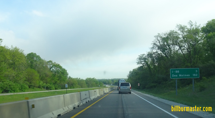
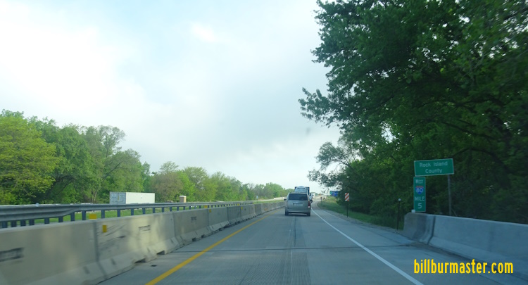
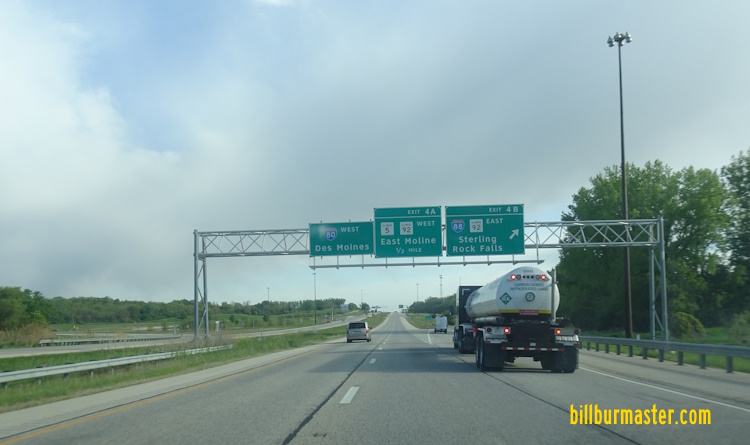
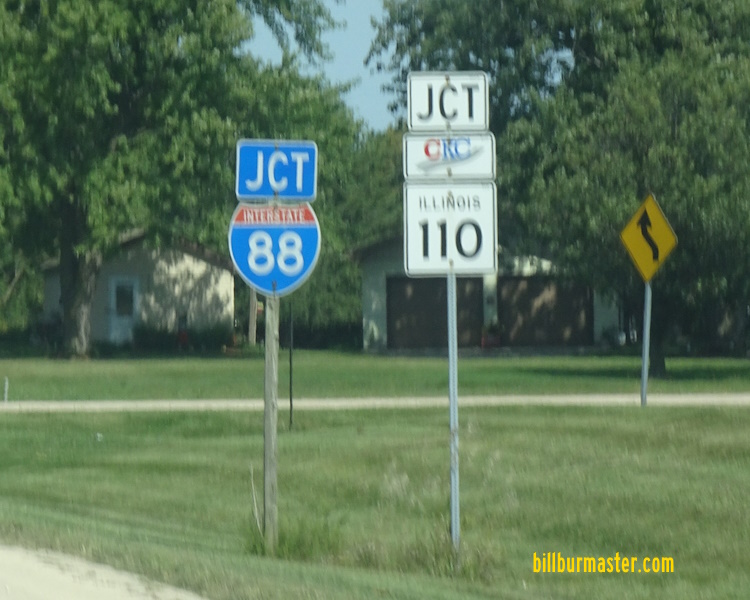
York Road Plaza Number 51 at Oak Brook. Westbound ONLY
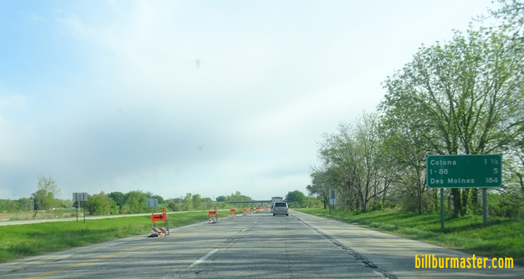
Toll overhead on EB I-88/IL St Rt 110. EB I-88/IL St Rt 110 near the York Road Toll Plaza. EB I-88/IL St Rt 110 at the York Road Toll Plaza. EB I-88/IL St Rt 110 in the I-PASS lanes at the York Road Toll Plaza. EB I-88/IL St Rt 110 at the York Road Toll Plaza, at the I-PASS Lanes. EB I-88/IL St Rt 110 at a set of lane markers for the York Road Plaza. (Sept. 2006) Another set of lane markers at the York Road Plaza. (Sept., 2006) The stop ahead sign for the York Road plaza. (Sept., 2006) The first toll warning sign on WB I-88/IL St Rt 110 for the York Road Toll Plaza. The lane markers for the York Toll Plaza. WB I-88/IL St Rt 110 near the York Plaza. WB I-88/IL St Rt 110 at the York Road Toll Plaza. WB I-88/IL St Rt 110 one mile from the York Plaza. (December, 2008) WB I-88/IL St Rt 110 a half mile from the York Plaza. (December, 2008) The stop ahead sign on WB I-88/IL St Rt 110 at the York Plaza. (December, 2008) WB I-88/IL St Rt 110 at the York Road Toll Plaza. (December, 2008) The Toll Ahead sign on WB I-88/IL St Rt 110 for the York Road Toll Plaza. (April, 2022) WB I-88/IL St Rt 110 near the York Road Toll Plaza. (April, 2022) Another Toll Ahead sign on WB I-88/IL St Rt 110. (April, 2022) WB I-88/IL St Rt 110 at the York Road Toll Plaza. (April, 2022) WB I-88/IL St Rt 110 at the I-Pass Lanes of the York Road Toll Plaza. (April, 2022) EB I-72/U.S. Rt. 36/IL St Rt 110 at the Illinois/Missouri State Line. (June, 2019) EB I-72/U.S. Rt. 36/IL St Rt 110 at the Illinois Welcome Sign. (June, 2019) EB I-72/U.S. Rt. 36/IL St Rt 110 east of IL St Rt 106. A guide marker on EB I-72/U.S. Rt. 36; NB IL St Rt 110. NB I-172/IL St Rt 110 near the Adams/Pike County Line. A set of guide markers on NB IL St Rt 57. Photo from: Paul Dienhart A set of guide markers on SB IL St Rt 57. Photo from: Paul Dienhart A guide marker on NB IL St Rt 57. NB I-172/IL St Rt 110 north of IL St Rt 57. NB I-172/IL St Rt 110 north of IL St Rt 57. A guide marker on NB IL St Rt 57. NB I-172/IL St Rt 110 near Marblehead. NB I-172/IL St Rt 110 north of IL St Rt 96. NB I-172/IL St Rt 110 south of IL St Rt 104. A guide marker on WB IL St Rt 104. A BGS on WB IL St Rt 104. A junction marker on EB IL St Rt 104. A BGS on EB IL St Rt 104. A BGS on EB IL St Rt 104. NB I-172/IL St Rt 110 north of IL St Rt 104. NB I-172/IL St Rt 110 north of IL St Rt 104. NB I-172/IL St Rt 110 northeast of Quincy. NB I-172/IL St Rt 110 at U.S. Rt. 24/IL St Rt 336. NB IL St Rt 110/336 near I-172. The southern end of IL St Rt 336 and the northern start of I-172. IL St Rt 110 continues onto I-172. NB IL St Rt 110/336 at U.S. Rt. 24. NB IL St Rt 110/336 north of U.S. Rt. 24. NB IL St Rt 110/336, north of U.S. Rt. 24. NB IL St Rt 110/336 near the Adams County Fairgrounds. NB IL St Rt 110/336 at IL St Rt 61. NB IL St Rt 61/110/336 north of south IL St Rt 61. NB IL St Rt 61/110/336 south of Loraine. NB IL St Rt 110/336 north of IL St Rt 61. NB IL St Rt 110/336 at the Adams/Hancock County Line. NB IL St Rt 110/336 south of IL St Rt 94. NB IL St Rt 94/110/336 north of east IL St Rt 94. NB IL St Rt 94/110/336 near Denver. NB IL St Rt 110/336 at U.S. Rt. 136/IL St Rt 94. A junction marker on EB U.S. Rt. 136/SB IL St Rt 94. EB U.S. Rt. 136; NB IL St Rt 110/336 east of Carthage. EB U.S. Rt. 136; NB IL St Rt 110/336 east of Carthage. EB U.S. Rt. 136; NB IL St Rt 110/336 near Webster. EB U.S. Rt. 136; NB IL St Rt 110/336 near the La Moline River. EB U.S. Rt. 136; NB IL St Rt 110/336 near the Hancock/Mc Donough County Line. EB U.S. Rt. 136; NB IL St Rt 110/336 at the Hancock/Mc Donough County Line. EB U.S. Rt. 136; IL St Rt 110/336 at IL St Rt 61. A junction marker on NB IL St Rt 61. EB U.S. Rt. 136; IL St Rt 110/336 east of IL St Rt 61. A guide marker on EB U.S. Rt. 136; IL St Rt 110/336. A guide marker on EB U.S. Rt. 136; IL St Rt 110/336. EB IL St Rt 110/336 near Tennessee. NB IL St Rt 110/336 east of U.S. Rt. 136. NB IL St Rt 110/336 south of Tennessee. NB IL St Rt 110/336 southwest of Macomb. The SB on-ramp from U.S. Rt. 136/IL St Rt 110 at Carthage to SB IL St Rt 110/336. As of June, 2010, this is the path for IL St Rt 110/336. NB IL St Rt 110/336 at the Macomb end of the expressway. NB IL St Rt 110/336 after the lane reduction at it's current end. NB IL St Rt 110/336 at the current end of the expressway. The bridge for the BNSF Railway over the right-of-way for IL St Rt 110/336. NB IL St Rt 110/336 south of U.S. Rt. 136 on the southwest side of Macomb. This was the former end of the IL St Rt 336 expressway. (June, 2019) NB IL St Rt 110/336 south of U.S. Rt. 136 on the southwest side of Macomb. This was the former end of the IL St Rt 336 expressway. (June, 2019) NB IL St Rt 110/336 south of U.S. Rt. 136 on the southwest side of Macomb. This was the former end of the IL St Rt 336 expressway. (June, 2019) NB IL St Rt 110/336 at U.S. Rt. 136. NB IL St Rt 110/336 as it moves from a 4-Lane to a 2-Lane expressway. NB IL St Rt 110/336 north of U.S. Rt. 136, southwest of Macomb. NB IL St Rt 110/336 at the La Moine River. NB IL St Rt 110/336 north of U.S. Rt. 136. NB IL St Rt 110/336 near N 1250 Rd. NB IL St Rt 110/336 near N 1350 Rd. NB IL St Rt 110/336 west of E 1100 Rd. NB IL St Rt 110/336 at E 1100 Rd. NB IL St Rt 110/336 at the current end of the IL St Rt 336 expressway on the northside of Macomb at U.S. Rt. 67. (June, 2019) NB IL St Rt 110/336 at the current end of the IL St Rt 336 expressway on the northside of Macomb at U.S. Rt. 67. (June, 2019) NB IL St Rt 110/336 at the current end of the IL St Rt 336 expressway on the northside of Macomb at U.S. Rt. 67. (June, 2019) NB IL St Rt 110/336 at the current end of the IL St Rt 336 expressway on the northside of Macomb at U.S. Rt. 67. (June, 2019) A junction marker on NB U.S. Rt. 67. NB U.S. Rt. 67/IL St Rt 110 north of Macomb. U.S. Rt. 67/IL St Rt 110 goes to two-way traffic through Good Hope. NB U.S. Rt. 67/IL St Rt 110 north of Good Hope. NB U.S. Rt. 67/IL St Rt 110 south of the Mc Donough/Warren County Line. NB U.S. Rt. 67/IL St Rt 110 at the Mc Donough/Warren County Line. NB U.S. Rt. 67/IL St Rt 110 near Swan Creek. NB U.S. Rt. 67/IL St Rt 110 south of Roseville. NB U.S. Rt. 67/IL St Rt 110 on the northwest side of Roseville. NB U.S. Rt. 67/IL St Rt 110 south of U.S. Rt. 34. EB U.S. Rt. 34; NB U.S. Rt. 67/IL St Rt 110 south of Monmouth. EB U.S. Rt. 34/IL St Rt 164; NB U.S. Rt. 67/IL St Rt 110 on the northeast side of Monmouth. EB U.S. Rt. 34/IL St Rt 164; NB IL St Rt 110 northeast of Monmouth. EB U.S. Rt. 34/NB IL St Rt 110 near Cameron. EB U.S. Rt. 34/NB IL St Rt 110 at the Knox/Warren County Line. WB U.S. Rt. 34/IL St Rt 110 at the Knox/Warren County Line. WB U.S. Rt. 34/IL St Rt 110 west of Galesburg. A junction marker on NB IL St Rt 41. A junction marker on NB IL St Rt 34. EB U.S. Rt. 34/IL St Rt 110 north of IL St Rt 41. EB U.S Rt. 34/NB IL St Rt 110 at U.S. Rt. 150. A set of guide markers on WB U.S. Rt. 150. EB U.S. Rt. 34/NB IL St Rt 110 east of U.S. Rt. 150. EB U.S. Rt. 34/NB IL St Rt 110 at Galesburg. EB U.S. Rt. 34/NB IL St Rt 110 at I-74. A guide marker on EB U.S. Rt. 34. A junction marker on WB U.S. Rt. 34. A guide marker on EB U.S. Rt. 34/IL St Rt 110. A set of guide markers on WB I-74. WB I-74/IL St Rt 110 north of U.S. Rt. 34. WB I-74/NB IL St Rt 110 north of Galesburg. WB I-74/NB IL St Rt 110 near Ontario. WB I-74/NB IL St Rt 110 at the Henry/Knox County Line. A junction marker on WB IL St Rt 17. WB I-74/IL St Rt 110 north of IL St Rt 17. WB I-74/IL St Rt 110 near IL St Rt 81. EB I-74/WB IL St Rt 110 south of IL St Rt 81. WB I-74/IL St Rt 110 north of IL St Rt 81. WB I-74/IL St Rt 110 one mile from I-80/280. WB I-74/IL St Rt 110 at EB I-80. WB IL St Rt 110 at WB I-74/280. EB I-80/WB IL St Rt 110 at I-74/280. A guide marker on EB I-80/WB IL St Rt 110. EB I-80/WB IL St Rt 110 near I-74/280. A junction marker on EB U.S. Rt. 6. WB I-80/IL St Rt 110 north of U.S. Rt. 6. WB I-80/IL St Rt 110 near Colona. EB I-80/WB IL St Rt 110 near Colona. EB I-80/WB IL St Rt 110 at the Henry/Rock Island County Line. WB I-80/IL St Rt 110 at the Henry/Rock Island County Line. WB I-80/IL St Rt 110 at I-88; IL St Rt 5/92. WB I-88/IL St Rt 110 at EB I-80. WB I-88/IL St Rt 110 at WB I-80. WB I-88/IL St Rt 110 near Former IL St Rt 2. (August, 2010) WB I-88/IL St Rt 110 near Former IL St Rt 2. (August, 2021) WB I-88/IL St Rt 110 west of Hillside. WB I-88/IL St Rt 110 at the Rock Island/Whiteside County Line. WB I-88/IL St Rt 110 at Erie. A junction marker on NB IL St Rt 78. WB I-88/IL St Rt 110 at IL St Rt 78. WB I-88/IL St Rt 110 east of IL St Rt 78. WB I-88/IL St Rt 110 west of Rock Falls. WB I-88/IL St Rt 110 near Como. WB I-88/IL St Rt 110 at the Rock River. WB I-88/IL St Rt 110 west of IL St Rt 40. A junction marker on NB IL St Rt 40. A junction marker on SB IL St Rt 40. WB I-88/IL St Rt 110 near Rock Falls. WB I-88/IL St Rt 110 west of U.S. Rt. 30. WB I-88/IL St Rt 110 at U.S. Rt. 30. A junction marker on WB U.S. Rt. 30. WB I-88/IL St Rt 110 near the Lee/Whiteside County Line. WB I-88/IL St Rt 110 at the Lee/Whiteside County Line. WB I-88/IL St Rt 110 at the western end of the Reagan Tollway. WB I-88/IL St Rt 110 near Nelson. WB I-88/IL St Rt 110 southwest of Dixon. WB I-88/IL St Rt 110 west of IL St Rt 26. WB I-88/IL St Rt 110 at IL St Rt 26. WB I-88/IL St Rt 110 near Franklin Grove. WB I-88/IL St Rt 110 near Ashton. WB I-88/IL St Rt 110 west of Rochelle. WB I-88/IL St Rt 110 at the Lee/Ogle County Line. WB I-88/IL St Rt 110 at the Lee/Ogle County Line. A junction marker on NB IL St Rt 251. WB I-88/IL St Rt 110 at IL St Rt 251. WB I-88/IL St Rt 110 at SB I-39/U.S. Rt. 51. WB I-88/IL St Rt 110 at I-39/U.S. Rt. 51. WB I-88/IL St Rt 110 east of I-39/U.S. Rt. 51. WB I-88/IL St Rt 110 at the De Kalb/Ogle County Line. WB I-88/IL St Rt 110 at the De Kalb/Ogle County Line. WB I-88/IL St Rt 110 west of De Kalb. WB I-88/IL St Rt 110 on the southwest side of De Kalb. WB I-88/IL St Rt 110 in De Kalb. WB I-88/IL St Rt 110 at the De Kalb Oasis. WB I-88/IL St Rt 110 east of the De Kalb Oasis. WB I-88/IL St Rt 110 at Peace Road. WB I-88/IL St Rt 110 east of De Kalb. WB I-88/IL St Rt 110 at the De Kalb/Kane County Line. WB I-88/IL St Rt 110 at the De Kalb/Kane County Line. WB I-88/IL St Rt 110 west of IL St Rt 47. WB I-88/IL St Rt 110 west of IL St Rt 47. WB I-88/IL St Rt 110 at IL St Rt 47. EB I-88/IL St Rt 110 east of IL St Rt 47. WB I-88/IL St Rt 110 west of IL St Rt 56. WB I-88/IL St Rt 110 west of IL St Rt 56. WB I-88/IL St Rt 110 at WB IL St Rt 56. WB I-88/IL St Rt 110 at IL St Rt 56. WB I-88/IL St Rt 110 at IL St Rt 56. WB I-88/IL St Rt 56-110 west of IL St Rt 31. WB I-88/IL St Rt 110 at the Fox River. WB I-88/IL St Rt 110 near Farnsworth Ave. in Aurora. WB I-88/IL St Rt 110 near the Du Page/Kane County Line. EB I-88/IL St Rt 110 at the Du Page/Kane County Line. EB I-88/IL St Rt 110 at Eola. WB I-88/IL St Rt 110 near the Canadian National Railroad, west of IL St Rt 59. EB I-88/IL St Rt 110 at IL St Rt 59. WB I-88/IL St Rt 110 near Naperville/Lisle. EB I-88/IL St Rt 110 five miles from I-355. EB I-88/IL St Rt 110 one mile from I-355. EB I-88/IL St Rt 110 one mile from I-355. (August, 2021) WB I-88/IL St Rt 110 west of I-355. EB I-88/IL St Rt 110 a half mile from SB I-355. EB I-88/IL St Rt 110 at SB I-355. EB I-88/IL St Rt 110 at SB I-355. (August, 2021) EB I-88/IL St Rt 110 a half mile from NB I-355. EB I-88/IL St Rt 110 near NB I-355. EB I-88/IL St Rt 110 at NB I-355. WB I-88/IL St Rt 110 at Downers Grove. EB I-88/IL St Rt 110 at the fly-over ramp from EB I-88/IL St Rt 110 to NB I-355. EB I-88/IL St Rt 110 near Highland Ave. in Downers Grove. EB I-88/IL St Rt 110 near Highland Ave. in Downers Grove. (October, 2016) EB I-88/IL St Rt 110 at Midwest Road. EB I-88/IL St Rt 110 east of IL St Rt 83. EB I-88/IL St Rt 110 near I-290/294. (October, 2022) A BGS for SB I-294 on EB I-88/IL St Rt 110. (October, 2022) EB I-88/IL St Rt 110 near Spring Road. (September, 2020) EB I-88/IL St Rt 110 near the ramp to SB I-294. (October, 2022) EB I-88/IL St Rt 110 at the ramp to SB I-294. (September, 2010) EB I-88/IL St Rt 110 at the ramp for SB I-294. (October, 2022) EB I-88/IL St Rt 110 near York Road. (September, 2010) EB I-88/IL St Rt 110 under one mile from I-290/NB I-294. (October, 2022) EB I-88/IL St Rt 110 near Roosevelt Road. EB I-88/IL St Rt 110 near I-290/NB I-294. (October, 2022) EB I-88/IL St Rt 110 at WB I-290/NB I-294. (September, 2010) EB I-88/IL St Rt 110 at I-290/NB I-294. (October, 2022) WB I-88/IL St Rt 110 at the Cook/Du Page County Line. EB I-88/IL St Rt 110 at the Cook/Du Page County Line. WB I-88/IL St Rt 110 at the Cook/Du Page County Line. The eastern end of I-88. IL St Rt 110 continues east on I-290. EB I-290/IL St Rt 110 at Wolf Road in Hillside. EB I-290/IL St Rt 110 near 17th Ave near Maywood. EB I-290/IL St Rt 110 at 9th Ave. EB I-290/IL St Rt 110 at 1st Ave. EB I-290/IL St Rt 110 near Des Plaines Ave. in Maywood. EB I-290/IL St Rt 110 at Home Ave. EB I-290/IL St Rt 110 at Oak Park Ave. EB I-290/IL St Rt 110 at Lombard Ave. EB I-290/IL St Rt 110 at Austin. EB I-290/IL St Rt 110 in Oak Park. The mileage chart along EB I-290/IL St Rt 110 in Oak Park. EB I-290/IL St Rt 110, just east of Austin Blvd. EB I-290/IL St Rt 110 at Cicero. EB I-290/IL St Rt 110 near Laramie in Chicago. EB I-290/IL St Rt 110 near Pulaski in Chicago. EB I-290/IL St Rt 110 at Paulina. EB I-290/IL St Rt 110 east of Paulina. EB I-290/IL St Rt 110 near the Loop. EB I-290/IL St Rt 110 one mile from I-90/94. EB I-290/IL St Rt 110 under one mile from I-90/94. EB I-290/IL St Rt 110 before I-90/94. EB I-290/IL St Rt 110 at Peoria. EB I-290/IL St Rt 110 at I-90/94. The end of EB I-290/IL St Rt 110 at the Circle Interchange. The end of I-290/IL St Rt 110.