Interstate 55, Missouri
Roads of the Mid-South & West > Highways of the State of Missouri > Interstate 55, Missouri
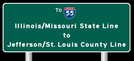
 | Interstate 55 |
Interstate 55 is the main north-south artery to the far southeastern foot hills of Missouri. It parellels the Mississippi River throughout Missouri.
While in Missouri, I-55 is multi-plexed several times.
I-55 is multi-plexed with...
...Interstate 64, from the Illinois/Missouri State Line, west for less than a 1/4 mile.
...U.S. Rt. 40, from the Illinois/Missouri State Line, west for less than a 1/4 mile.


...Interstate 44, at St. Louis.


...Missouri State Route 74, at Cape Girardeau.

...U.S. Rt. 61, from Cape Girardeau to near Scott City.

...U.S. Rt. 61, from near Portageville to near Steele.

In December, 2015 into January, 2016, Interstate 44 and 55 were closed to all traffic in each direction near St. Louis. This was dues to flooding of the highway. Many local roads were shut down as well. These are pictures of a variable message board on SB Interstate 57, near Manteno, Illinois.

A VMS on SB I-57, near Manteno, IL. (January, 2016)

A VMS on SB I-57, near Manteno, IL. (January, 2016)

A VMS on SB I-57, near Manteno, IL. (January, 2016)
In Missouri, I-55 intersects the following interstates.
Interstate 44, in Downtown St. Louis.
Interstate 64, in Downtown St. Louis.

SB I-55; WB I-64/70; U.S. Rt. 40 near their split in Downtown St. Louis.

SB I-55; WB I-64/70; U.S. Rt. 40 at WB I-70.

WB I-64/U.S. Rt. 40; SB I-55 a half mile from the ramps to I-44/55. (June, 2019)

WB I-64/U.S. Rt. 40; SB I-55 near the ramps to I-44/55.
(June, 2019)

WB I-64/U.S. Rt. 40; SB I-55 at the ramps to I-44/55. (June, 2019)

NB I-55 near I-64/70.

Another BGS on NB I-55.

NB I-55 at I-64/70.

NB I-55 near I-64/70. (May, 2012)

Another set of BGS's on NB I-55. (May, 2012)

NB I-55 at I-64/70. (May, 2012)

Lane markers prior to the interchange with I-55/64. (July, 2014)

EB I-44 near I-55/64. (July, 2014)

EB I-44 at I-55/64. (July, 2014).
Interstate 44, at St. Louis.

The first BGS for I-44 on NB I-55.

NB I-55 near I-44.

NB I-55 at I-44.

NB I-55 a half mile from I-44. (May, 2012)

NB I-55 near I-44. (May, 2012)

NB I-55 at I-44. (May, 2012)

NB I-55 two miles from I-44. (July, 2016)

NB I-55 under one mile from I-44. (July, 2016)

NB I-55 before I-44. (July, 2016)

NB I-55 at I-44. (July, 2016)

SB I-55 less than a mile from I-44.

SB I-55 near I-44.

SB I-55 at I-44.

SB I-55 under one mile from WB I-44. (June, 2019)

SB I-55 near WB I-44. (June, 2019)

SB I-55 at WB I-44. (June, 2019)

SB I-55 near WB I-44. (June, 2022)

SB I-55 before WB I-44. (June, 2022)

SB I-55 at WB I-44. (June, 2022)
Interstate 270, near Webster Grove.
Interstate 255, near Webster Grove.

SB I-55 two miles from I-255/270.

A BGS on SB I-55.

SB I-55 near I-255/270.

A set of lane markers on SB I-55.

SB I-55 at I-255/270.

A mileage sign on NB I-55.

A BGS on NB I-55 1 1/2 miles from I-255/270.

A set of overhead BGS's on NB I-55.

Another set of overhead BGS's on NB I-55.

NB I-55 at I-255/270.

NB I-55 under two miles from I-255/270. (June, 2022)

NB I-55 near I-255/270. (June, 2022)

NB I-55 before I-255/270. (June, 2022)

NB I-55 at I-255/270. (June, 2022)
Interstate 57, near Sikeston.

BGS on SB I-55.

SB I-55 at I-57.

A BGS on SB I-55 at the ramp to NB I-57.
Interstate 155, near Hayti.

Overhead sign on SB I-55.

BGS on SB I-55.

SB I-55 near the interchange with I-155.

SB I-55 at I-55.
Branches of I-55 in Missouri.


Photos of Interstate 55 as it travels through Missouri.
Select A Section of I-55.


5 December 2023