Roads of the Mid-South & West > Highways of the State of Missouri > Interstate 70, Missouri > Interstate 270, Missouri
 | Interstate 270 |
Interstate 270 forms the majority of the beltway around St. Louis. Starting at Interstate 55 on the southside of the metro area, around the westside to the Mississippi River at Chain of Rocks on the northside.
While in the State of Missouri, I-270 is not multi-plexed.
Interstate 270 has what MoDOT and the Missouri Highway Patrol call a "Accident Reduction Site". On the first picture (below), notice the warning of heavy traffic. The second picture (below), indicated that crossing the Double White Line is prohibited. Missouri Highway Patrol does monitor and enforce that strictly.

A sign warning motorists.

NB I-270 south of I-70.

Traffic heading to I-70 can not re enter NB I-270 traffic.
Interstates that I-270 crosses in Missouri...
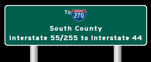
Interstate 55, at Mehlville.

SB I-270 two miles from I-55.

SB I-270 one mile from I-55.

SB I-270 near I-55.

SB I-270 two miles from I-55. (June, 2022)

SB I-270 one miles from I-55. (June, 2022)

SB I-270 near I-55. (June, 2022)
Interstate 255, at Mehlville.

SB I-270 at I-55/255.

SB I-270 at I-55/255. (June, 2022)
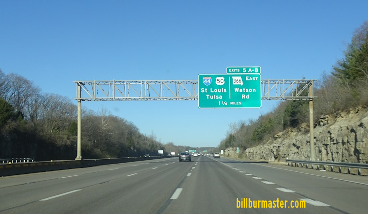
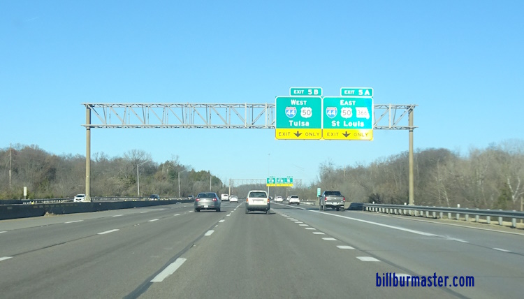
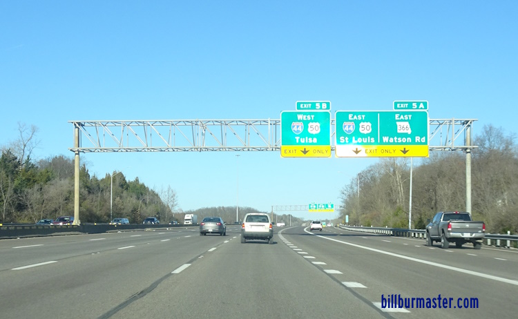
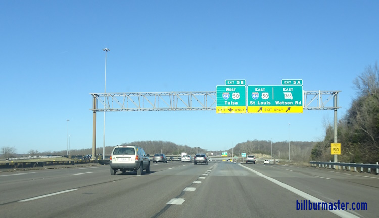
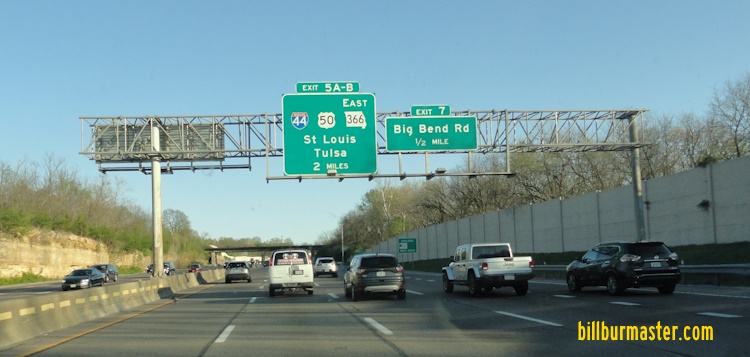
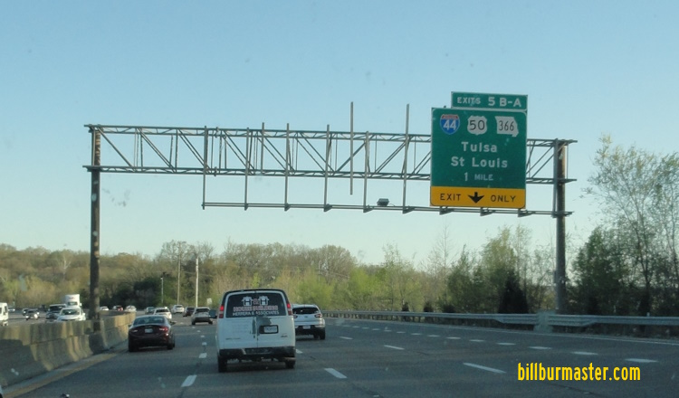
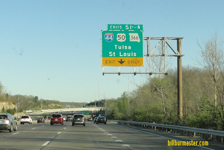
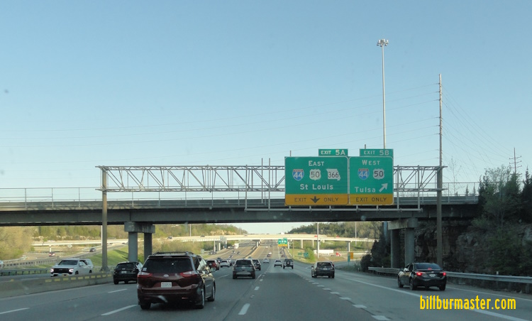
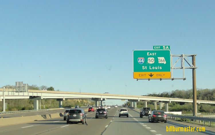
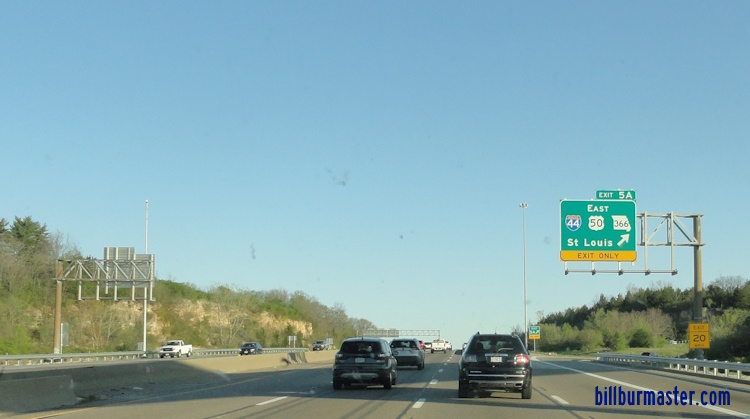
Interstate 44, at Sunset Hills.

A BGS on NB I-270.

Another BGS on NB I-270.

Lane makrers on NB I-270.

NB I-270 at I-44.

View of the I-44/I-270 interchange on NB I-270.

NB I-270 over one mile from I-44. (August, 2014)

NB I-270 less than a miles from I-44. (August, 2014)

Lane markers on NB I-270 for I-44. (August, 2014)

NB I-270 at EB I-44. (August, 2014)

NB I-270 near WB I-44. (August, 2014)

NB I-270 at WB I-44. (August, 2014)
NB I-270 over one mile from I-44. (December, 2024)
NB I-270 less than one mile from I-44. (December, 2024)
NB I-270 near I-44. (December, 2024)
NB I-270 at EB I-44. (December, 2024)
NB I-270 near WB I-44. (December, 2024)
NB I-270 at WB I-44. (December, 2024)

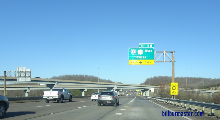
SB I-270 two miles from I-44. (August, 2018)

SB I-270 one mile from I-44. (August, 2018)

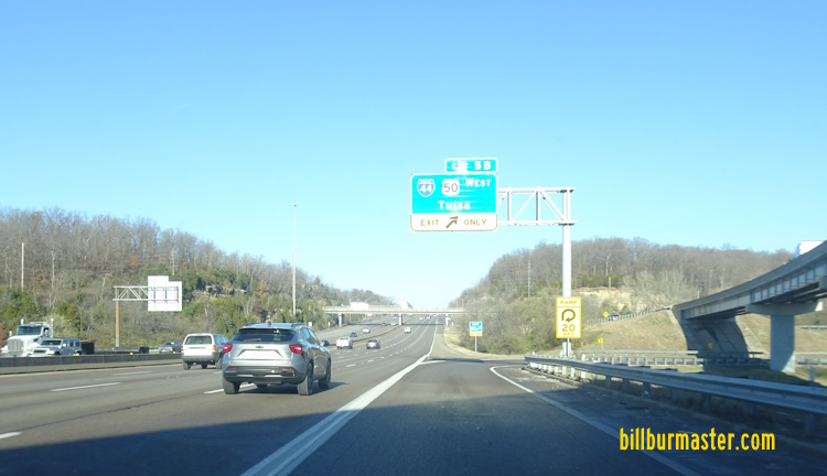
SB I-270 near WB I-44. (August, 2018)

SB I-270 at EB I-44. (August, 2018)

SB I-270 near EB I-44. (August, 2018)

SB I-270 at EB I-44. (August, 2018)
SB I-270 two miles from I-44. (April, 2024)
SB I-270 one mile from I-44. (April, 2024)
A lane makrer for I-44 on SB I-270. (April, 2024)
SB I-270 at WB I-44. (April, 2024)
SB I-270 near EB I-44. (April, 2024)
SB I-270 at EB I-44. (April, 2024)
Interstate 64, at Westwood.

A mileage sign on NB I-270.

A BGS one mile from I-64 on NB I-270.

The lane markers on NB I-270.

NB I-270 at I-64.

NB I-270 one mile from I-64.

NB I-270 near I-64.

NB I-270 at I-64.

SB I-270 over one mile from I-64. (June, 2019)

SB I-270 about one mile from I-64. (June, 2019)

SB I-270 near I-64. (June, 2019)

SB I-270 at I-64. (June, 2019)
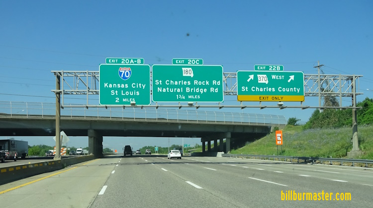
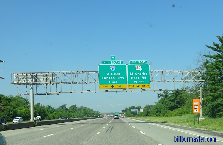
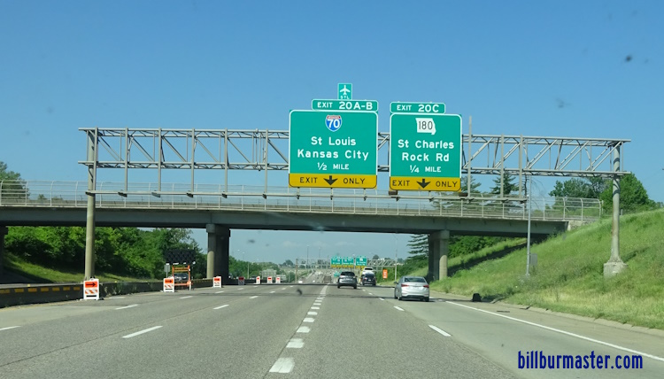
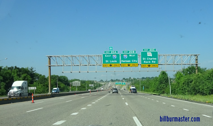
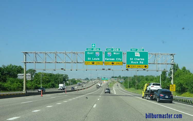
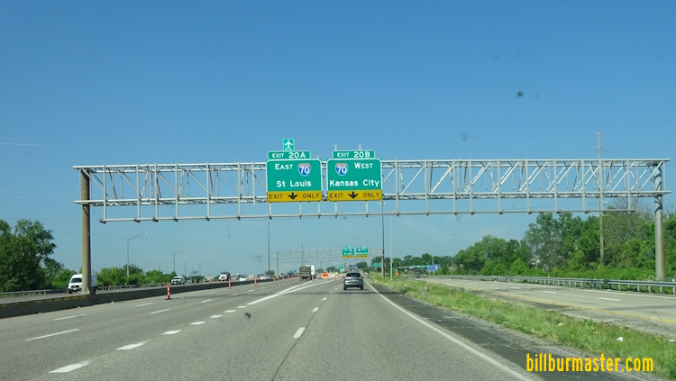
Interstate 70, at Bridgeton.

The first BGS on NB I-270.

Lane markers on NB I-270.

Another set of BGS's on NB I-270.

NB I-270 near I-70.

NB I-270 at I-70.

NB I-270 over one mile from I-70. (August, 2014)

Lane markers on NB I-270 for I-70. (August, 2014)

A BGS for WB I-70 on NB I-270. (August, 2014)

Lane markers on NB I-270 for I-70. (August, 2014)

NB I-270 near I-70. (August, 2014)

NB I-270 just before I-70. (August, 2014)

NB I-270 at I-70. (August, 2014)

NB I-270 one and a half miles from I-70. (August, 2022)

NB I-270 one and a quarter miles from I-70. (August, 2022)

NB I-270 near I-70. (August, 2022)

NB I-270 before I-70. (August, 2022)

NB I-270 at I-70. (August, 2022)
WB I-270 two miles from I-70. (June, 2023)
WB I-270 one mile from I-70. (June, 2023)
WB I-270 a half mile from I-70. (June, 2023)
WB I-270 near I-70. (June, 2023)
WB I-270 before I-70. (June, 2023)
WB I-70 at I-70. (June, 2023)
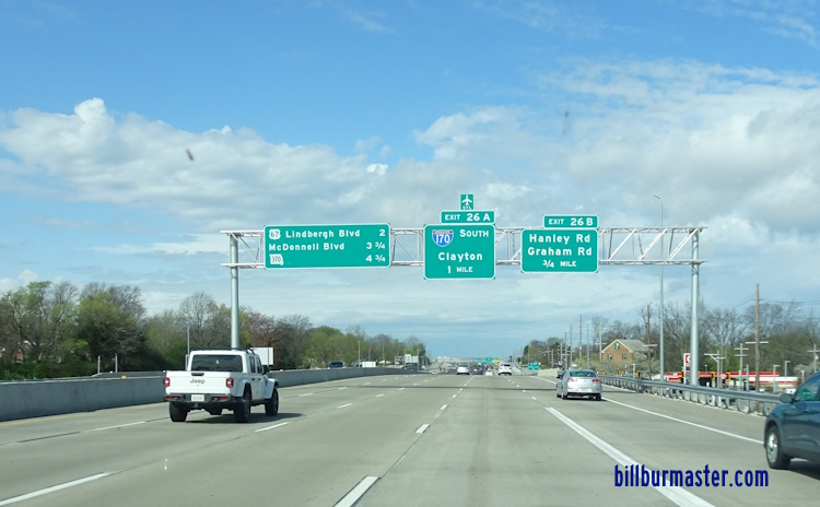
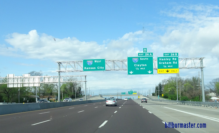
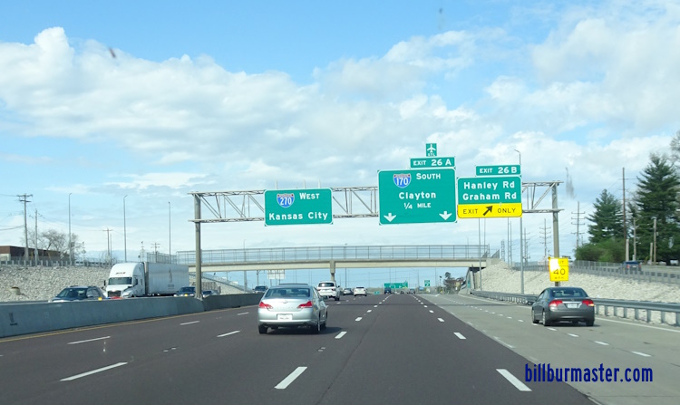
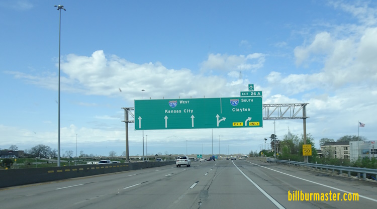
Interstate 170, at Hazelwood.

The two mile BGS on NB I-270.

A BGS on NB I-270 near I-70.

EB I-270 a quarter mile from I-170.

EB I-270 at I-170.

WB I-270 near I-170.

WB I-270 at I-170.

WB I-270 over two miles from I-170. (March, 2025)
WB I-270 one mile from I-170. (March, 2025)
WB I-270 a half mile from I-170. (March, 2025)
WB I-270 at quarter mile from I-170. (March, 2025)
WB I-270 at I-170. (March, 2025)
Info on I-270's Parent Route.

Photos of Interstate 270 as it travels through Missouri.
Select A Section of I-270.
27 June 2025