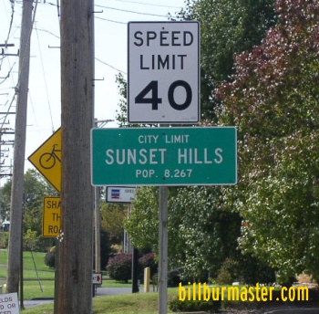
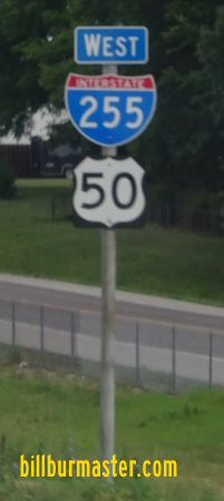
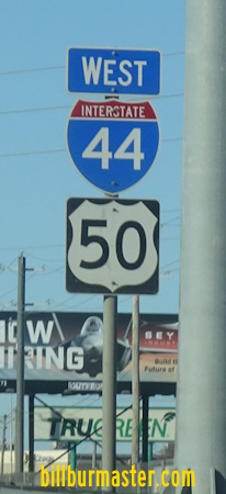
U.S. Federal Route 50 runs east-west across Southern St. Louis County. Most of this is on the areas expressway system. This enters the county from Illinois on Interstate 255. In the southwestern portion of the county it runs along Interstate 44. U.S. Rt. 50 passes through the following towns in St. Louis County. Sunset Hills
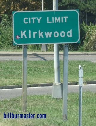
Kirkwood
Fenton
Eureka
U.S. Rt. 50 is multi-plexed in St. Louis County. Interstate 255, from the Illinois/Missouri State Line to South County.
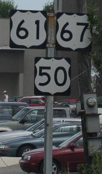
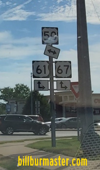
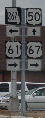
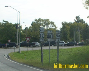
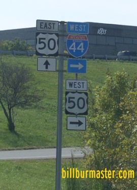
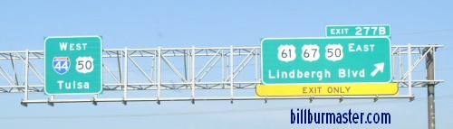
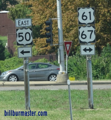
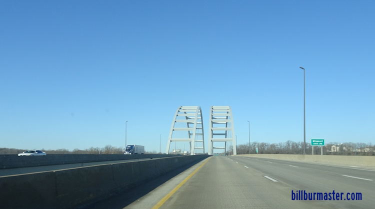
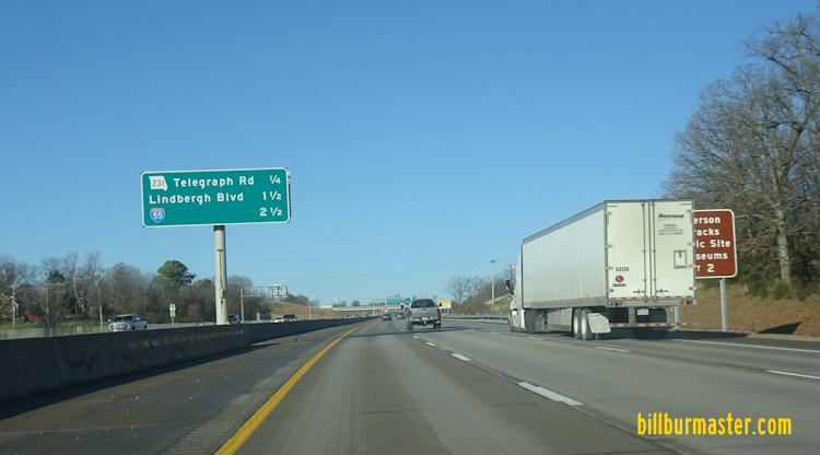
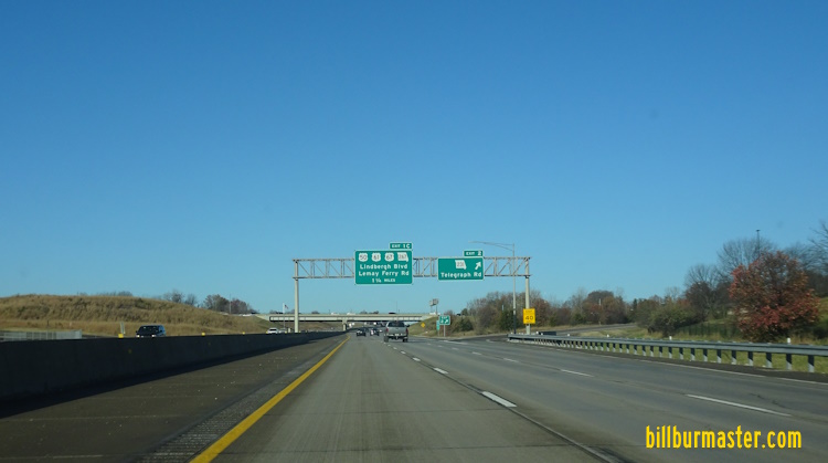
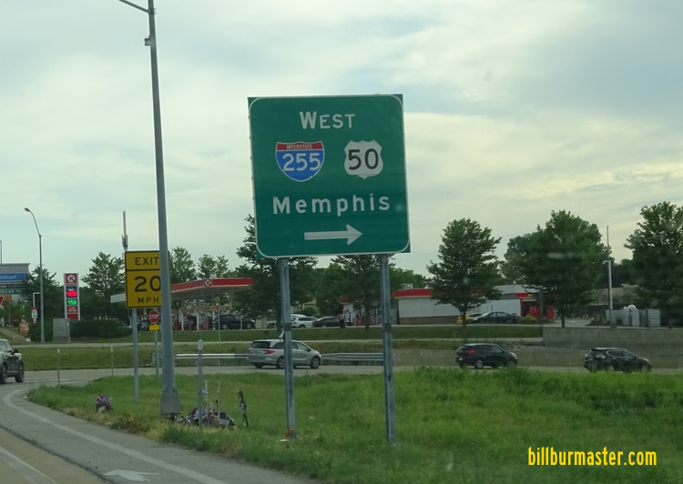
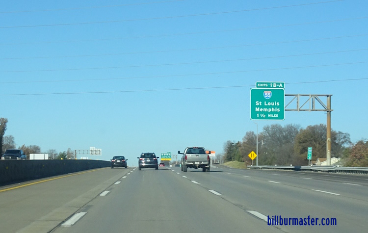
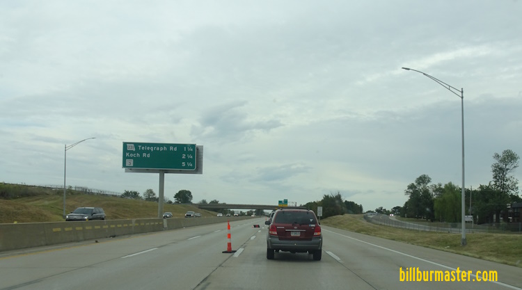
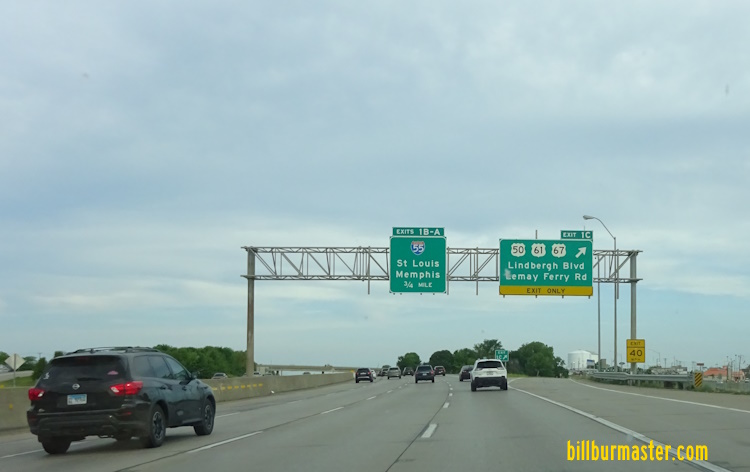
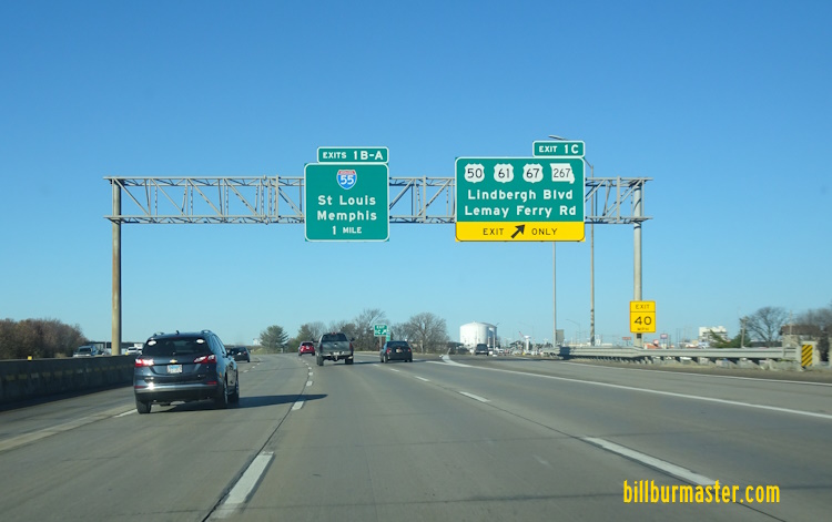
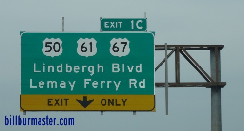
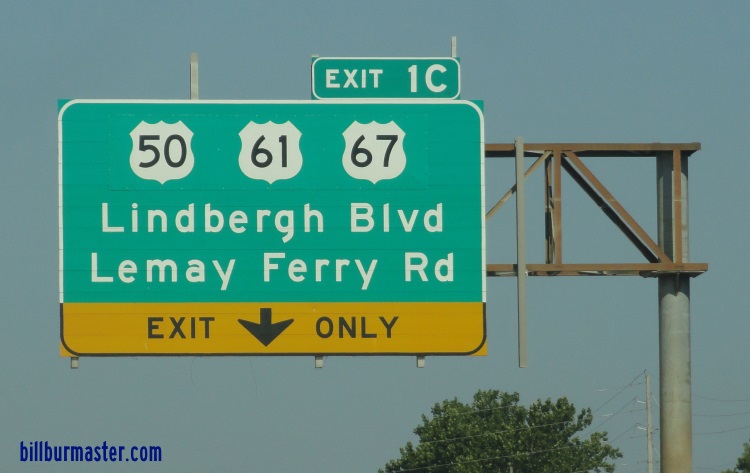
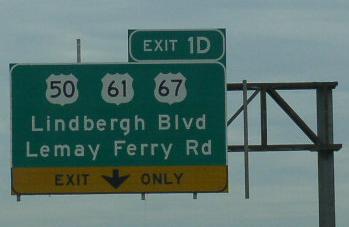
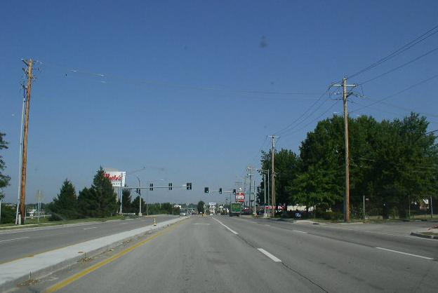
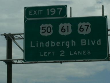
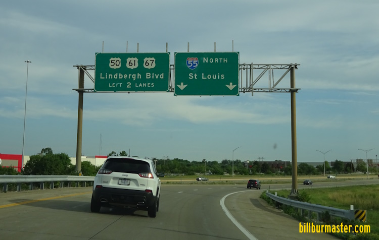
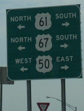
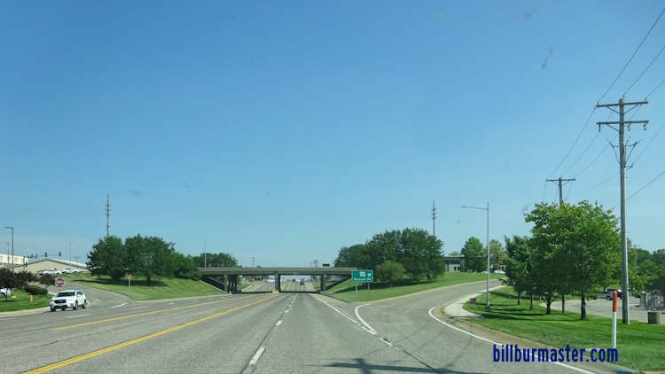
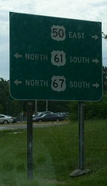
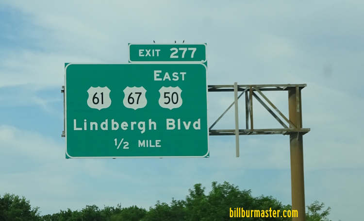
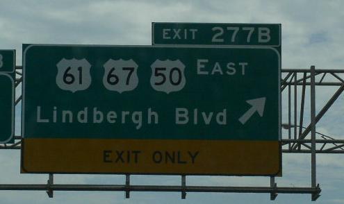
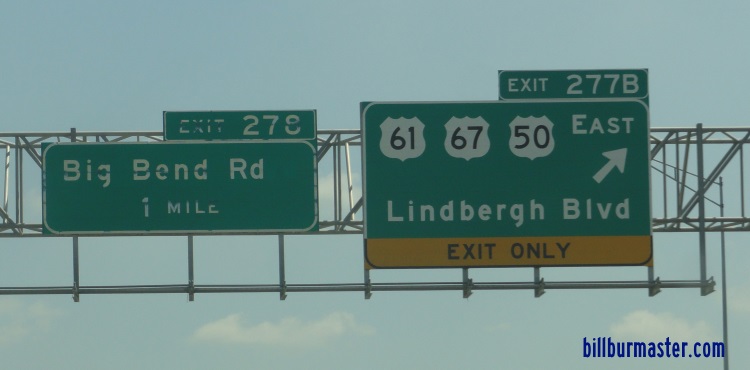
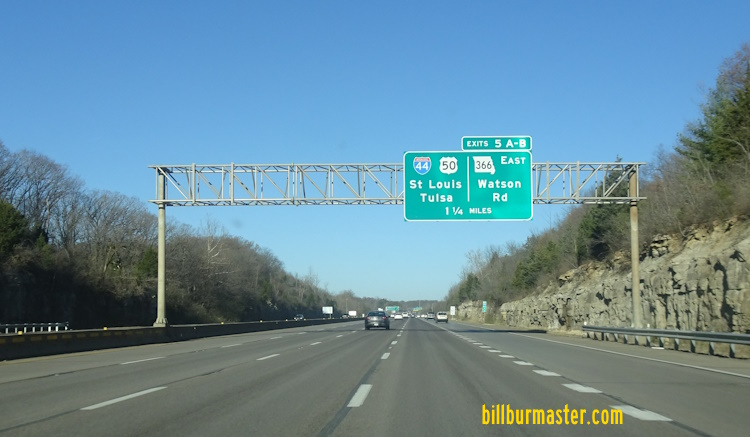
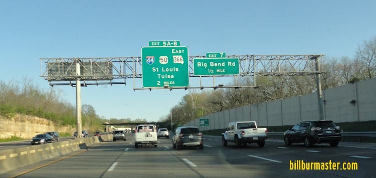
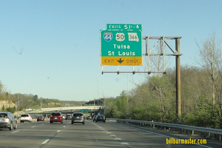
WB I-255/U.S. Rt. 50 at the Missouri State Line. (August, 2014) WB I-255/U.S. Rt. 50 at the Missouri State Line. (December, 2024) WB I-255/U.S. Rt. 50 crossing the J.B. Bridge. EB I-255/U.S. Rt. 50 crossing the JB Bridge. EB I-255/U.S. Rt. 50 at the JB Bridge. EB I-255/U.S. Rt. 50 near the J.B. Bridge. WB I-255/U.S. Rt. 50 at the Missouri Welcome Sign. WB I-255/U.S. Rt. 50 at the Missouri Welcome Sign. (August, 2011) WB I-255/U.S. Rt. 50 at the Missouri Welcome Sign. (December, 2024) WB I-255/U.S. Rt. 50 near the J.B. Bridge. EB I-255/U.S. Rt. 50 at Koch Road. (May, 2023) EB I-255/U.S. Rt. 50 at Koch Road. (September, 2025) WB I-255/U.S. Rt. 50 at Koch Road. WB I-255/U.S. Rt. 50 west of Koch Road. WB I-255/U.S. Rt. 50 at Telegraph Road. WB I-255/U.S. Rt. 50 at Telegraph Road. A set of guide markers on SB MO St Rt 231. A BGS on NB MO St Rt 231. WB I-255/U.S. Rt. 50 west of MO St Rt 231. (August, 2018) WB I-255/U.S. Rt. 50 west of MO St Rt 231. (December, 2024) EB I-255/U.S. Rt. 50 east of Lemay Ferry Road. WB I-255/U.S. Rt. 50 near Lemay Ferry Road. WB I-255/U.S. Rt. 50 at U.S. Rt. 50/61/67. (August, 2018) WB I-255/U.S. Rt. 50 at U.S. Rt. 50/61/67. (June, 2022) WB I-255/U.S. Rt. 50 at west I-255. (December, 2024) A BGS on WB I-255/U.S. Rt. 50. A BGS on SB I-255/WB U.S. Rt. 50. A BGS on WB I-255/U.S. Rt. 50. A BGS on WB I-255/U.S. Rt. 50. A BGS on WB I-255/U.S. Rt. 50. A junction marker on NB U.S. Rt. 61/67. WB U.S. Rt. 50; NB U.S. Rt. 61/67 in South St. Louis County. A BGS on NB I-55. A BGS on SB I-55. A BGS on the ramp from WB I-255 to NB I-55. A guide marker on the ramp from NB I-55. WB U.S. Rt. 50; NB U.S. Rt. 61/67 north of MO St Rt 30. WB U.S. Rt. 50/NB U.S. Rt. 61/67 south of MO St Rt 366-Watson Road. WB U.S. Rt. 50/NB U.S. Rt. 61/67 south of MO St Rt 366-Watson Road. WB U.S. Rt. 50/NB U.S. Rt. 61/67 at MO St Rt 366-Watson Road. A junction marker on WB MO St Rt 366. A BGS on WB MO St Rt 366. A guide marker on the ramp from EB I-44/U.S. Rt. 50. A BGS on WB I-44. A BGS on WB I-44. A BGS on EB I-44/U.S. Rt. 50. A BGS on EB I-44/U.S. Rt. 50. A BGS on EB I-44/U.S. Rt. 50. EB I-44/U.S. Rt. 50 west of Lindberg Blvd. EB I-44/U.S. Rt. 50 west of Lindberg Blvd. WB I-44/U.S. Rt. 50 west of Lindberg Blvd. WB I-44/U.S. Rt. 50 at Geyer Road. A BGS on NB I-270. A BGS on NB I-270. A BGS on NB I-270. A BGS on SB I-270. A BGS on SB I-270. A BGS on SB I-270. NB I-270 at the stack interchange with I-44/U.S. Rt. 50. WB I-44/U.S. Rt. 50 at the stack with I-270. EB I-44/U.S. Rt. 50 at I-270. EB I-44/U.S. Rt. 50 at I-270. (June, 2022) WB I-44/U.S. Rt. 50 at I-270. (May, 2023) EB I-44/U.S. Rt. 50 at the Meramec River. EB I-44/U.S. Rt. 50 at the Meramec River. (June, 2022) EB I-44/U.S. Rt. 50 west of the Meramec River. (June, 2022) EB I-44/U.S. Rt. 50 one mile from I-270. EB I-44/U.S. Rt. 50 one mile from I-270. (June, 2022) A set of guide markers in Fenton. EB I-44/U.S. Rt. 50 east of MO St Rt 141. EB I-44/U.S. Rt. 50 east of MO St Rt 141. A BGS on WB I-44/U.S. Rt. 50. A BGS on the ramp from WB I-44/U.S. Rt. 50. A BGS on SB MO St Rt 141. A BGS on SB MO St Rt 141. A BGS on NB MO St Rt 141. WB I-44/U.S. Rt. 50 west of MO St Rt 141. WB I-44/U.S. Rt. 50 west of MO St Rt 141. WB I-44/U.S. Rt. 50 near M.P. 268. EB I-44/U.S. Rt. 50 east of M.P. 269. EB I-44/U.S. Rt. 50 east of Antire. WB I-44/U.S. Rt. 50 near Forest 44. WB I-44/U.S. Rt. 50 east of the Meramec River. EB I-44/U.S. Rt. 50 at Williams. A junction marker on NB MO St Rt 109. WB I-44/U.S. Rt. 50 west of MO St Rt 109. WB I-44/U.S. Rt. 50 near Six Flags-St. Louis. A guide marker near Six Flags-St. Louis. WB I-44/U.S. Rt. 50 west of Six Flags-St. Louis. EB I-44/U.S. Rt. 50 at the Franklin/St. Louis County Line.