
Lincoln 1930-1940
The second alignment of U.S. 66 follows the four-lane bypass along the north and west sides of the city. It is marked with the Historical Route shields. Locally this highway is named Lincoln Parkway.

Lincoln

SB Rt. 66 at I-55, northeast of Lincoln.

Looking SB along Rt. 66 before the split for the 1930-1940 route.

SB Rt. 66 on the northside of Lincoln.

SB Rt. 66 going under the Union Pacific railroad.

This part of Rt. 66 is a very nice drive.

SB Rt. 66 near the northwest side of Lincoln.

A sharp and banked curve on the northwest side of Lincoln.

SB Rt. 66 near IL St Rt 10/121 on the westside of Lincoln.
At the corner of Rt. 66 and IL St Rt 10/121 there are several places of to visit. A place called the Tropics is a local place for coffee and dining. The Logan County Fairgrounds are here. Plus, on the northeast corner you will see a covered wagon with Abe sitting on it reading a book. A storm damaged the wagon and it has since moved further south along U.S. 66 about a half mile from IL 10/121. Further west down IL St Rt 10/121, there are many shops, gas stations, and restaurants. If you head east along IL St Rt 10/121 it will lead you to Downtown Lincoln. For details on Downtown Lincoln, see the 1930-1940 alignment.

The Tropics at the corner of IL St Rt 10/121 and Rt. 66.

The relocated Tropics sign still at the corner of IL St Rt 10/121 and Rt. 66.

A tourist marker at the sign.
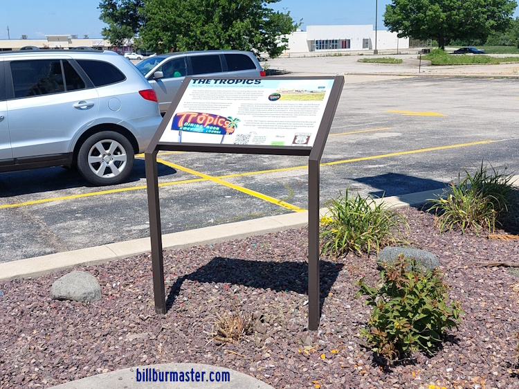
Another tourist marker at the sign.

A close-up of the sign.

The covered wagon at IL St Rt 10/121 and Rt. 66.

Looking attraction marker for the wagon.

A close up of a attraction marker.

Looking at the wagon.

SB Rt. 66 south of IL St Rt 10/121 at the Logan County Fairgrounds.

SB Rt. 66 where the 1930-1940 alignment joins back up.

NB Rt. 66 at Salt Creek, south of Lincoln.

NB Rt. 66 near Salt Creek, south of Lincoln.


