Chicago to Bolingbrook
The starting point in Chicago for the famed highway. This runs west to the suburbs following the Chicago River, the BNSF Railway-Southern Traction (ex-Atchison, Topeka, & Santa Fe), Chicago Ship & Sanitary Canal corridor.
View U.S. 66 Chicago to Romeville in a larger map
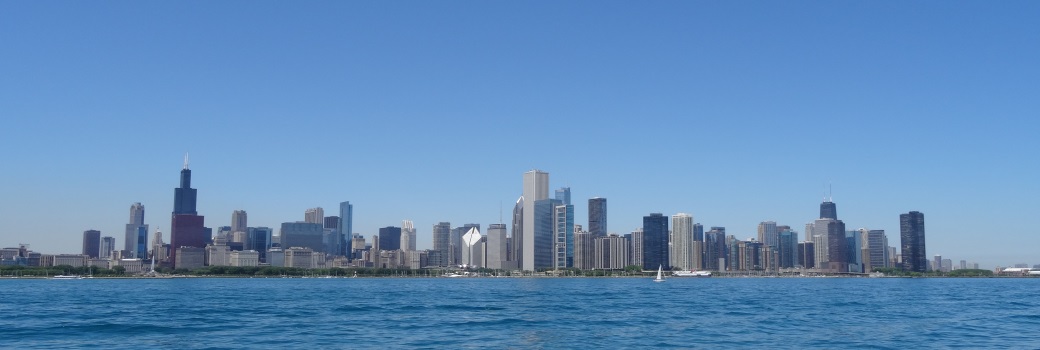
Chicago
This is the eastern end point for the entire route. Also, it is the eastern start of the entire route. NB Rt 66 is on Jackson, and SB is on Adams.
Then the highway turns in to a angel to cut across the western portions of the city to the suburbs on Ogden Ave.


The above signs mark the start and end of U.S. 66 in Chicago. The beginning on Adams Street at Michigan Ave. The end marker is on Jackson Street at Michigan Ave. This is near the Chicago Institute of Art. While heading west, U.S. 66 passes by the Willis Tower (ex-Sears Tower), Chicago Union Station, over the Chicago River, Old St. Patrick's Church.

The Art Institute.

Looking west at Chicago Union Station.

NB U.S. 66 crossing the Chicago River.

Old St. Patrick's Church.
West of Downtown Chicago (the "Loop"), where Jackson Blvd, and Adams Street meet Ogden Ave. U.S. 66 heads southwest along Ogden Ave. This intersection is just east of the United Center, home to the Chicago Bulls and Chicago Blackhawks. Before turning southwest it runs along the Interstate 290 corridor. This passes near Skinner Park. After turning on Ogden Avenue, U.S. 66 passes the Cook County-Hospital-John Stroger Hospital Complex. As U.S. 66 heads out of Chicago it passes through Douglas Park.

NB U.S. 66 near Skinner Park.

A guide marker on SB U.S. 66.

NB U.S. 66 near Douglas Park.
Cicero
The famed route slices through Cicero running along a rail yard and going through a odd intersection with 26th Street (here's a hint...go straight...).
Berwyn
The village of Berwyn seemed to be in the Route 66 spirit when I passed through. There were U.S. 66 banners on every street pole and a concrete monument near Harlem Ave.

This is located on Ogden Ave., just east of Harlem Ave.

These banners are located all along Ogden Ave.

This is a former resturant on Rt. 66 in Berwyn. It has since been removed.
Lyons
Here Rt. 66 joins IL St Rt 43/Harlem Ave. and heads south to Joliet Road.

NB U.S. 66 at Harlem Ave/IL 43.
Mc Cook
This is a small community, much of the route passes through the industrial section of the area.

NB Rt 66 at Mc Cook. IL St Rt 171 (1st Ave.) is on the overpass in the picture.
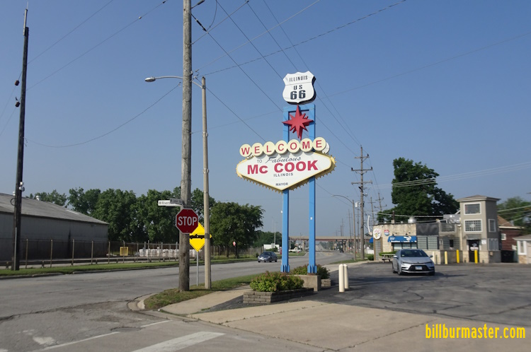
A tourism marker in Mc Cook.
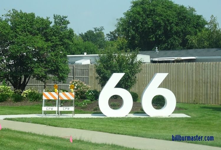
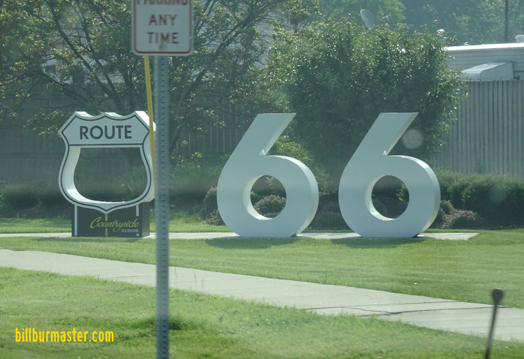
Countryside
Much of this area is shopping centers and auto dealers.
The tourism monument under-contrustion in Countryside. (August, 2024)
The tourism monument in Countryside. (June, 2025)
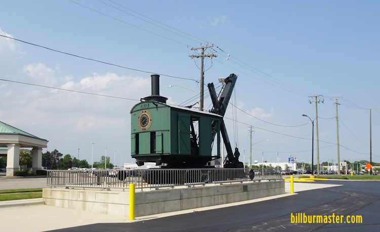
An old steam shovel along U.S. 66 in Countryside. (August, 2024)
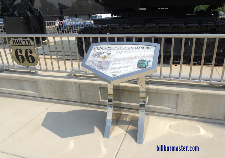
A marker for the old steam shovel along U.S. 66 in Countryside. (August, 2024)
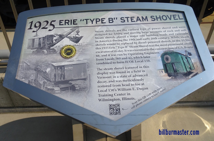
A close-up of the above marker. (August, 2024)
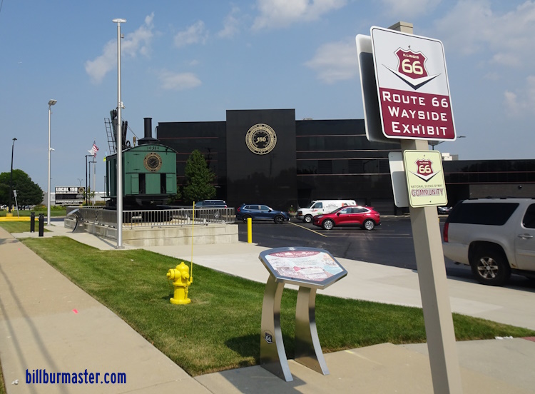
A historical marker along U.S. 66 in Countryside. (August, 2024)
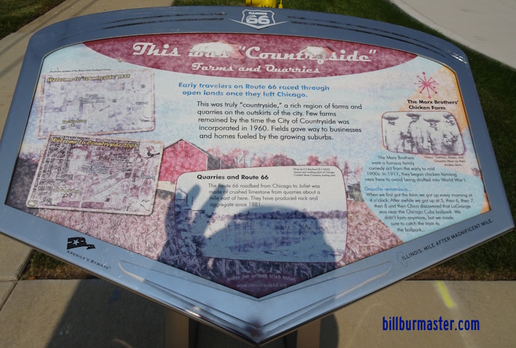
A close-up of the above marker along U.S. 66 in Countryside. (August, 2024)
Indian Head Park
This is a small village nestled between Countryside, Burr Ridge, Interstate 55 (Stevenson Expressway), & Interstate 294 (Tri-State Tollway). This is also where U.S. 66 joins with Interstate 55 for the first time.

NB U.S. 66 exits to the left at the massive interchange with I-294.

A guide marker for traffic on SB U.S. 66.
Burr Ridge, Darien, Willowbrook, & Woodridge
These communities get a brief touch of Rt. 66. Through this area Rt. 66 uses the Interstate 55 alignment.
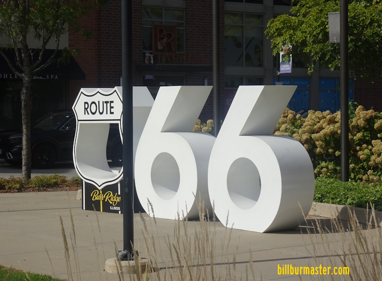
A tourist monument in Burr Ridge.

NB Rt 66 with I-55.
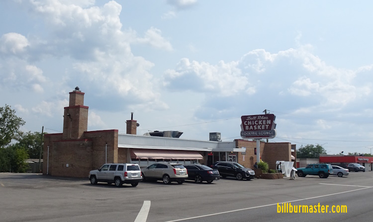
Del Ray Chicken Basket in Willowbrook. (August, 2024)
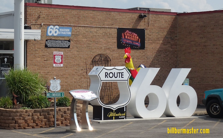
A tourist monumet Del Ray Chicken Basket in Willowbrook. (August, 2024)
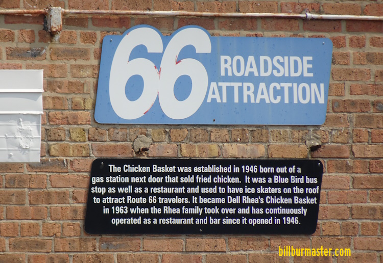
A close-up of a marker at Del Ray Chicken Basket in Willowbrook. (August, 2024)
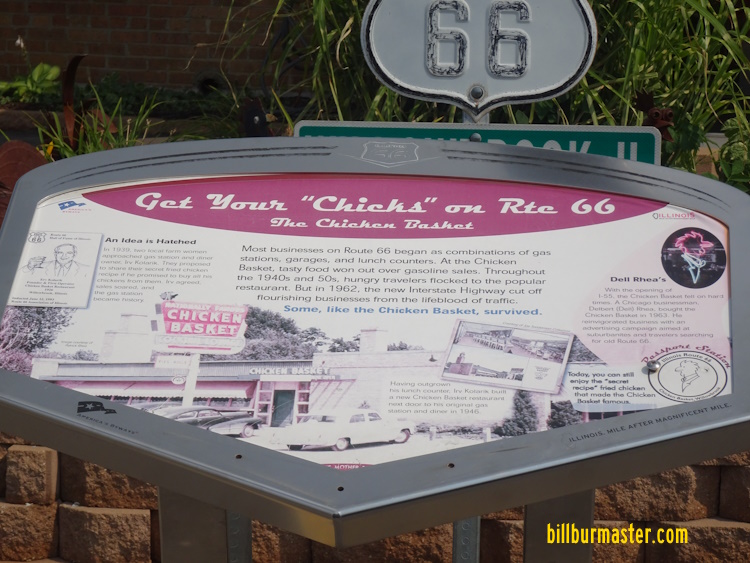
A close-up of a marker at Del Ray Chicken Basket in Willowbrook. (August, 2024)
Bolingbrook
At I-355 (Veterans Tollway) and Joliet Road, U.S. 66 splits from I-55 and heads toward Joliet. A later alignment follows Interstate 55 south to Illinois 126. Info on this alignment and the orginal that follows Joliet Road are in the next section.

NB Rt 66 at I-55 in Bolingbrook.


