
Illinois State Line to Merrillville
This section of the Lincoln Highway generally runs north of and parallel to U.S. 30. One this page we cover from where the Lincoln Highway crosses the Illinois/Indiana State Line to Interstate 65.
Dyer
Crossing the state line as part of U.S. 30, the Lincoln Highway heads east. Through Dyer, the Lincoln Highway is part of what is called the "Ideal Mile". Funded through public and private sources, it gave travelers the idea of what a proper highway should be. Also in Dyer is the Ostermann Memorial. This is dedicated to the Vice President and Field Secretary of the Lincoln Highway Association; whom passed away in 1920. Also, in Dyer is a marker for a former schoolhouse that was part of the St. John Township School District 2.
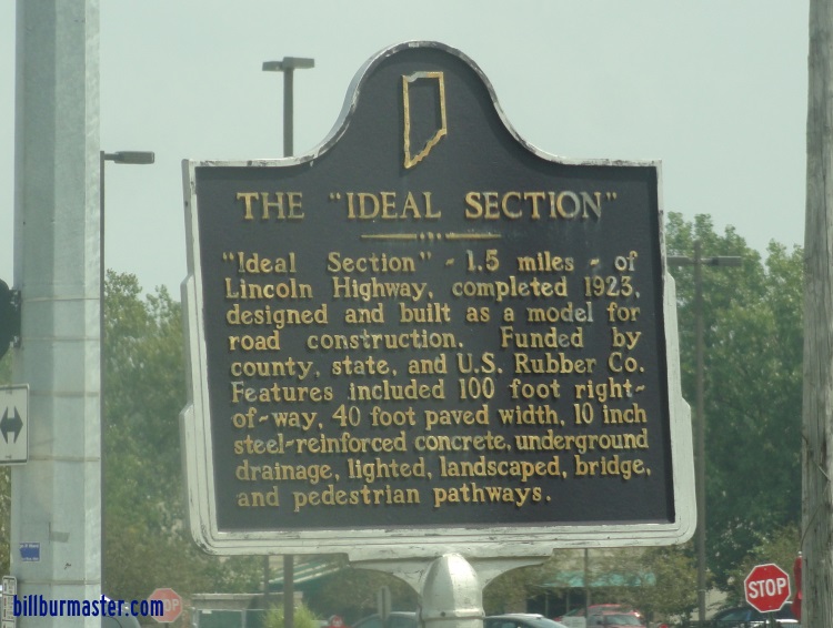
A marker for the Ideal Section.
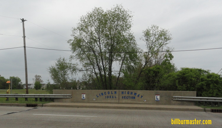
A bridge along the Ideal Section in Dyer.
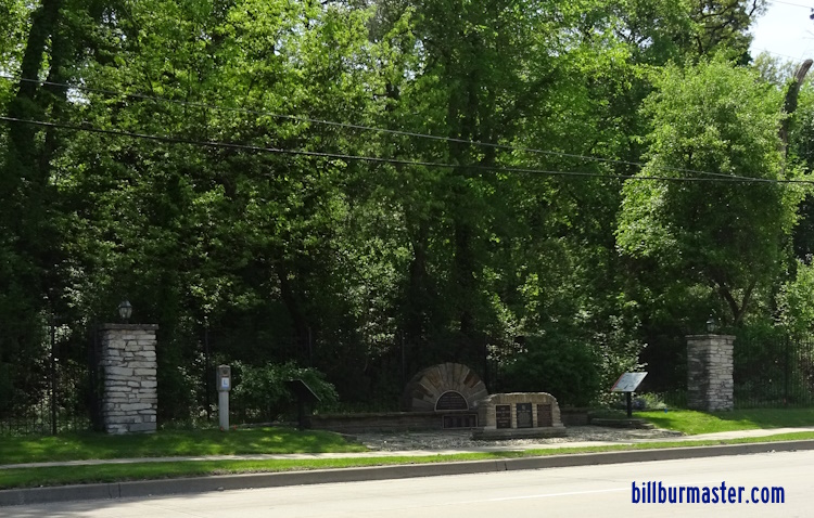
A Lincoln Highway park area in Dyer.
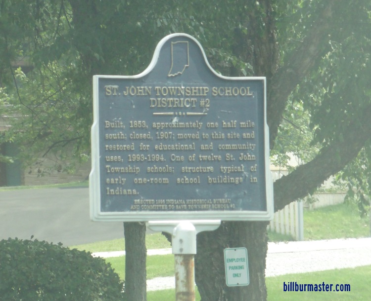
A marker for the former school house.
Another historical marker for the Lincoln Highway in Dyer.
Schereville
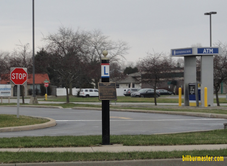
In Schereville, to the south of the intersection of U.S. 30 and U.S. 41 is an old split up section of the Lincoln Highway. At the Walgreen's on the southeast corner of the U.S. 30, and U.S. 41 intersectsion is a marker regarding the old pavement of the Lincoln Highway and for the Lincoln Highway. It is located on the north wall of the store to the east of the entrance. Just east of the railroad underpass that is just past U.S. 41, the Lincoln Highway splits to the north from U.S. 30 and runs along Lincoln Highway. Within Schererville, you will pass through the downtown area and their tribute to the national tragity that occured on September 11th, 2001, located at the Schererville Police Department.
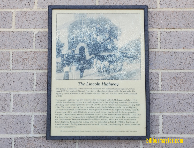
A plaque at the Walgreen's.
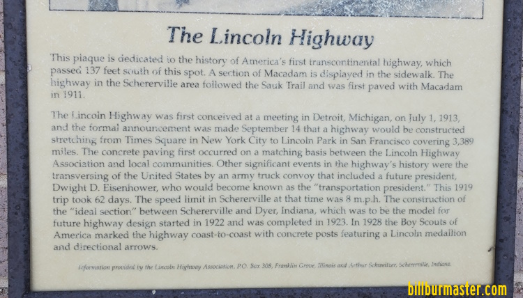
A close-up of the plaque.
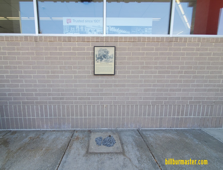
wide shot of the plaque and pavement in the sidewalk.
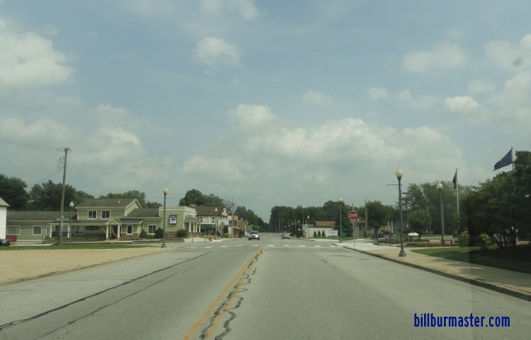
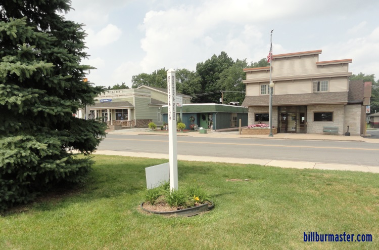
Looking east on the Lincoln Highway in Downtown Schererville.
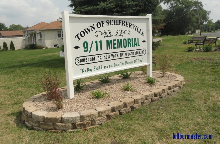
The 9/11 Memorial.
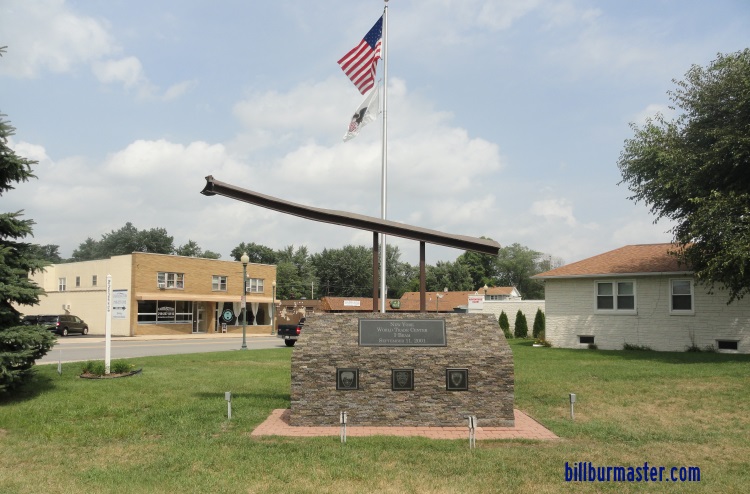
The 9/11 Memorial.
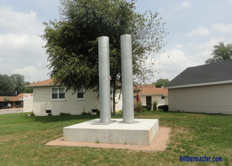
The 9/11 Memorial.
The 9/11 Memorial.
Merrillville
Through Merrillville, the highway runs along Lincoln Highway and becomes 73rd Avenue. It is a countinuous highway through mostly residential areas. The only stopping point of interest is at Turkey Creek. It also is the conclusion of this section.
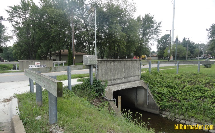
Looking southwest at the bridge.
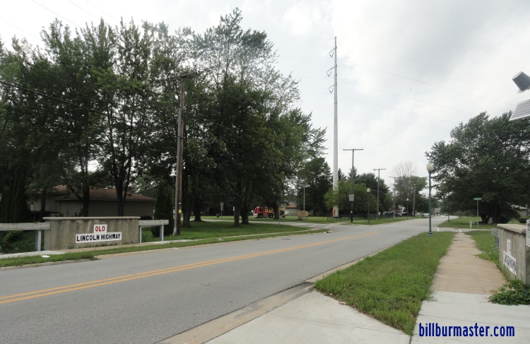
Looking west along the Lincoln Highway at the bridge.


