
Valparaiso to South Bend
1913 Route
This section of the Lincoln Highway generally runs along Indiana 2 and along U.S. 20 from Valparaiso to South Bend. Near Westville, the Lincoln Highway follows an old alignment of Indiana 2 and through the town of Westville. Near Rolling Prairie, the Lincoln Highway goes along N 450E Road, and Oak Knoll Road. At one time it went along Bootjack Road and Michigan Road in Rolling Prairie.
Westville
The Westville section leaves Indiana 2 at S 1100W Rd; then turns on Lowman Lane. After crossing U.S. 6, the Lincoln Highway turns east of Coulter Road. Shortly after this turn, the Lincoln Highway meets back up with Indiana 2. It joins it briefly and then turns on to Main Street. The highway follows Main Street through Westville to U.S. Rt. 421.
After going north on U.S. Rt. 421, the Lincoln Highway rejoins Indiana 2 and heads east to La Porte, and South Bend.

A giant mug of beer in Westville.
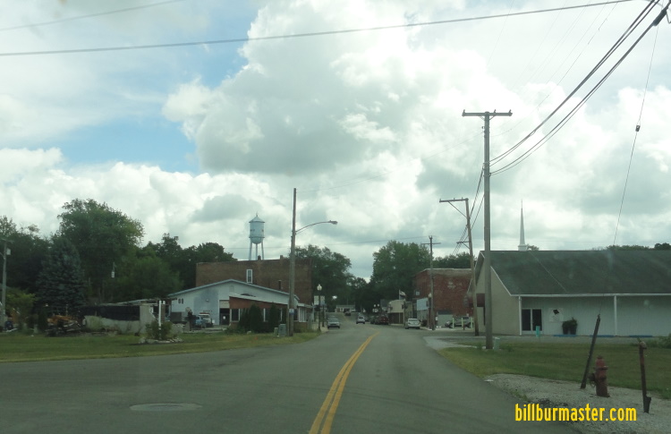
Looking at Downtown Westville on Main Street
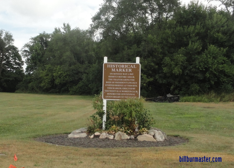
A marker explaining when Abraham Lincoln's funeral train passed through Westville.
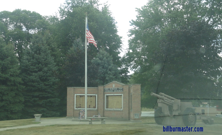
A war memorial in Westville
La Porte
In La Porte, the Lincoln Highway passes through town along Indiana 2. Here is goes past the La Porte County Courthouse.
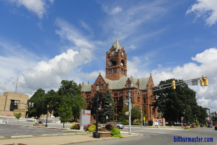
The La Porte County Courthouse in La Porte. (August, 2020)
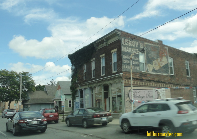
An old ghost sign along the Lincoln Highway in La Porte.
The Lincoln Highway moves off of Indiana 2 and joins U.S. 20. As explains above there were several paths that it followed.
New Carlisle
At New Carlisle, the Lincoln Highway leaves La Porte County and enters St. Joseph County. It also changes from the Central Time Zone to the Eastern Time Zone.
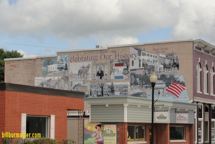
A mural in New Carlisle.
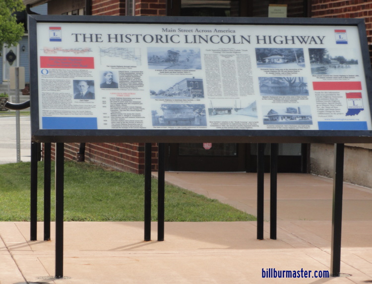
A Lincoln Highway marker in New Carlisle.


