Lincoln 1926-1940
The original alignment takes you through town. It is marked with a "1930-1940" banner. This alignment does follow the posted BUSN Loop I-55 through town. It leaves the four lane by-pass at North Kickapoo Street, and follows that south into Lincoln. At Keokuk Street (Illinois 10/121) it heads west briefly to Logan Street. Once on Logan Street it goes south to 5th Street, then back to the four lane by-pass.
At the junction of BUSN Loop I-55 and Illinois 10/121 (Kickapoo & Keokuk) the 1926-1930 alignment continues south on Kickapoo until Broadway. At Broadway it heads west and rejoins the 1930-1940 alignment on Logan Street.
Click this link for info on the 1926-1930 Alignment:
1926-1930 Alignment

Lincoln

Looking east along NB Rt. 66 (1930-40).

The Postville Courthouse
A few blocks east of the courthouse, the old highway turns to the north. Here it passes along the westside of Downtown Lincoln. This is worth a side trip. Here you'll find the Lincoln Train Station. This is where Abraham Lincoln christened the town with the juice from a watermelon. Just past the train staion is the Logan County Courthouse.

NB Rt. 66 near downtown.
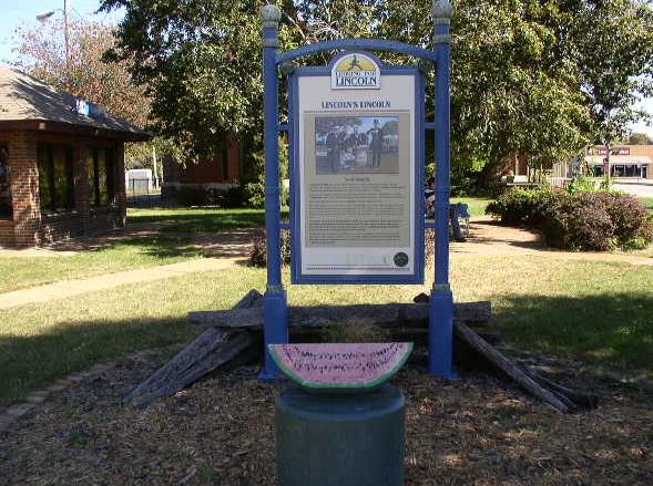
A display at the train station about the town christening.

A old Coke mural in Downtown Lincoln.

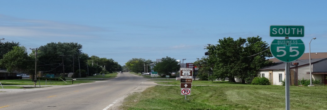
NB Rt 66 north of IL St Rt 10/121 on Kickapoo Street.

NB Rt. 66 along the northside of Lincoln.

NB Rt. 66 near the northeast side of Lincoln.

This is the northern end to the 1930-1940 alignment.
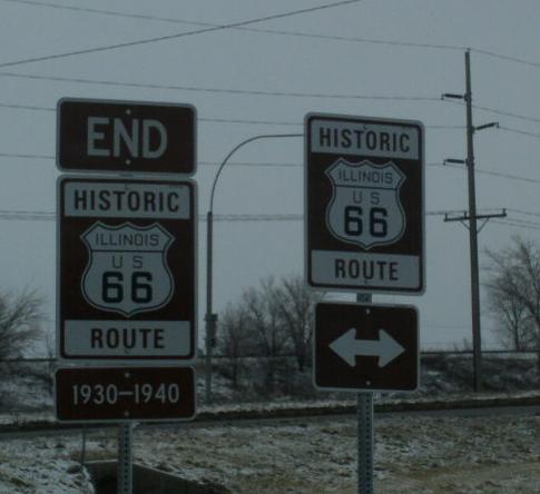
The northern end makrer.


