
Mt. Olive 1930-1940
Rte 66
This is the original route through Mt. Olive. The 1930-40 alignment runs along the north and west side of Mt. Olive. This passes the Mother Jones Monument and the Soulsby Shell Station.
View Mt Olive IL 1930-1940 in a larger map
Mt. Olive
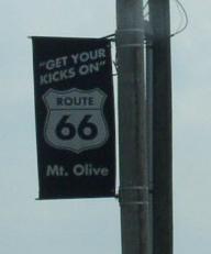
A banner on a street pole in Mt. Olive.

City limit sign.

SB Rt. 66 on the northside of Mt. Olive.

SB Rt. 66 on the eastside of Mt Olive.

A guide sign to the Mother Jones monument.

The Mother Jones monument north of Mt. Olive.

A mural in Mt. Olive.


Street signs at the intersection of Rt. 66 and IL St Rt 138.

The Rt. 66 attraction sign at the Soulsby Shell Station.

Close up of the old Shell sign.

A look at the old gas pumps.

A look at the Soulsby Shell Station.

SB Rt. 66 south of Mt. Olive.


