Springfield to Staunton
via Divernon, Litchfield, Mt. Olive, & Staunton
This is the last alignments of U.S. 66 before it was replaced by Interstate 55. At Springfield, the marked route follows Business Loop I-55 through Downtown Springfield. A later alignment followed Dirksen Parkway to Stevenson Drive. South of Springfield, U.S. 66 runs along Interstate 55. It follows the Frontage Road, and with the interstate. At Litchfield, Mt. Olive, and Staunton, there is a second alignment.
View Springfield to Staunton 1930-1977 in a larger map
Springfield
In Springfield there is two alignments of Rt. 66, besides the 1926-1930 route. The main route for tourists is the one that goes near downtown Springfield. Then from 1940-1977, it By-Passed the city along Dirksen Parkway.
1930-40 Alignment 1940-77 Alignment
SB Rt. 66 near the 6th Street Interchange with I-55/72 on the southside of Springfield.

Rt. 66 runs along I-55 across Lake Springfield.

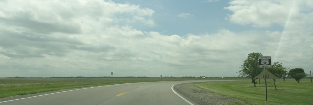
A U.S. 66 sign off of Toronto Road south of Springfield.

The Big Ron statue under the giant U.S. 66 sign south of Springfield.
Rural-Chatham
On the southern side of Lake Springfield, Rt. 66 exits I-55 and heads long the frontage road.

A guide marker at the end of the ramp from SB I-55.

SB Rt. 66 goes back to two-way traffic here.
Glenarm-Rural Sangamon County
Glenarm is a small little town between Chatham and Divernon. This is located north of the IL St Rt 104 interchange with I-55.

City Limit sign.

SB Rt 66 at Glenarm.
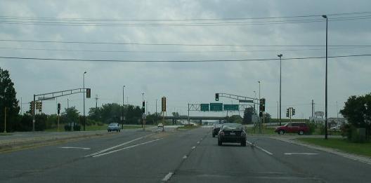
At IL 104, U.S. 66 links up with I-55 and runs to near Divernon.

BGS informing travelers to use I-55.
Divernon
Divernon is the southern most town that Rt. 66 passes through in Sangamon County. This highway passes along the eastern side of the village.

City limit sign.

Welcome sign.

SB Rt. 66 south of Divernon.
Farmersville
This is another small little town that Rt. 66 passes through along this alignment.

SB Rt. 66 at Farmersville. Note: How this old highway is somewhat limited access...
Rural-Montgomery County
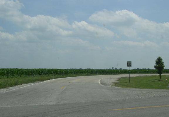
In Central Montgomery County, Rt. 66 runs along both sides of Interstate 55. South on Illinois 108, U.S. 66 crosses over the highway and keeps heading south.

SB IL St Rt 66 near IL St Rt 108.

Guide markers in Rural Montgomery County.
Also there is two different alignments of the highway. A few sharp curves were straightened out in the 1940's around a railroad crossing.

I-55 is in the right of the picture, the old SB lanes start up here.

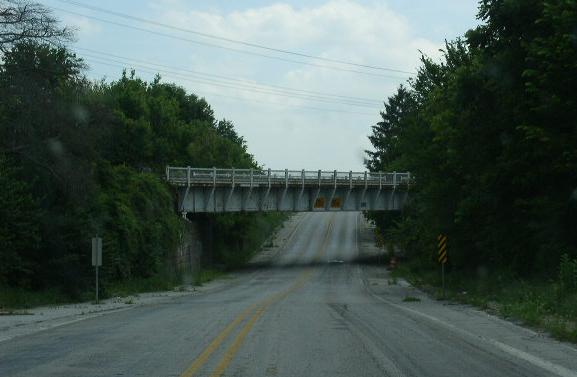
Height marker for the underpass at the railroad crossing.
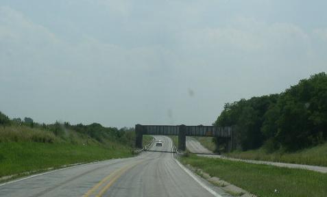
The railroad underpass in Rural Montgomery County.
Litchfield
At Litchfield, U.S.66 was aligned twice. Once more directly through town and some rural areas. the other was about a city block to a half mile west of the original alignment.


The water town on the northside of Litchfield.
Mount Olive
This is the northern most town in Macoupin County that Rt. 66 passes through. Rt. 66 was aligned at least twice in the Mt. Olive area. The first alignment went into town and closely by-passes it to the north and west. On the west side is the Soulsby Shell Station. This is another historical service station.

SB U.S. 66 at the Macoupin/Montgomery County Line.

SB U.S. 66 at the split between the two alignments of U.S. 66 at Mt. Olive.

Guide marker where the two alignments split.
1930-40 Alignment 1940-77 Alignment
Rural Macoupin County-Staunton
This alignment of Rt. 66 crosses back over to the westside of Interstate 55, south of Mt. Olive. Then runs along the eastside of Staunton.