Bolingbrook to Gardner
Alternate U.S. 66, via Joliet, Wilmington, & Braidwood
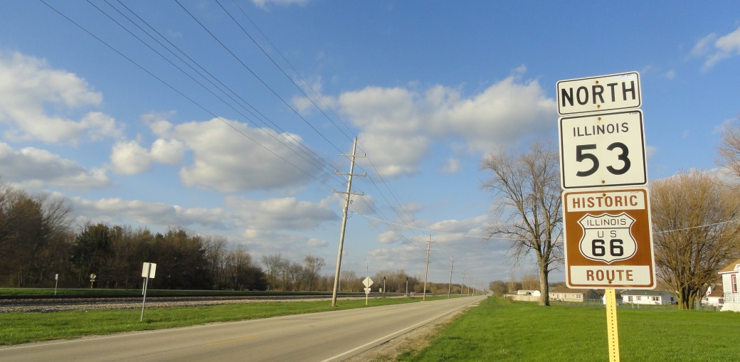
The original followed Joliet Road south from Interstate 55/355, and joins with Illinois 53, as it makes it's way south toward and through Joliet. This path followes the Union Pacific Railroad (ex- Illinois Central Gulf, Gulf Mobile, & Ohio, Chicago & Alton). From I-55/355 south, this is the path signed with the "Historical" markers. It was the original highway before the traffic volume caused the Joliet Metro Area to be by-passed to the west.
View ALT U.S. 66 Will County in a larger map
Bolingbrook
From I-55/355, U.S. 66 follows Joliet Road. Then main attraction here is White Fence Farm. They are famous for their chicken.

A tourist monument at the Pomenade in Bolingbrook.

Looking north at White Fence Farm.

Looking south at White Fence Farm.

An Illinois Tourism marker at White Fence Farm.

A chicken at White Fence Farm.

A tourist monument at White Fence Farm.

The sign for White Fence Farm. This sign has since been destroied by a storm. (April, 2025)

NB Rt 66 north of IL 53 on Joliet Road.
Romeoville
Recently, this route was re-surfaced, so it's a much smoother ride. This is also where U.S. 66 joins IL 53.

NB Rt 66 in Romeoville.
Lockport
U.S. 66 brushes the outskirts of the western side of Lockport. Here, it passes Lewis University. Along with the National Weather Service office for Chicago.

Looking west at Lewis University.

Lockport's tourism monumnet along IL 171 just south of Downtown Lockport. (August, 2024)

A mural in Downtown Lockport.

A mural in Downtown Lockport.

A mural in Downtown Lockport.

A mural in Downtown Lockport.
Crest Hill
The main attraction to Crest Hill is Stateville Prison. This facility is located just off U.S. 66. Also, right near Statesville, is District 5, Illinois State Police.

Looking west at Stateville Prison.

An old public service building along Rt. 66. (May, 2013)

A tourist monument at the city hall in Crest Hill.
Joliet
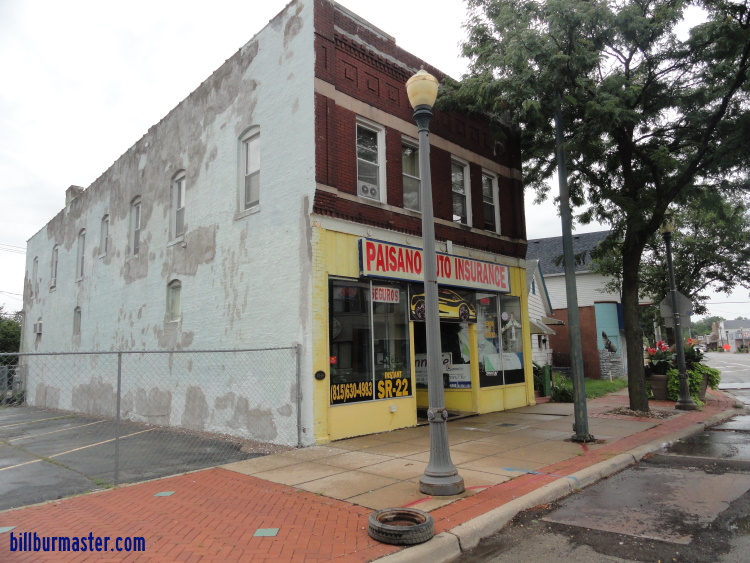
U.S. 66 passes through the scenic downtown area (called locally "City Centre"). 66 crosses one of many draw bridges at Downtown Joliet. There are many things to see here. Such as, the Rialto Square Theater, Union Station, Duly Health and Care Field, and the Will County Courthouse to name a few. Joliet has launched a big campaign to promote the U.S. Rt. 66 tourism. There are five historical gas pumps located along U.S. 66 (4 downtown, 1 on Broadway). They are located at many historical points. At the border of Crest Hill and Joliet (the intersection of Theodore Street (IL 7) and Broadway (IL 53/U.S. 66)) is a gas station that claims to be the oldest operating station on all of U.S. 66.

Lambert's Mobil in Joliet.

A mural on the north side of the station.

NB Rt 66 in Joliet on Broadway.

A attraction sign at the park along Broadway between Ruby St. & Haunted Trails.

A ice cream stand in the park along Broadway with the "Blues Brothers" on top.

A great place to have a picture taken in the Rt 66 park on Broadway.

A tourist monument in Joliet.

A greeting sign at the roadside park.
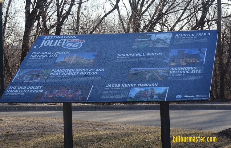
A sign regarding the Joliet area in the roadside park.

A sign regarding the Joliet area in the roadside park.

A sign regarding the Joliet area in the roadside park.

A sign regarding the Joliet area in the roadside park.

Across from the park along Broadway is Dick's towing.

A sign on old U.S. Rt. 66 that was installed January, 2011.

A marker for the Joliet Iron Works Park. This is on NB IL 53 at the curve to go under the BNSF Railway and over the Des Plaines River.

Along SB IL St Rt 53/U.S. Rt. 66 near the Joliet Junior College is a marker for the visitor center ahead.

Union Station in Downtown Joliet.

The Shell pump located in the Rt. 66 Park along Broadway.

The Texaco pump located at the Rialto Square Theater.

The Mobil pump located on Ottawa Street at the Joliet Historical Museum.

The Sinclair pump is located on the northeast side of the Will County Courthouse.

The Standard Oil pump is located at the intersection of Chicago and Cass Streets. This is where the original alignments of U.S. Rt. 66 & the Lincoln Highway met.

A marker on SB U.S. 66A in Downtown Joliet.

A close-up on the marker above.

A close-up on the marker above.

A marker on SB U.S. 66A.

A close-up on the marker above.

A close-up on the marker above.

Looking at the 66 Welcome Center.

A tourist photo shot spot in Joliet.

A marker at the corner of Cass and Chicago Streets for the place where U.S. 66 and the Lincoln Highway intersect.

A mural along Jackson Street in Downtown Joliet.
A look at the building that housed the first Dairy Queen (DQ) at the corner of Ohio and Chicago Streets.

A close-up of the plaque on the building for the first Dairy Queen.

A mural along Chicago Street in Downtown Joliet.

A artistic guitar in Joliet during the summer of 2023.

A artistic guitar in Joliet during the summer of 2023.

A artistic guitar in Joliet during the summer of 2023.

A artistic guitar in Joliet during the summer of 2023.

A artistic guitar in Joliet during the summer of 2023.

A artistic guitar in Joliet during the summer of 2023.

A artistic guitar in Joliet during the summer of 2023.

A artistic guitar in Joliet during the summer of 2023.

The Rock 'n Roll Museum of Illinois in Joliet.

A tourist monument at the train station in Downtown Joilet.

A mural along Scott Street.

A sign on the back of the Rialto Theater.

A sign post in Joliet.

The Milano Bread Bakery on U.S. 66A in Joliet.
Preston Heights
Not much here. Joliet wraps around this town. To the south of Preston Heights is the Chicagoland Speedway and Route 66 Raceway.

Looking NB on U.S. 66 in Preston Heights.

A replica Blues Brothers car at a gas station near the Chicagoland Speedway along U.S. 66.

A plaque under the replica Blues Brothers car at a gas station near the Chicagoland Speedway along U.S. 66.
Elwood
At Elwood there are two alignments of this highways.


Rural Wilmington
U.S. 66 passes through the old Joliet Arsenal, north of Wilmington. From near Elwood south to Wilmington, both sides of the highway are fenced off for the Arsenal property. In recent years, this area has been converted to a national cemetery, and the Midewin National Tall Grass Prairie.

The entrance to the Abraham National Cemetery.

Inside the Abraham National Cemetery.
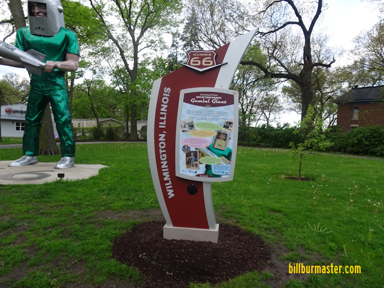
Wilmington
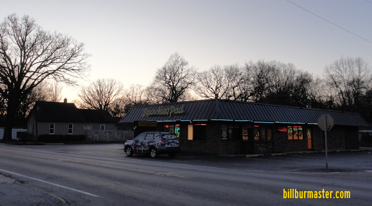
As you enter Wilmington, you pass the "Launching Pad". This is a American food restaurant with excellent food. You can't miss it, the sign holder is a giant astronaut. Wilmington is know for their antiques. Many shops are located on Water Street (IL St Rt 102) just north of Rt. 66. What is interesting is most of these shops kept the original store fronts. So you get a peak into the local history of Wilmington.

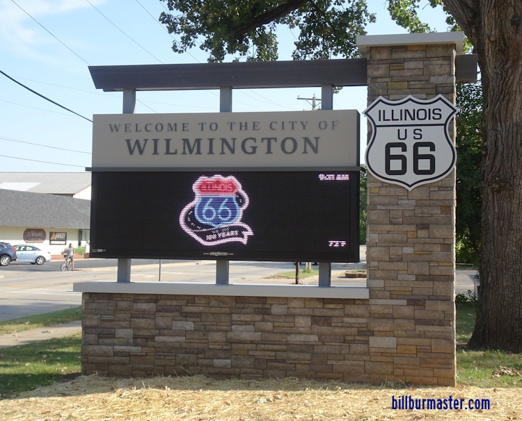
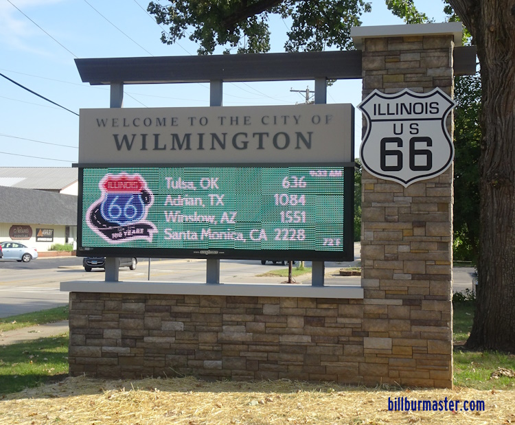
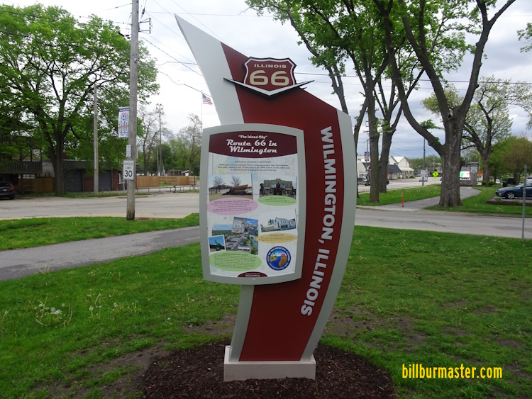
The tourism marker in Wilmington.

A close-up of the tourism marker in Wilmington.

A close-up of the tourism marker in Wilmington.

A backside of the tourism marker in Wilmington.
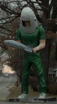
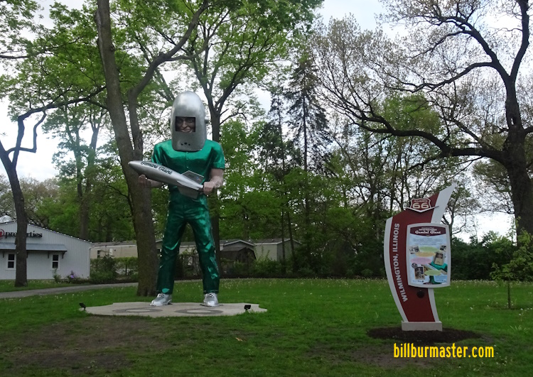
"Gemini Giant" at the Launching Pad in Wilmington.

The "Gemini Giant" unmasked during a repainting.
The former Launching Pad after the items that were auctioned off were removed; including the giant.

The Giant Gutiar that hangs outside the Illinois Rock & Road Museaum in Joliet, as it was being brought up U.S. 66. It stopped in Wilmington in January, 2023 across from the famed Launching Pad briefly for locals to see.


Various banners in Wilmington.

The Mar theater in Wilmington.

What was a old watch store.

An old drug store.

A mural along U.S. 66 at the corner of IL 53/U.S. 66 & IL 102. (July, 2024)

A mural in Wilmington.

A roadside marker in Wilmington.

A short lived car museum in Wilmington.

A picture on the windows of the museum.

A car out front of the museum.

A picture on the windows of the museum.

A picture on the windows of the museum.

The concrete pad where the Gemini Giant will stand.

An electornic message board in Wilmington.

An electornic message board in Wilmington.
An electornic message board in Wilmington.
An electornic message board in Wilmington.

A tourist monument in Wilmington.

A mural in Wilmington.

A mural in Wilmington.

A mural in Wilmington.

A sign post in Wilmington.
The Gemini Giant and a tourist marker on South Island in Wilmington.
The frontside of the tourist marker.
The backside of the tourist marker.

This mileage sign replaced a old one that was posted when U.S. 66 ran down this road. IL St Rt 53 which uses the old road doesn't go to Dwight, but U.S. 66 did.
Braidwood
At Braidwood, there is another excelent resturant. The "Polk-a-Dot" is set in a 50's Drive-In.

Sign at the Polk-a-Dot.

The "Polk-a-Dot" restaurant in Braidwood.

Looking north along U.S. 66A, just north of IL 113.
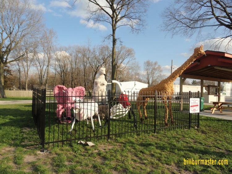
A close-up of the "zoo"

Looking at the Braidwood Roadside Park.

A close-up of the zoo. (September, 2017)
Godley
Godley is a small village at the Will/Grundy County Line. It sits on the south side of the highway, just west of the Exelon Nuclear Generating Station. Godley is home to the Kmine museum. This shows sights of the fossils from the area. On the south end of Godley on Kankakee Street, the county line, is the Godley Park District. This place has playground equipment and trails to walk on. It also give access to the Braidwood-Mazonia Fish and Wildlife Area.
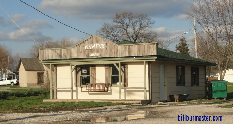
Looking east at the K Mine Museum.

A historical marker in Godley.

A historical marker in Godley.

A shield on the Godley Village Hall.

A private display of old vehicles on a hillside south of Godley.
Braceville
Braceville is a small town along U.S. 66. This is located just west off the Grundy/Will County Line.

A sign in Braceville.
Rural Southeastern Grundy County
Near the location of an old bridge over the UPRR Rail Spur on the north alignment, there is the "Riviera". This restaurant has been here since the 1930's, and not much has changed. You eat in the basement of this old road house. The floors are painted and the walls...they are carpeted.
In June, 2010, the Riviera went up in flames.

A sign for the Riviera.

Another "66 Roadside Attraction".
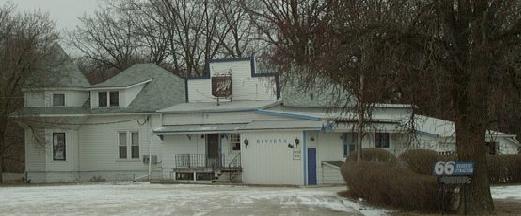
The "Rivera" near Gardner.

The Riv after the fire. (June, 2010)

A marker at the site of the Riviera. (September, 2017)

A close-up of the marker. (September, 2017)

A close-up of the marker. (September, 2017)

A close-up of the marker. (September, 2017)

A look at the site of where the restaurant once stood. (September, 2017)
Gardner
At Gardner, this alignment forms the east and south sections of the loop around the town. As you pass through the town, you pass Gardner-South Wilmington High School. On the south side, the railroad over pass was closed for many years while IDOT review the need for it. Since then this one was replaced with a newer structure. One of the main attractions in this town is a park that has the old two celled jail. This was used till around the 1950's. Also, there is a street car from the old Riviera Restaurant that was north of town. It is located near downtown Gardner.

Looking at the park with the jail and street car.

A marker for the jail.

A marker for the street car.

The street car.

The jail.

A mural in Downtown Gardner.

A mural in Downtown Gardner. (July, 2010)

A gazebo in Downtown Gardner.

A plaque on the gazebo.

Now IL 53 curves to the left, but straight ahead is where U.S. 66 headed south to Dwight.

This bridge was recently constructed in the place of a old steel structure that was deemed un-fit for travel.

Rt. 66 heading north on the southeast side of Gardner.

NB Rt. 66 on the northeast side of Gardner. Rt. 66 curves to the right and Carbon Hill Road heads straight across the tracks.
Bolingbrook-GardnerBolingbrook-Gardner/U.S. 66Interstate 55Illinois 53


